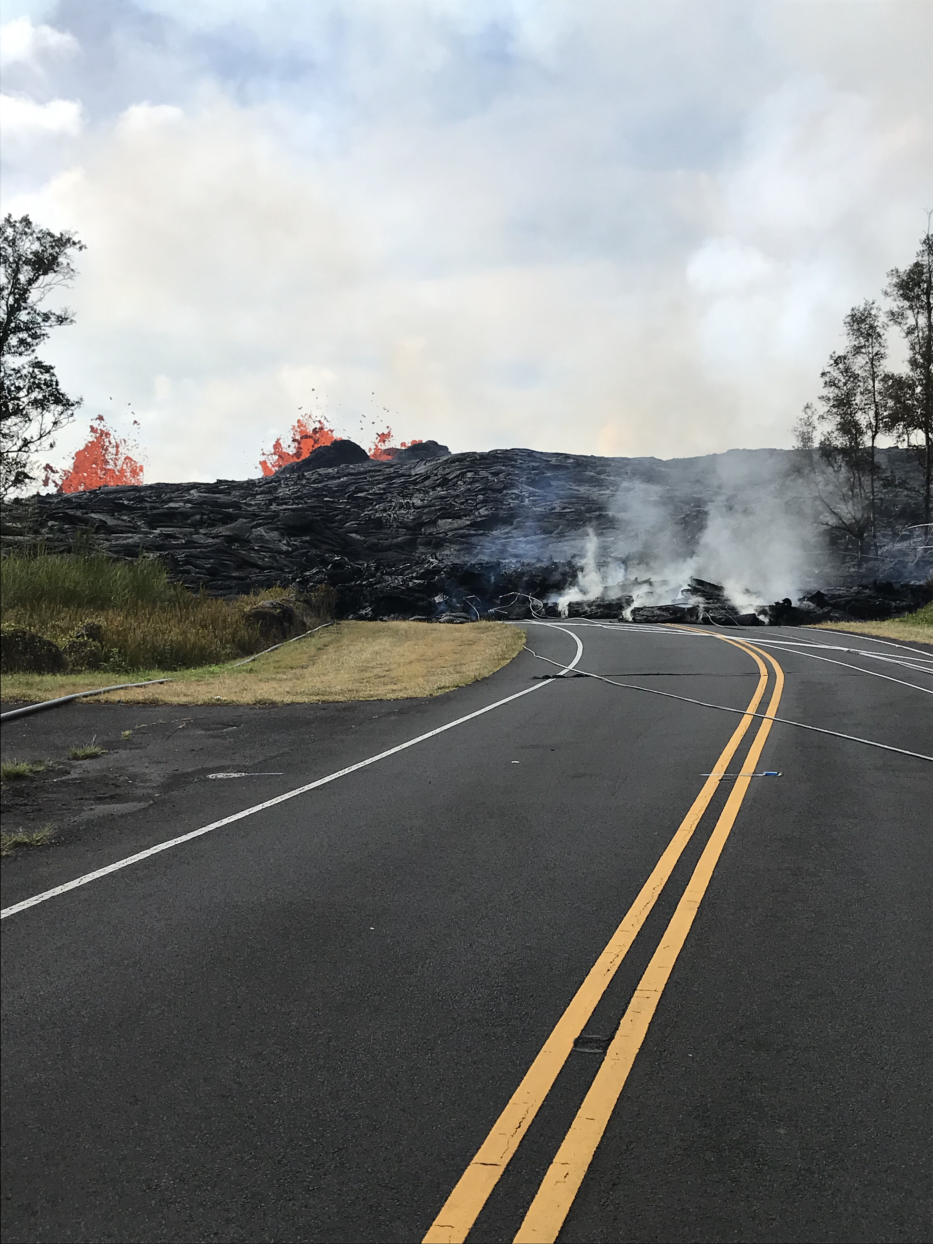
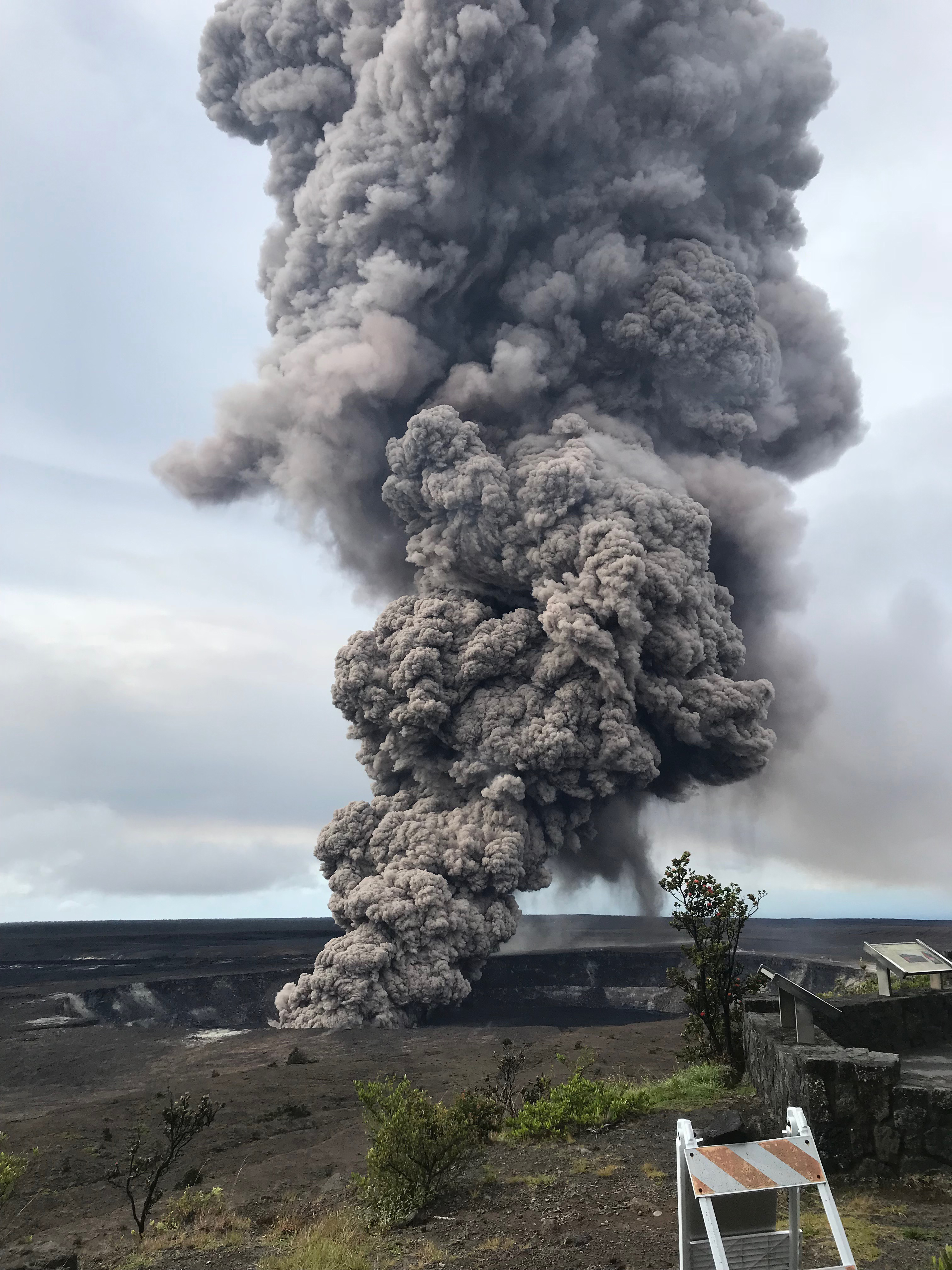
Showing posts with label ash. Show all posts

Tuesday, July 10, 2018

Lower East Rift Zone eruption continues unabated

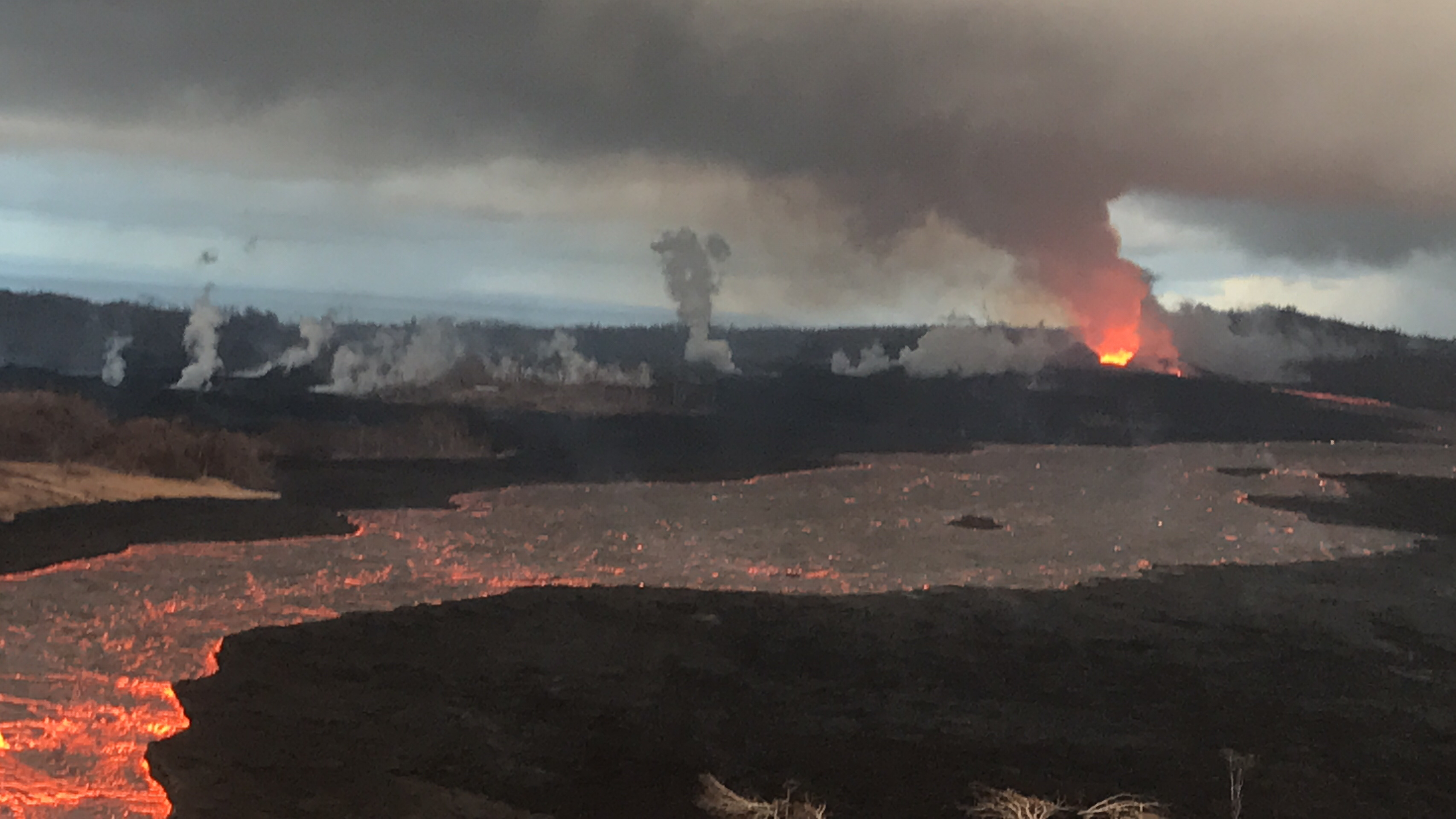
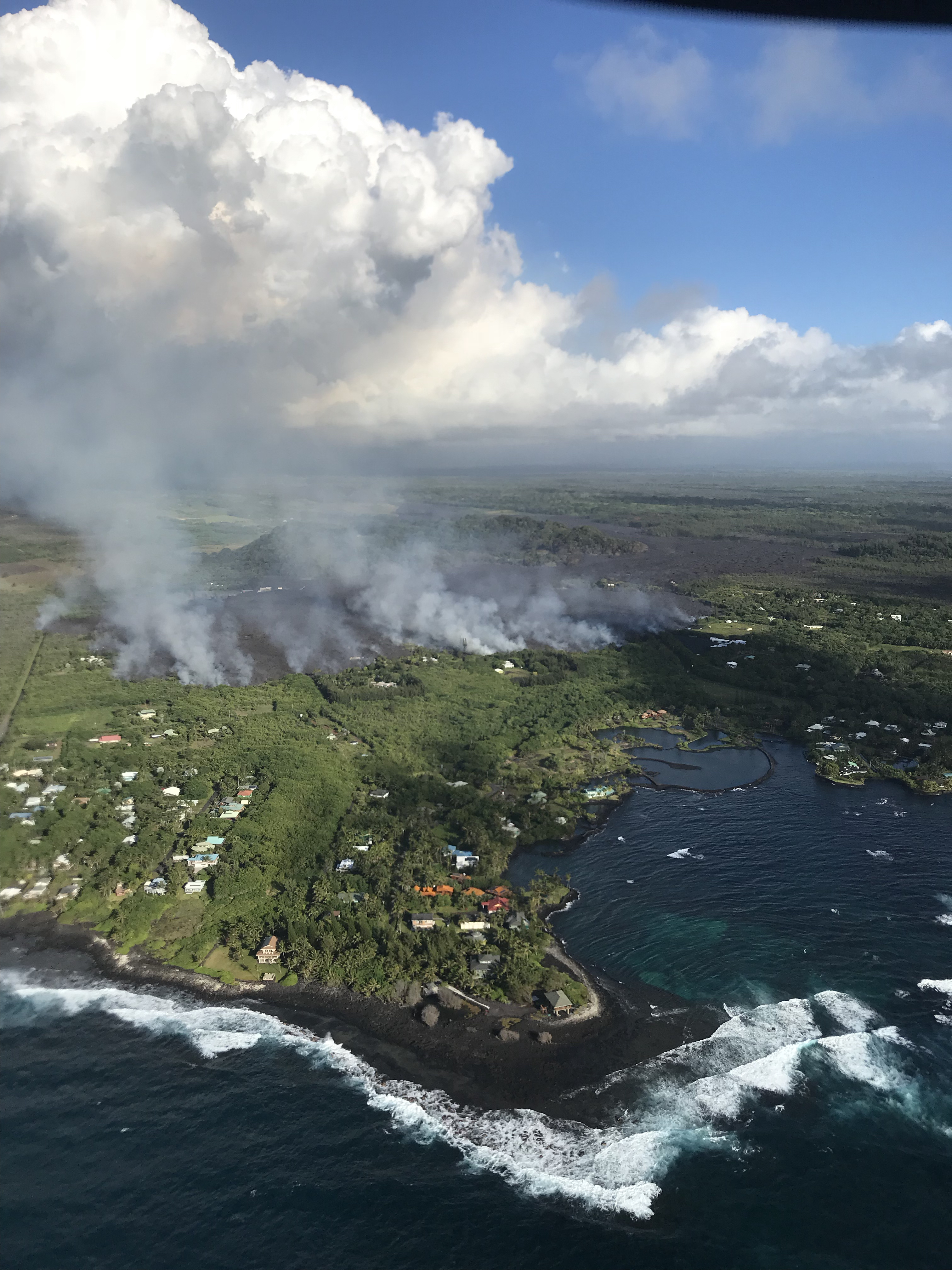
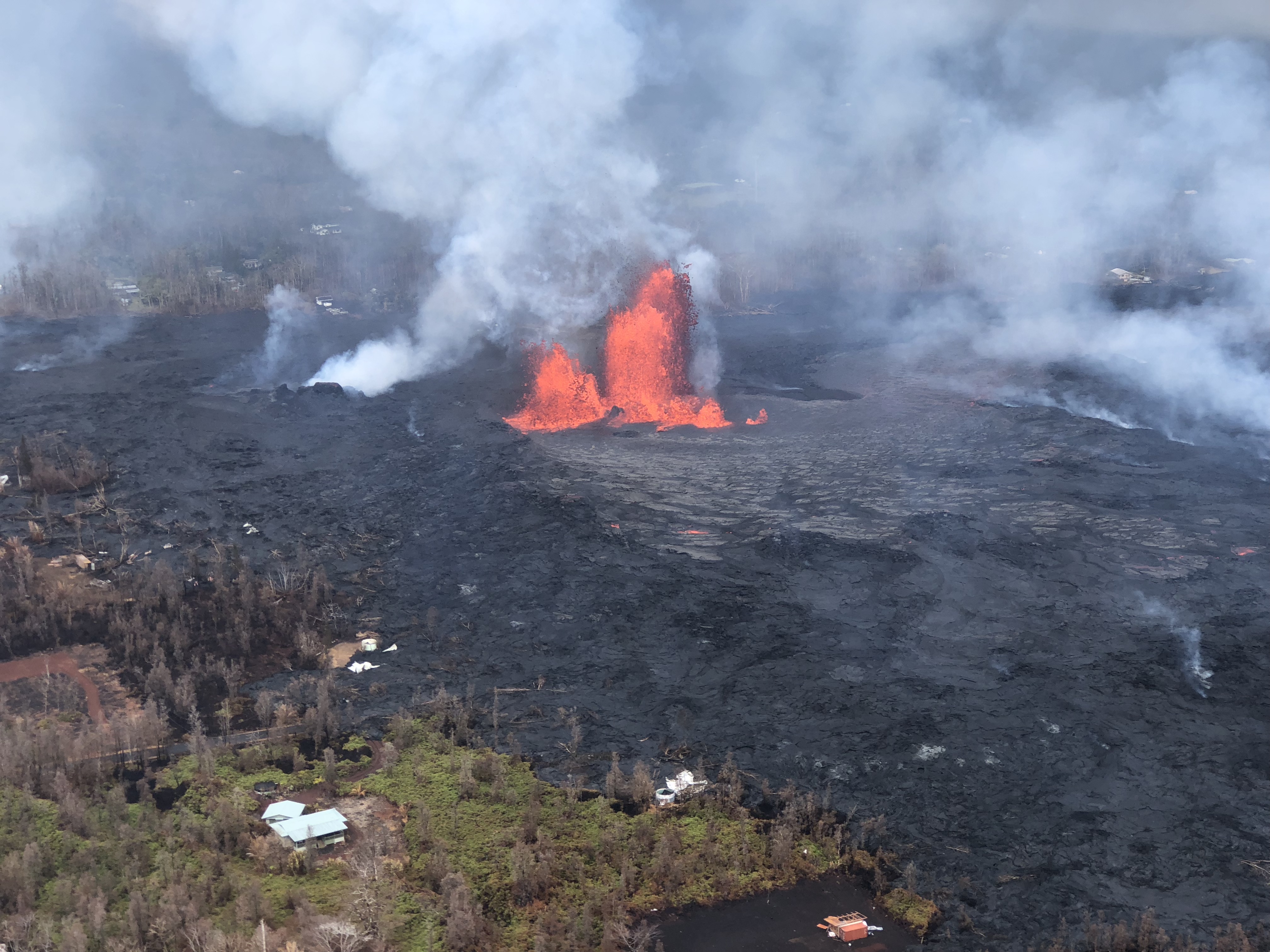
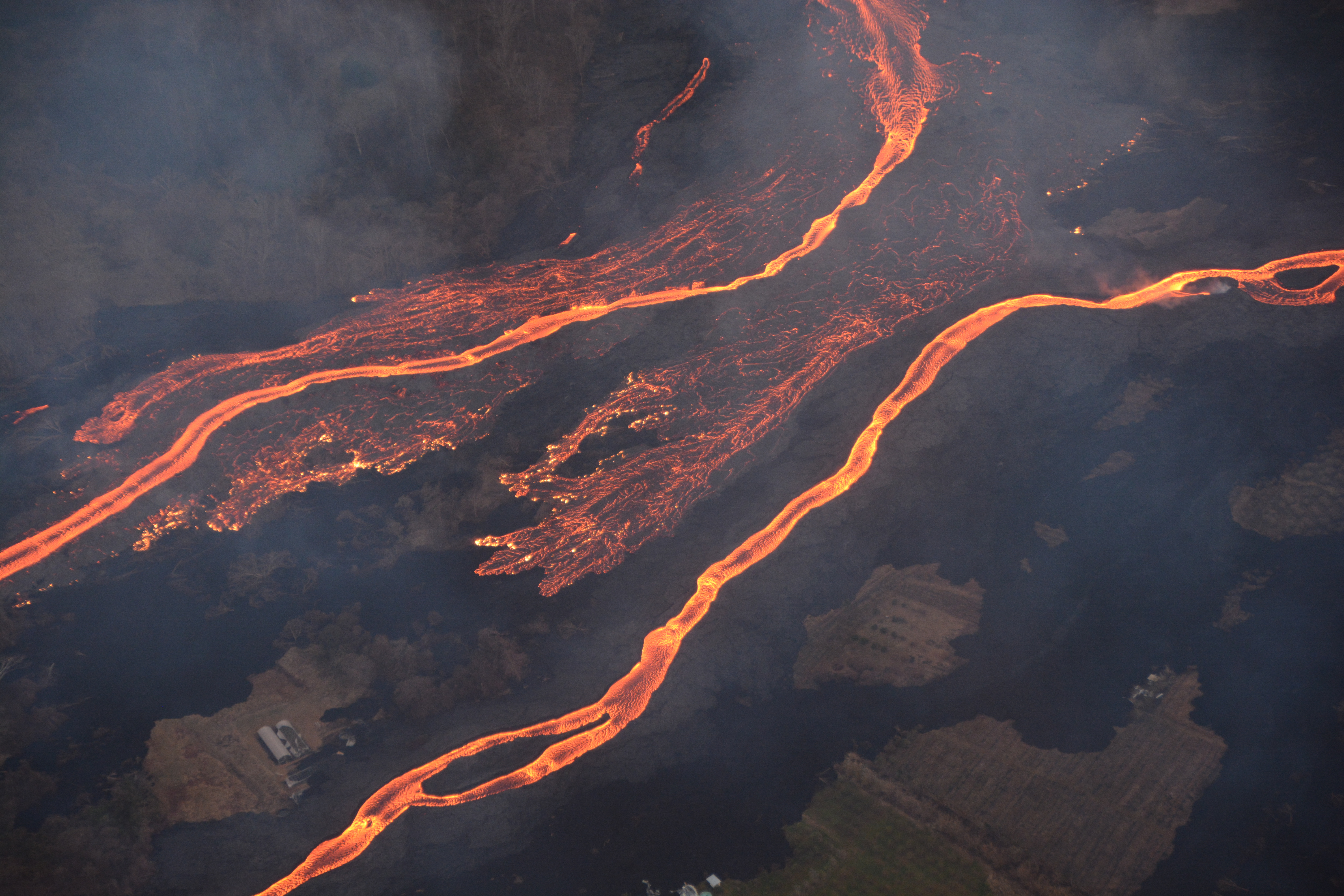
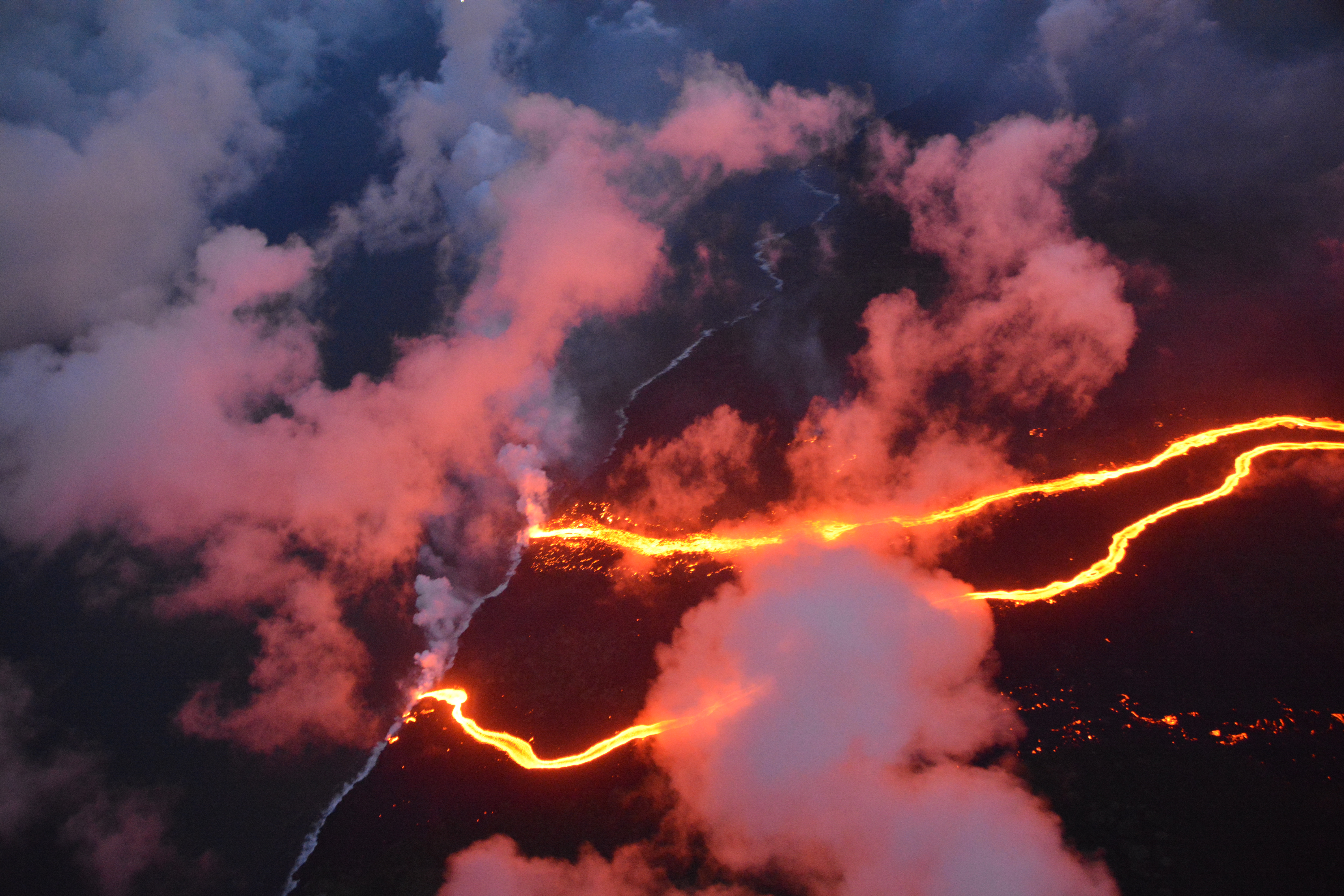
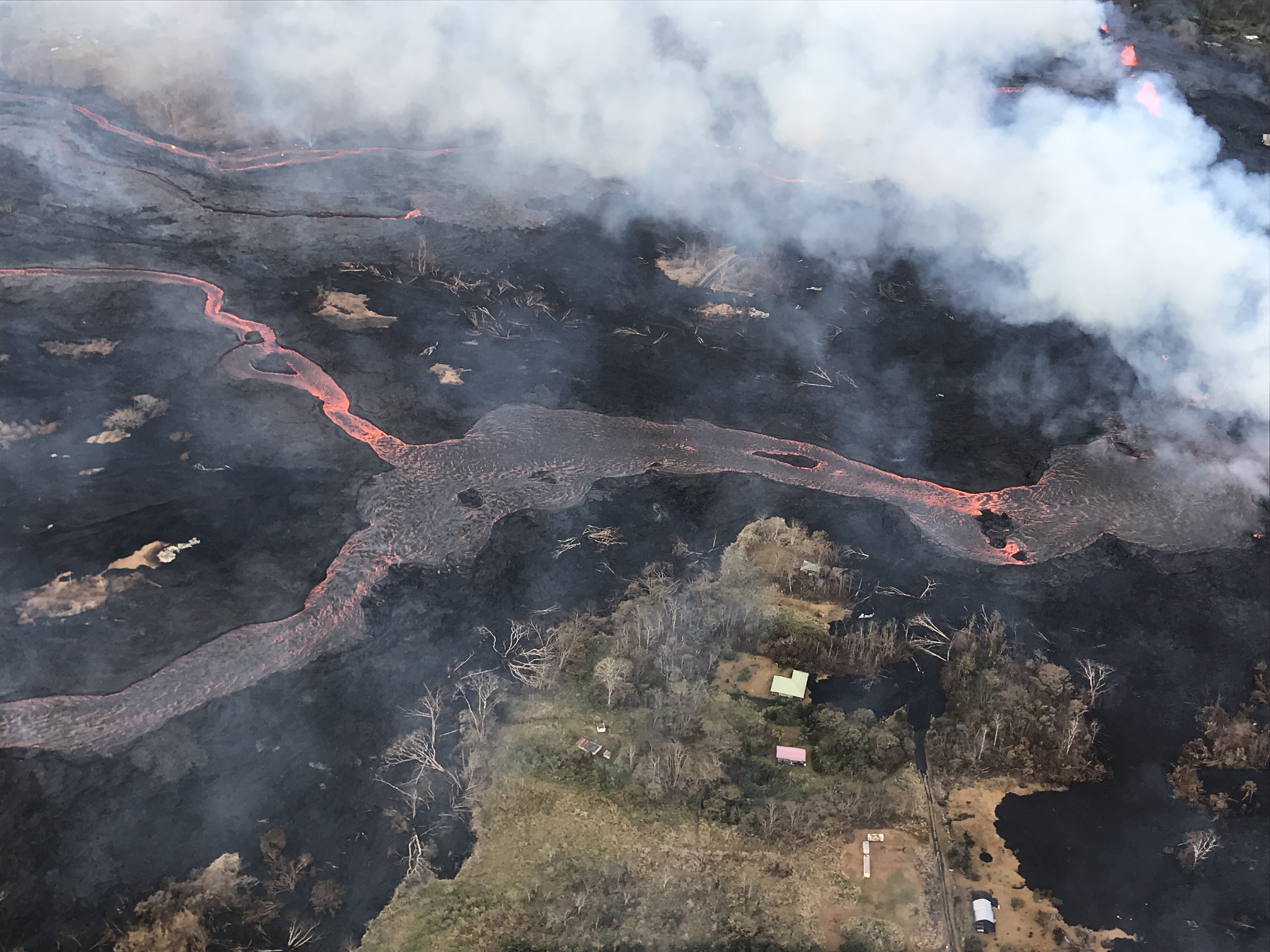
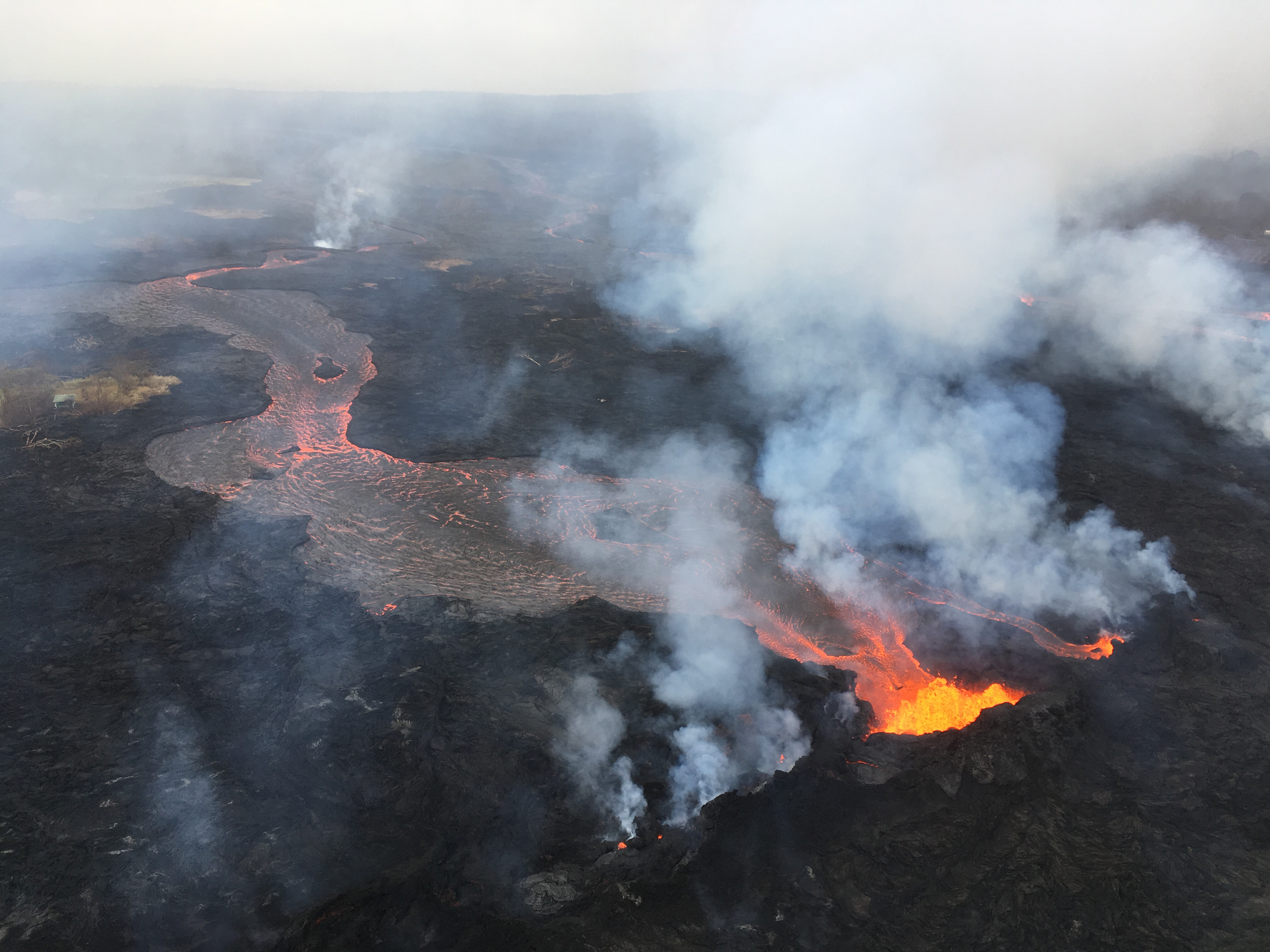
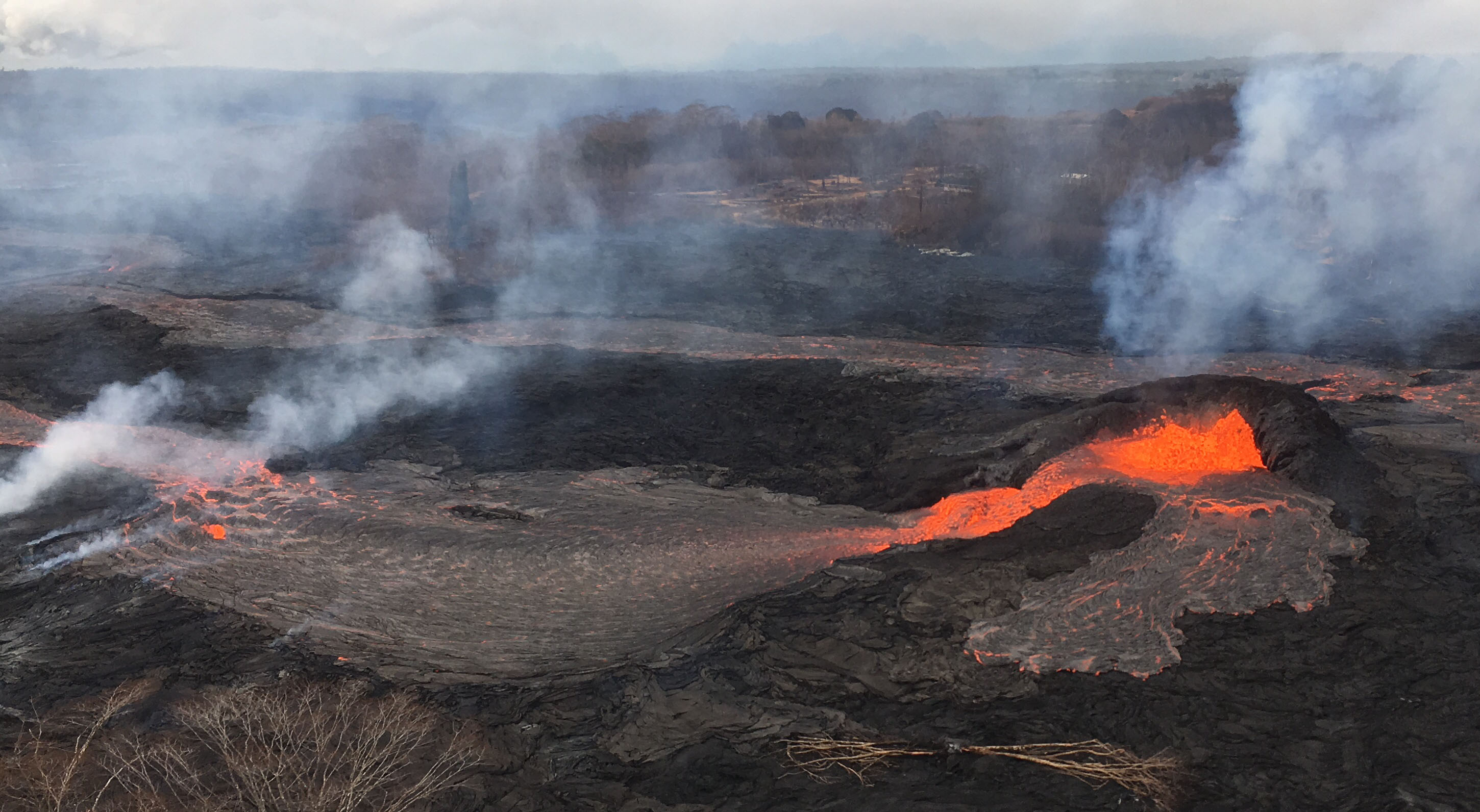
View of Fissure 8 and channel during the morning overflight on July 7.

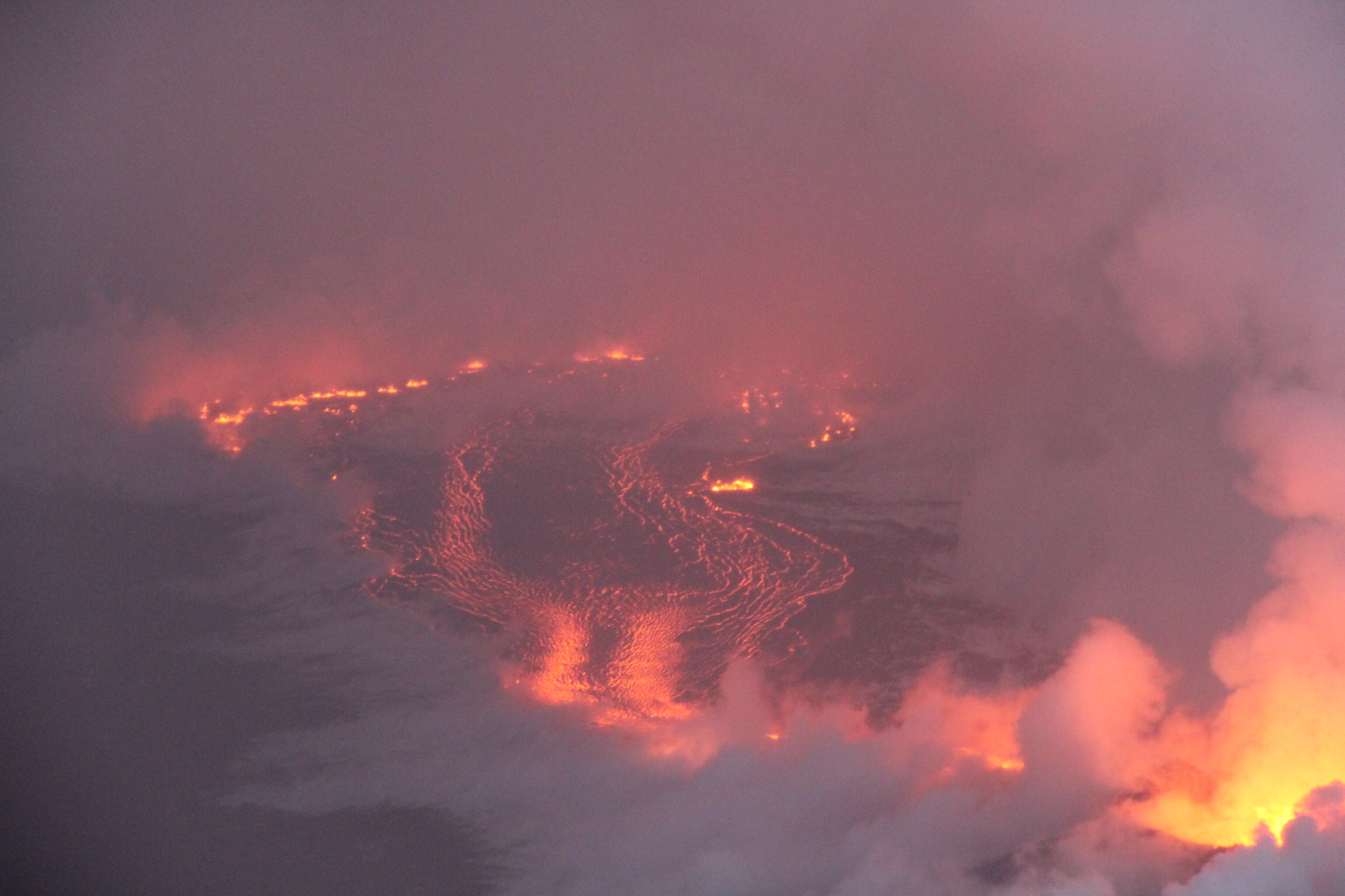
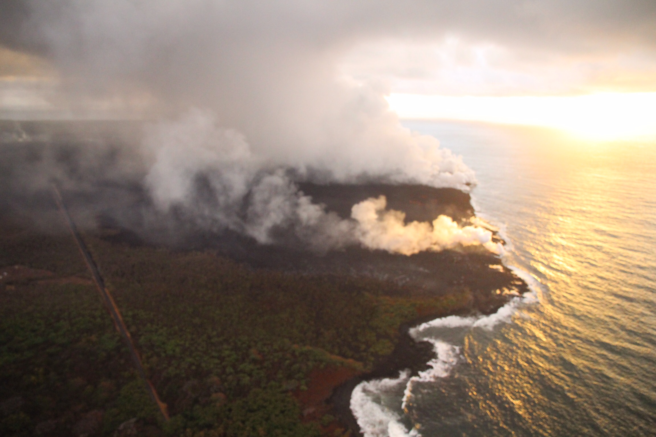
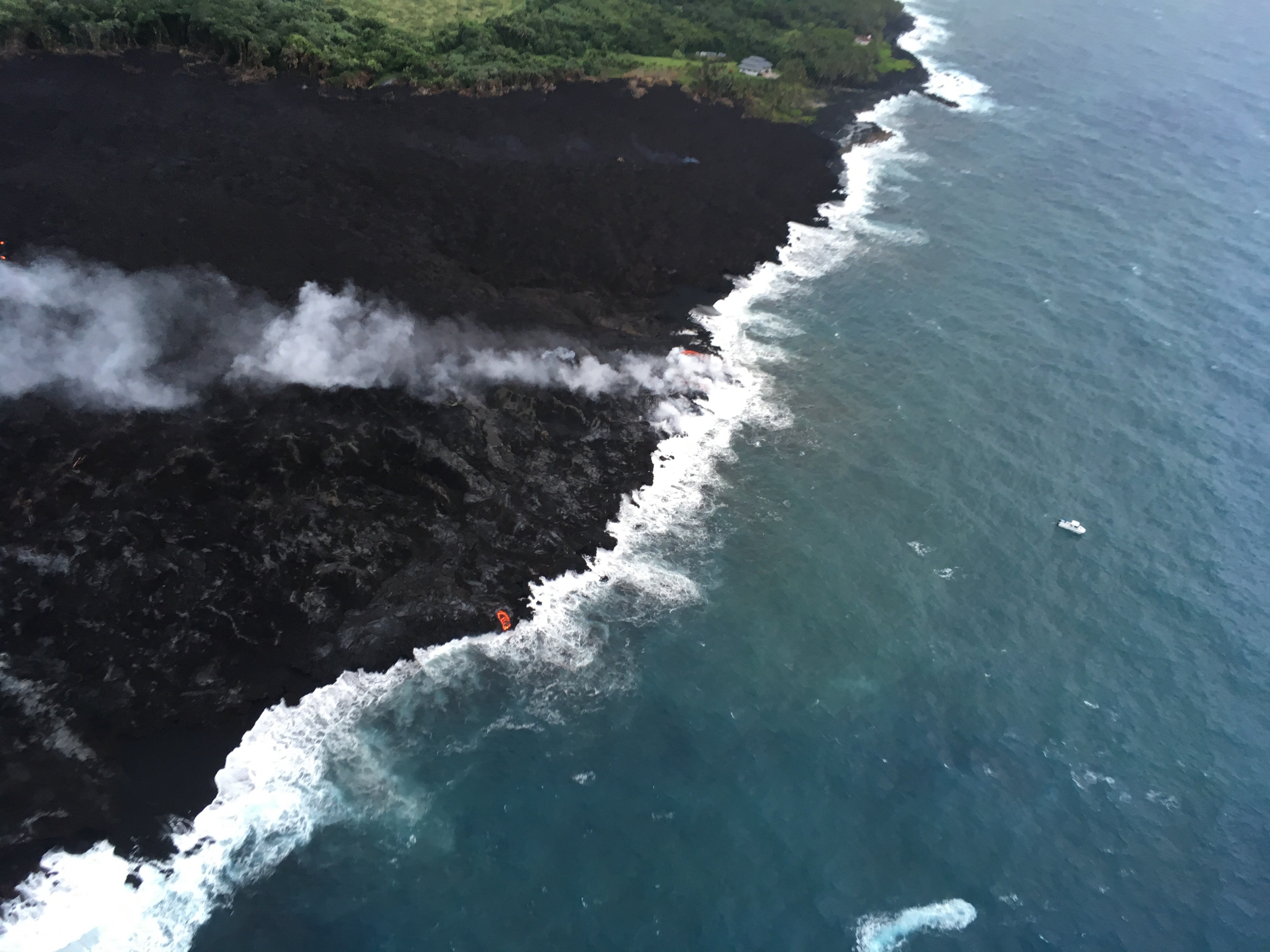
Lava entering the ocean as seen through steam and rain early this morning.

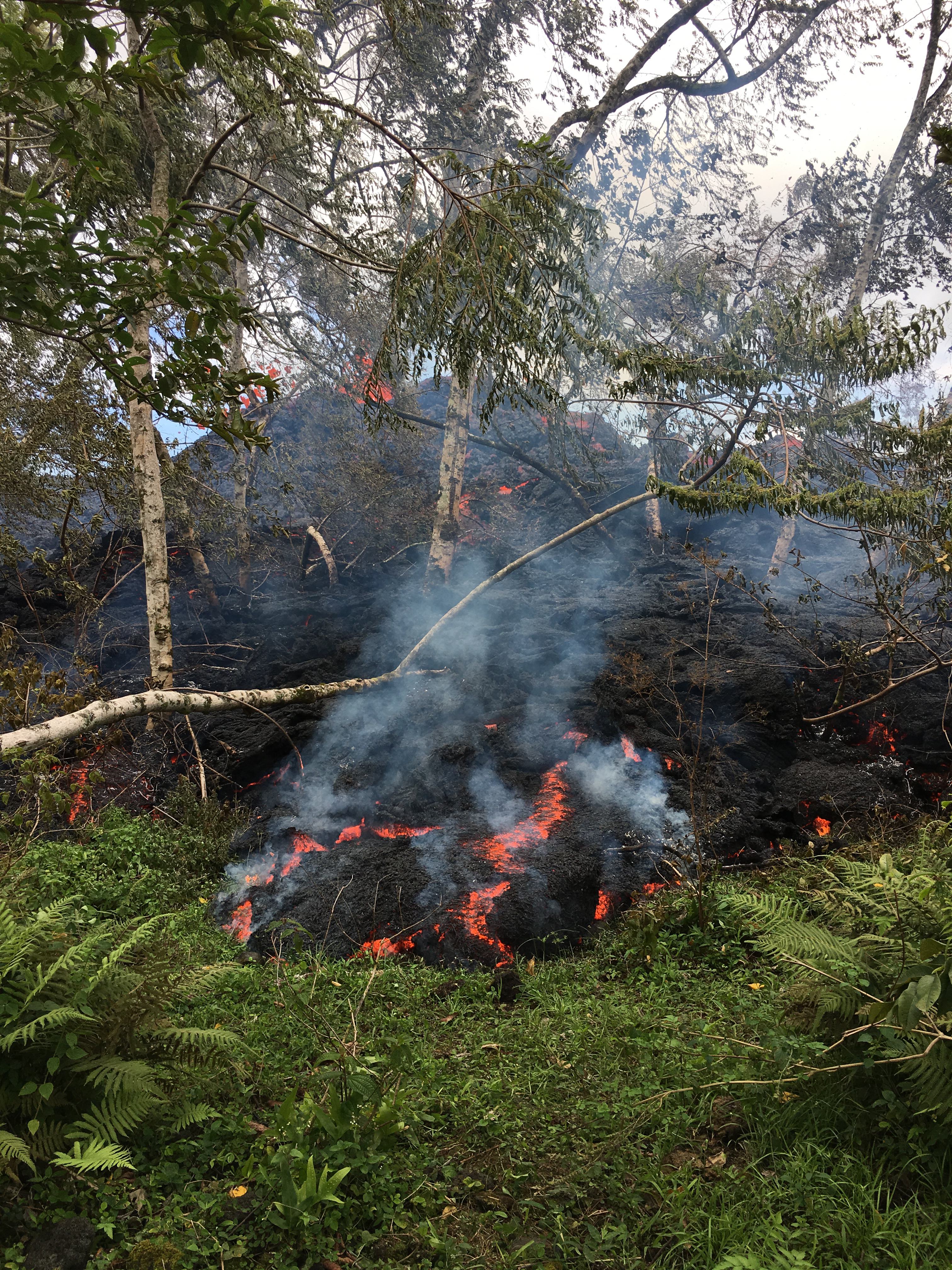
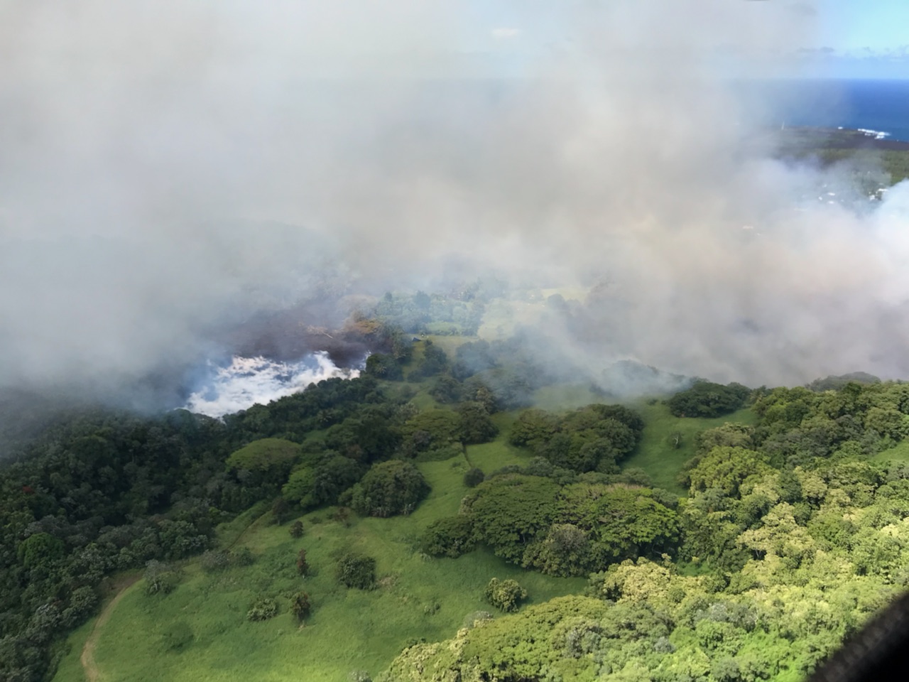
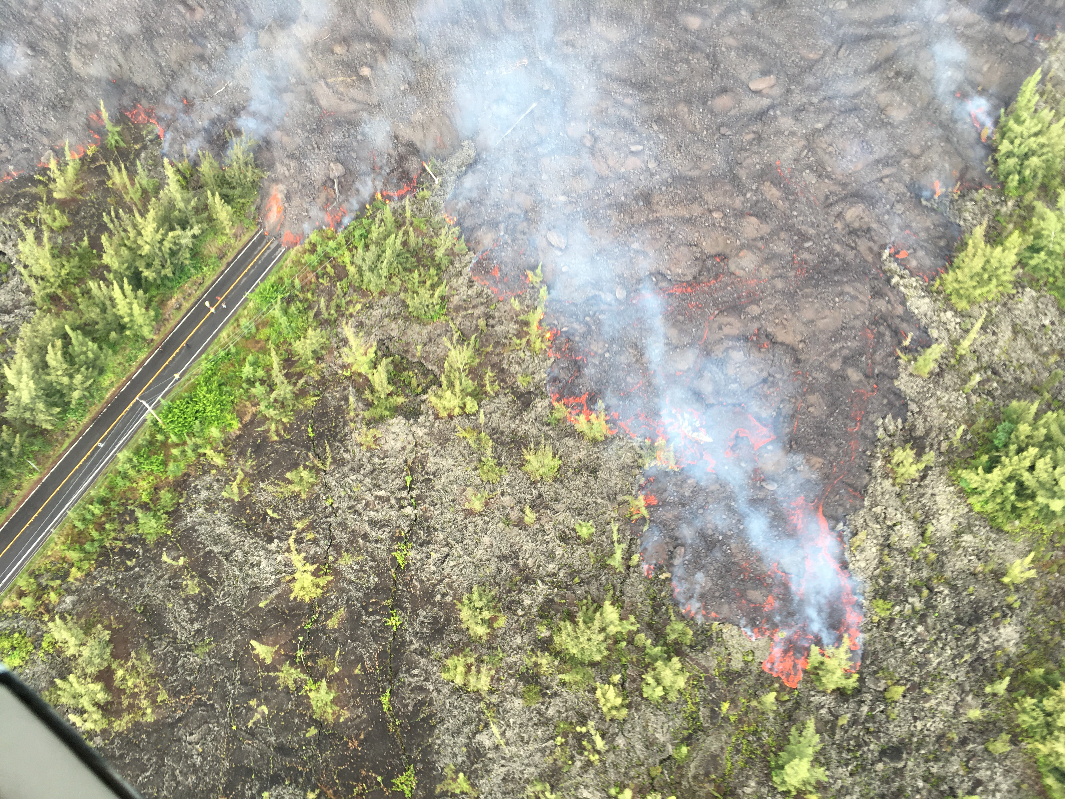
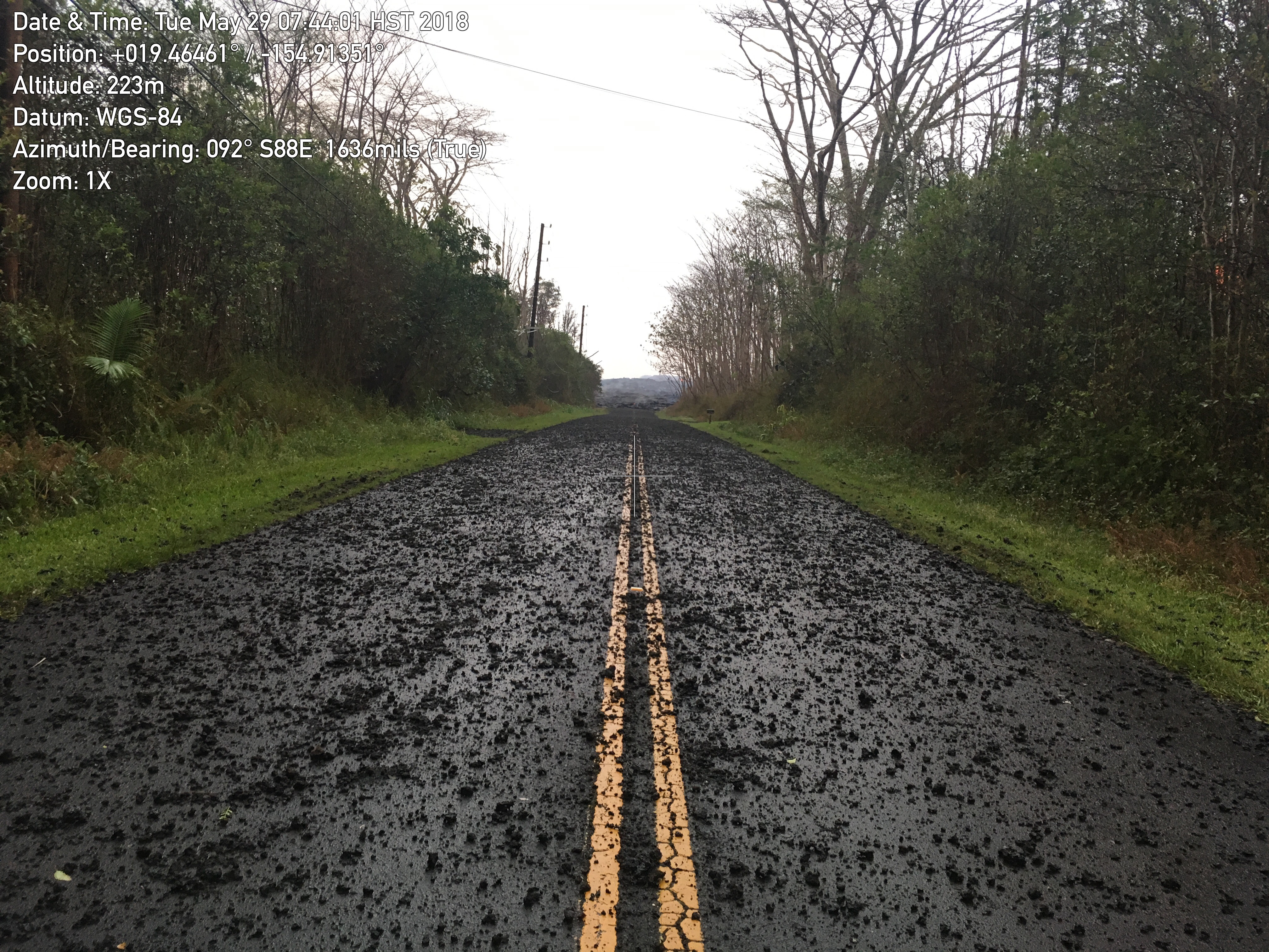
Fissure 8 continues to erupt lava steadily into the perched channel leading northeastward from the vent. Disruptions to the mid-channel occurred yesterday afternoon producing localized overflows along the margins of the flow field, mostly atop earlier lavas. A significant overflow north of the cinder quarry advancing yesterday and last night towards Cinder Rd. has stalled. An overflow lobe moving around the west side of Kapoho Cone remains active this morning and small brushfires are reported along the margins. Downstream, lava appears to be reoccupying the channel leading to the ocean entry were multiple fingers of lava are active. The southern margin of the ocean entry shows little sign of movement.

Yesterday's channel disruption and overflows were caused by blockages that developed along the channel. Additional blockages and resulting overflows are likely to occur as long as the activity continues.

Fissure 22 continues to exhibit weak spattering. No other fissures are active.

Pele's hair and other lightweight volcanic glass fragments from the lava fountain at Fissure 8 continue to fall downwind of the fissure, dusting the ground within a few hundred meters (yards) of the vent. High winds may waft lighter particles to greater distances. Residents are urged to minimize exposure to these volcanic particles, which can cause skin and eye irritation similar to volcanic ash.

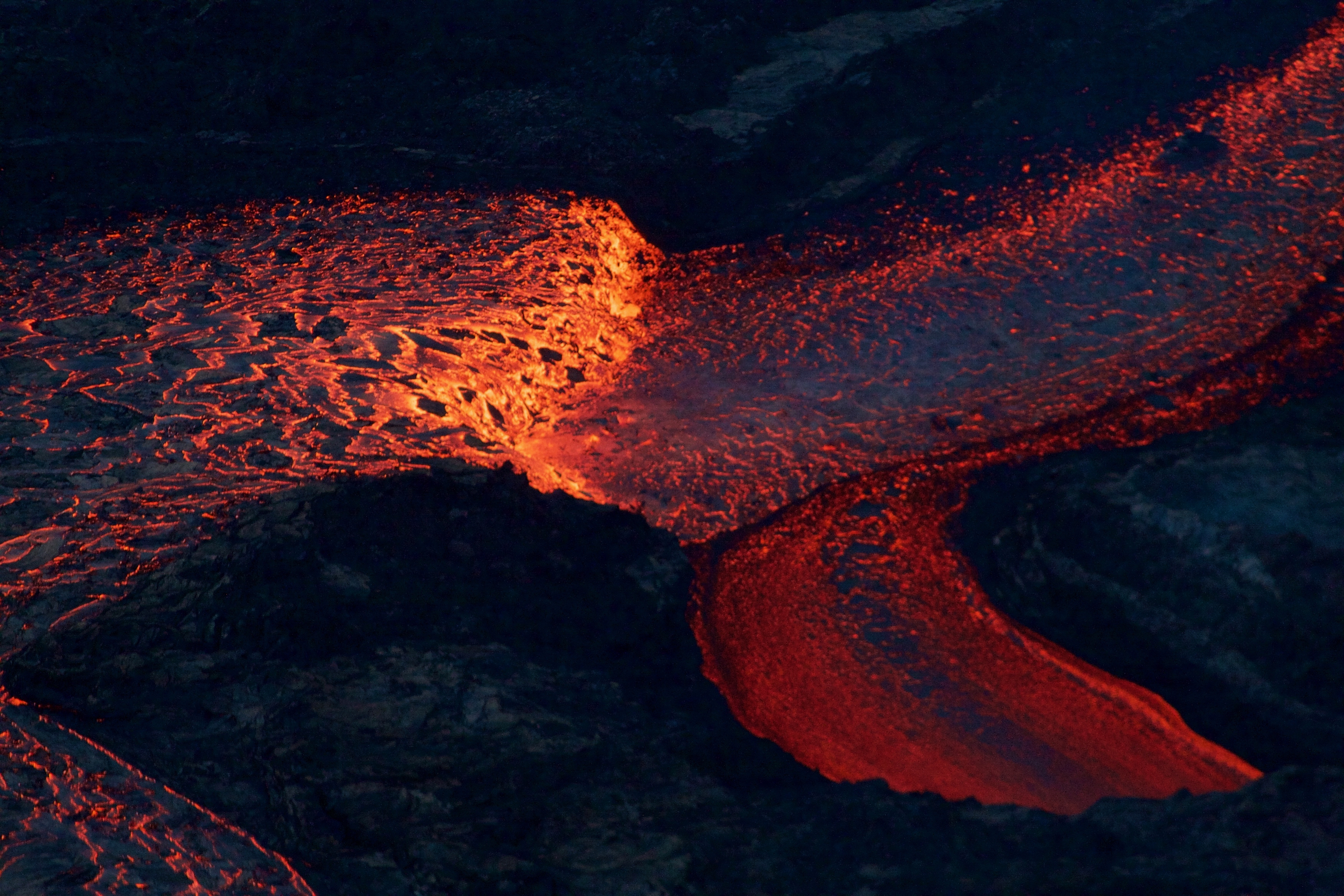
Near the Kapoho Crater, in the area called Four Corners, the lava channel makes a 90-degree bend. After lava exits the bend, it makes a short drop to form a lavafall. A side channel makes a short surface diversion before rejoining the existing channel.

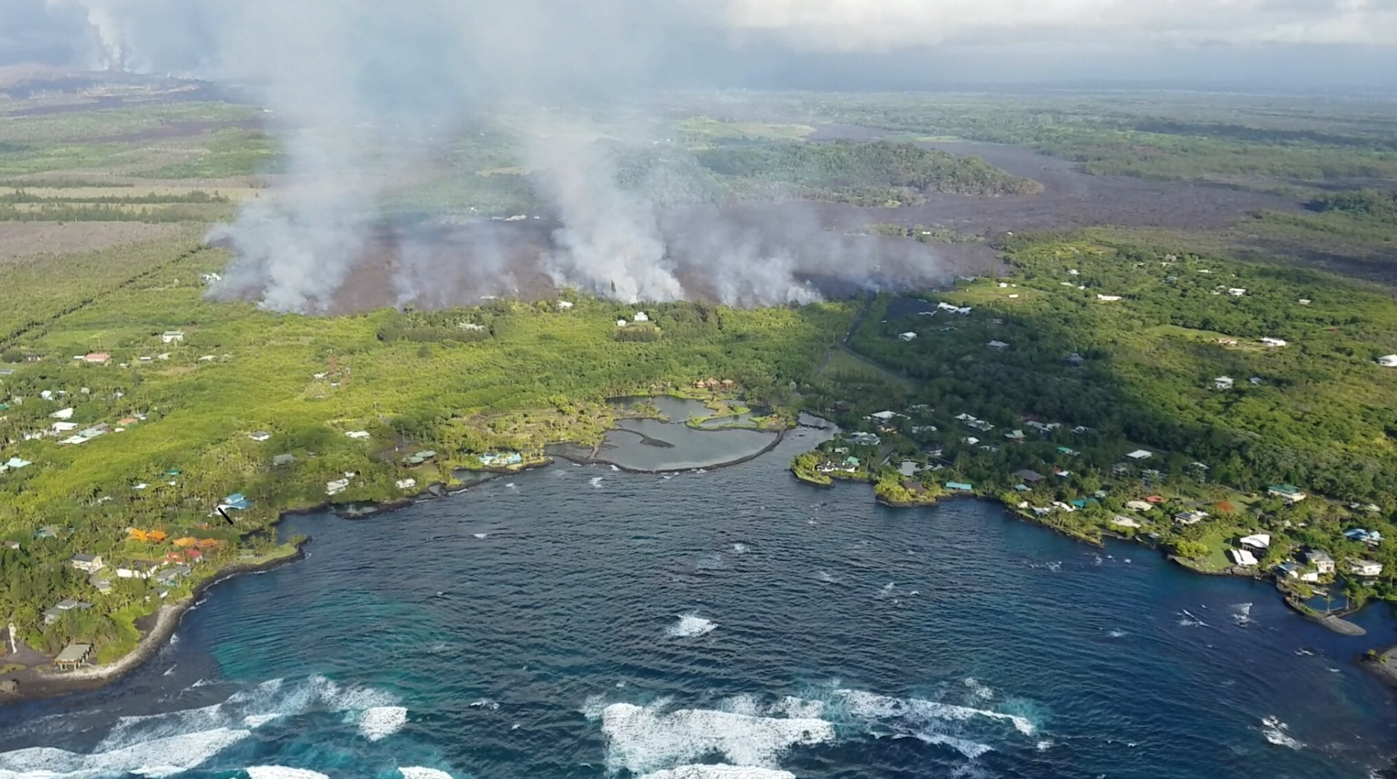
Southern end of the active fissure 8 flow margin north of the Ahalanui Beach Park, known as the warm ponds. The flow margin is estimated to be about 500 m (0.3 mi) from the par


Friday, June 15, 2018

Wall collapse at Halema‘uma‘u crater continues as Kīlauea vent lava unabated


This recent United States Geological Survey Video on June 13, 2018, filmed details of the dramatic changes occurring within Halema‘uma‘u Crater at Kīlauea's summit since explosive eruptions of ash and gas and ongoing wall collapse began in mid-May.

The video shows steep crater walls that continue to slump inward and downward in response to the ongoing subsidence of the summit area. This video was taken from a UAS (Unmanned Aircraft Systems). Limited UAS flights into this hazardous area are conducted with permission and in coordination with Hawai'i Volcanoes National Park.

The video is used to assess hazards at the summit and the information is shared with the National Park Service and emergency managers.

Sunday, June 3, 2018

UAS mission films astonishing details of changes occurring within Halema‘uma‘u crater at Kīlauea's summit


This new U.S. Geological Survey aerial video reveals the astonishing changes within Halema‘uma‘u Crater and the vent that housed a 12-acre lava lake up until a few weeks ago. The vent is now about 100 acres and is devoid of lava as far as the eye can tell. Where did all that lava go? Is the vent capped in rock material now? When, or how could it, explode? These are the questions scientists will try to answer by studying this video and other data they are collecting about the ongoing changes with the #KilaueaEruption.

A UAS mission on May 31, 2018, filmed details of the dramatic changes occurring within Halema‘uma‘u Crater at Kīlauea's summit since explosive eruptions of ash and gas and ongoing wall collapse began in mid-May.

Clearly visible are steep, and in places, overhung crater walls, new cracks and faults that reflect ongoing subsidence of the area and intense steaming from a new collapse pit on the north margin of Halema‘uma‘u. Footage also shows yellow sulfur precipitate on the rubble-covered floor and a scattering of large ballistic blocks around the crater rim.

This video was taken from a UAS (Unmanned Aircraft Systems). Limited UAS flights into this hazardous area are conducted with permission and coordination with Hawai‘i Volcanoes National Park. The overflights collect visual information on what is happening at this rapidly changing eruption site. Scientists will be examining the footage in detail to understand how the expanding collapse area is evolving, the extent of ballistic debris, and other clues as to what is happening at Kīlauea's summit. 

This information informs the assessment of hazards, which is shared with the National Park Service and emergency managers. Video by the U.S. Geological Survey and Office of Aviation Services, Department of the Interior, with support from the Hawaiian Volcano Observatory and Hawai‘i Volcanoes National Park.

Vigorous lava eruption continues from lower east rift zone of Kilauea

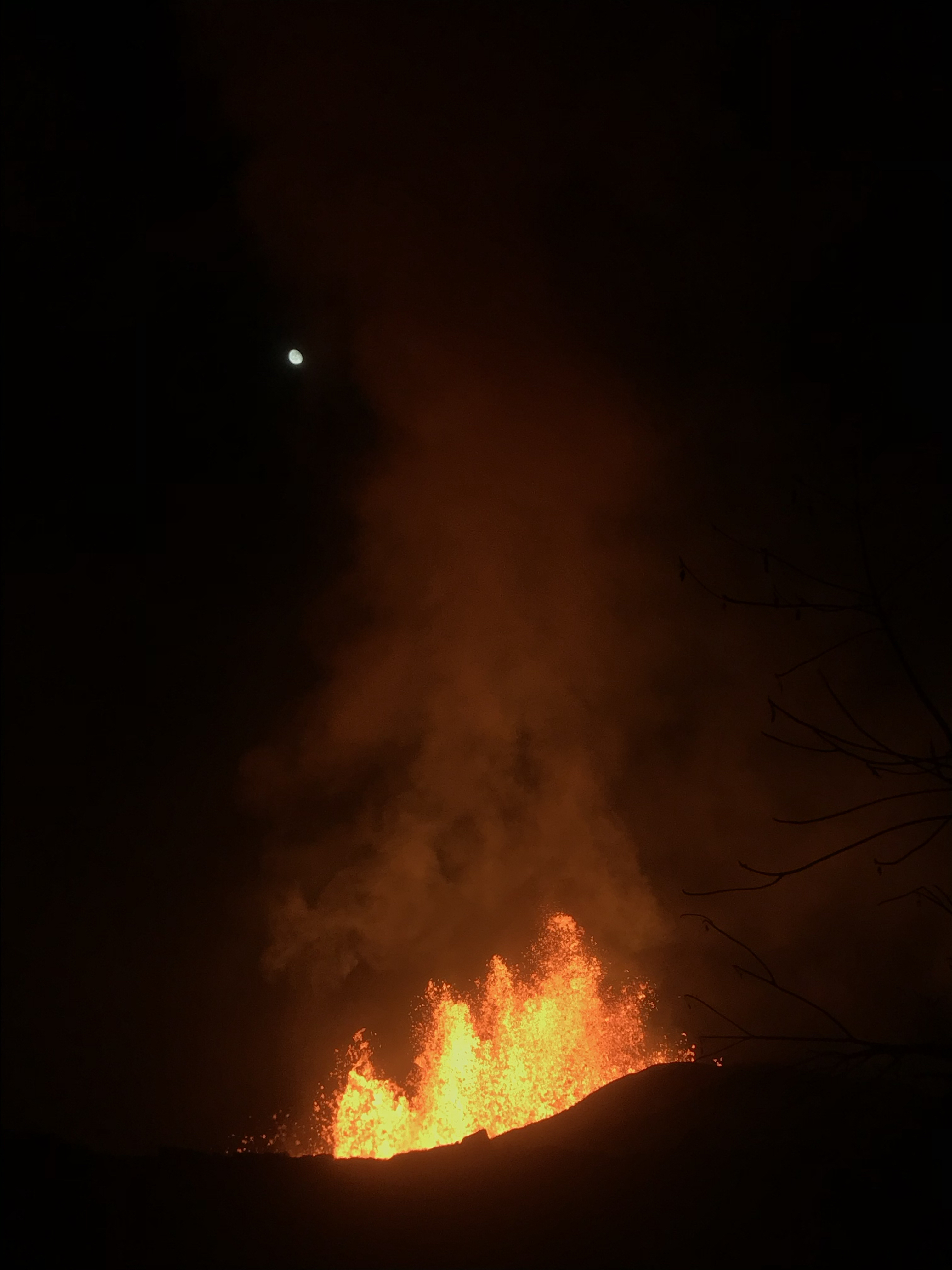
Overnight (June 1-2), fissure 8 lava fountains decreased to heights of about 50 m (164 feet). The moon can be seen in the upper left.


Photo from 7AM helicopter overflight, hovering offshore and looking up the flowfront. Nearly all of the front was active and advancing; advance rates were estimated at an average of 250 feet/hour (76 m/hr), and as of 7AM the flow was 500 yards (457 m) from the ocean.

This video was taken on the June 3 7AM HST helicopter overflight, hovering offshore and looking up the flow front. Nearly all of the front was active and advancing; advance rates were estimated at an average of 250 feet/hour (76 m/hr), and as of 7AM the flow was 500 yards (457 m) from the ocean.

Mount Kilauea continues to erupt lava one month after it all started on May 3, 2018.  Fissure 8 is persistently fountaining since a week delivering lava northeast along Highway 132 to the Kapoho area. The lava stream was about 430 yards from the ocean at the Kapoho Bay between Kapoho Beach Road and Kapoho Kai Drive.

All other fissures are silent now, although Fissure 9 is steaming heavily.

Pele's hair and other lightweight volcanic glass from high fountaining of Fissure 8 are falling downwind of the fissure and accumulating on the ground within Leilani Estates.

Earthquake activity at the summit was high overnight, and it is possible that a small explosion, much like those that have occurred during the past two weeks, will take place in the next day. Ash emissions are low as revealed by webcam views this morning. Volcanic gas emissions at the summit remain high.


Here are some of the latest photos by United States Geological Survey 
As fissure 8 lava flowed into Green Lake, the lake water boiled away, sending a white plume high into the sky—visible from afar between around 11:30 a.m. and 1:30 p.m. HST. This aerial photo, taken a couple of hours later by the Hawai‘i County Fire Department, shows still-steaming lava within Green Lake, located near the intersection of Highways 132 and 137.
Summit plume at 8:40AM HST on June 3. A slight mist in the air softens the look of the plume, which is predominantly white steam with very minor amounts of ash.

Overflight photo at 7AM HST from offshore looking up the flowfront. Nearly all of the front was active and advancing/spreading.

Overnight (June 1-2), fissure 8 lava fountains decreased to heights of about 50 m (164 feet). The moon can be seen in the upper left.


Wednesday, May 30, 2018

What’s going on with the Kilauea Volcano?


Fissure 8 was active throughout Tuesday and into Wednesday morning sending fountains of lava at a sustained height of 200 feet with multiple secondary fountains that reached 60-feet.

This increased activity continued feeding a lava flow that moved towards Highway 132 at the rate of approximately 600 yards/hour. The flow moved north of Highway 132 in the vicinity of Noni Farms and Halekamahina roads, advancing along the steepest descent path that could take the flow to the Four Corners area.

Adding on to yesterday’s eruption, flow from fissure 18 increased further moving downslope toward Highway 137 at rates of less than 100 yards per hour. Overnight, sporadic bursts of activity were also observed from Fissures 7 and 15.

Pele's hair and other lightweight volcanic glass from high fountaining of Fissure 8 are falling to the west of the fissure and continue accumulating on the ground within Leilani Estates. Winds may waft lighter particles to greater distances. Residents are urged to minimize exposure to these volcanic particles, which can cause skin and eye irritation similar to volcanic ash.

On the other hand, Kīlauea Volcano Summit saw relatively few activities on Tuesday and into Wednesday. Ash continued to erupt intermittently from the vent within Halemaʻumaʻu crater, but vertically high ash plumes were not recorded.

USGS warns that explosive events that could produce minor amounts of ash fall downwind are possible at any time. Volcanic gas emissions at the summit remain high and will combine with wind conditions to produce widespread vog across the Island of Hawaii on Wednesday.


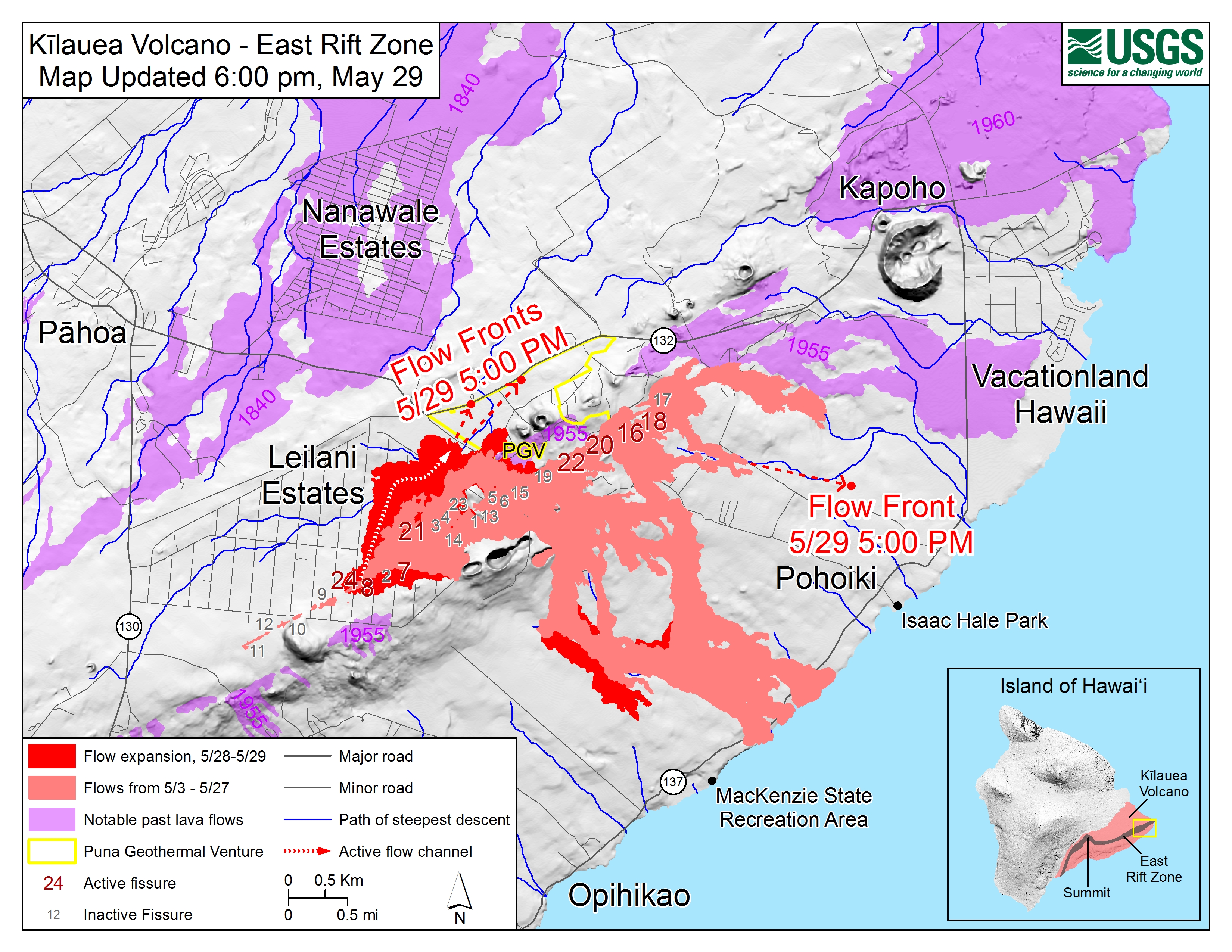
Kīlauea Lower East Rift Zone Fissures and Flows, May 29, 6:00 p.m. HST. Shaded purple areas indicate lava flows erupted in 1840, 1955, 1960, and 2014-2015.
Map Courtesy USGS - Hawaiian Volcano Observatory


Tuesday, May 29, 2018

Fissure 8 reactivated to create 200-feet high lava fountains


Lava eruption and gas emission continue unabated from the lower East Rift Zone (LERZ) fissure system in the area of Leilani Estates and Lanipuna Gardens. Today, fissure 8 remained very active, at times fountaining to the height of 200-feet. The lava flowed atop the Fissure 8 ʻaʻā flow that was active Sunday night/Monday morning to cross the highway 132 just before 2 pm HST Tuesday.

This voluminous activity of fissure 8 has produced Pele's hair and other lightweight volcanic glass that is being transported downwind and falling to the west of the fissure.

Tuesday also saw weak activity at fissure 18 and 19, but fissure 18 eruption has created a lava channel which has advanced 1.6 miles towards the coast.

Ash and gas eruption are continued from the summit, while ocean entry of lava has diminished significantly as viewed from this overflight photo.


Tephra (airborne lava fragments) erupted by the high lava fountains of fissure 8 was carried downwind, where the frothy rock fragments fell on Leilani Street, just past Kupono Street, in the Leilani Estates subdivision. Courtesy: USGS

Here is a video of fissure 8 reactivation


Immediate evacuation ordered as advancing lava threatens shut down of Highway 132

Lava flow near Highway 132
Fast moving lava approaching Highway 132 at Lava Tree State Park to Four Corners prompts more evacuations in Leilani estate in Puna, Big Island of Hawaii. If the Highway is completely shut down, Beach road will be the only escape route left for residents in lower Puna.

The Hawaiian Volcano Observatory reports an additional lava flow has crossed Pohoiki Road south of the Highway 132 junction.  


Late Monday afternoon, Fissure 8 erupted into volcanic fountain reaching a height of 100-150 feet, spawning a fast-moving flow that moved north along Luana Street. According to Hawaiian legend, this has led to Pele's hair being transported downwind with some strands falling in Pahoa. The United States Geological Survey (USGS) has urged the residents to minimize exposure to Pele's hair (volcanic glass), which can cause skin and eye irritation similar to volcanic ash.


Here is a YouTube video in which the Hawaii Volcanoes National Park Ranger, Adrian Boone explains the origin of "Pele's Hair" at Kilauea Volcano.


Lava Fountain at Fissure 7
Kīlauea Volcano — Fissure 7 Activity

Rapidly advancing lava consuming houses and trees

Since last reported 16, 18, 22,13, and 20 were active, with a flow moving south from Fissures 16/18.
An ash eruption at Halemaumau crater last night produced ash plume 15,000 feet in the air.  Light winds are blowing toward the northwest and ash fall may affect the Volcano and Pahala areas. Earthquakes continue in the summit region as the area is adjusting to the flow of magma.

A car being engulfed by the lava stream


Kīlauea Volcano — Pāhoehoe Flows on Kaupili Street

Here is a YouTube video by a resident as Lava surrounds his house 


Friday, May 25, 2018

Some New Photos of Kilauea Eruption

This image shows the scale of the lava channels feeding the ocean entries. Note that lava is overflowing the channels and is on top of slightly older, black lava flows. The visible haze is sulfur dioxide gas that's being emitted from the fissures. Photo courtesy of J. Ozbolt, Hilo Civil Air Patrol.


Photograph of the coastline where lava flows are entering the sea. There are currently three primary ocean entry points, which have evolved over the course of the eruption. Photo courtesy of J. Ozbolt, Hilo Civil Air Patrol.

Helicopter overflight of Kīlauea Volcano's lower East Rift Zone shows the lava channel emerging from Fissure 22 (not visible but to the center, far right of the image). The lava is flowing downhill, from right to left in the photo.


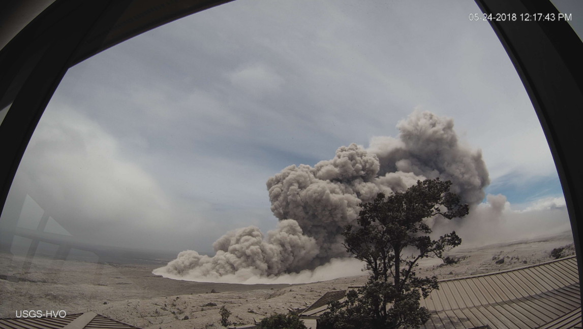
HVO's webcam capture of the image of an ash plume rising from the crater


 Fissure 22 fountain is not as high as several days ago but is still erupting significant lava.


Activity at fissure 6 this morning (May 25, 2018). Lava fountains have built a small spatter cone (black mound) from which lava was spilling out onto the surface and flowing into a small pond (left of the cone).

All these photos are sourced from United States Geological Survey (USGS) or flights conducted by the Hilo Civil Air Patrol.  

Three short videos of Kilauea from helicopter overflights


Compilation of three short videos from helicopter overflights of the fissure complex, in Kīlauea Volcano's lower East Rift Zone on May 22, 2018. Fissure 22 is the dominant fissure, with lava fountaining to 50 m (about 160 ft) or more in height.

A moderate-level eruption of lava continues from multiple points along the central and northeast end of the active fissure system.

Fissure 6 through 22 are erupting lava fountains. The fountains from Fissure 22 feed a single lava channel that reaches the coast just north of MacKenzie State Park. The actual point of entry has been shifting to the west today. Spattering continues from Fissures 5, 6, and 19 that fed a lava flow to the south that is now stalled and a smaller flow to the north along and south of Pohoiki Rd. Fissures 17 continue weak spattering.

Thursday, May 24, 2018

USGS Scientist Gives Hawaii Eruption Presentation


An informative video from the scientists at the United States Geological Survey about the recent Kilauea eruption in Hawaii

Wednesday, May 23, 2018

The Mighty Kilauea shows no signs of slowing down

Solidified lava from Fissure 17 (located to the east of the currently active fissure complex) has a consistency similar to toothpaste.

Magma continues to be supplied to the lower East Rift Zone leading to robust eruptive activity in the middle portion of the fissure system. In the last 24 hours, the most active fissures have been 22,19, 6, 5, and 23. A faint glow was seen from Fissure 9, but no flows, and methane was observed burning in road cracks overnight.

The ocean entry remains active and is producing occasional small explosions. Observers noted the height of the perched lava pond/channel had reached 11 meters / 36 feet above the ground level.
Volcanic gas emissions remain very high from these fissure eruptions.


Blue burning flame of methane gas was observed in the cracks on Kahukai Street, during the overnight hours.


The channelized lava flow and active ocean entry. The fissure complex is visible in the upper center of the image.

Small ash emissions from the Overlook crater occurred frequently throughout the night. Moderate trade winds were blowing to the southwest and ashfall may be noticed in downwind locations. 

Earthquakes in the summit area continue at a moderate rate, as does deflation of the summit region.


Helicopter overflight of Kīlauea Volcano's lower East Rift Zone shows the lava channel emerging from Fissure 22


Monday, May 21, 2018

Kīlauea Volcano - Spattering (Aerial Between Fissures 16 and 20)


Aerial view (from a helicopter) of spattering between fissures 16 and 20, Kīlauea Volcano Lower East Rift Zone, at approximately 7:30 AM HST on May 16, 2018. The audio is the sound of the helicopter.

Wednesday, May 16, 2018

Hawaii Volcano Eruption Update - Wednesday Night (May 16, 2018)

Ash emission from the Overlook crater within Halema`uma`u has generally decreased since yesterday. Although varying in intensity, at times the plume contains enough ash to be gray in color. The cloud is rising an estimated 3 to 4,000 feet above the ground, but altitudes are varying with pulses of emission. The ash cloud is drifting slowly northward from the Kilauea summit and ashfall may occur in Hawai`i Volcanoes National Park and Volcano Village. Communities downwind may receive ashfall and should take necessary precautions.

Strong earthquakes within the summit of Kīlauea Volcano continue in response to ongoing deflation and lava column drop. As of the afternoon of May 16, the floor of Kīlauea caldera has dropped approximately 3 feet (90 cm). This movement is stressing faults around the caldera of Kilauea, causing them to move and resulting in strong earthquakes of up to magnitude 4.4 thus far.

Employees at the Hawaiian Volcano Observatory, Hawai`i Volcanoes National Park, and nearby residents are reporting frequent ground shaking and damage to roads and buildings. Hawaii County Police reports cracks across Highway 11 between mile markers 28 and 29. Although these are passable, motorists are urged to use caution.

As deflation continues, strong earthquakes in the area around Kilauea Volcano's summit are expected to continue and may become more frequent. Areas further from these earthquakes may feel some ground motion as well, but much less severe.


The shallow depths of these earthquakes make them more damaging in the immediate vicinity of the epicenter, and individuals need to take precautions to minimize damage from the shaking, including the removal of unstable items from walls and shelves. Steep slopes should be avoided as they may become destabilized during strong earthquakes.


U.S. Geological Survey


Paradise Shaken: Is it the wrath of Madam Pele-The Goddess of fire on the Hawaiian Islands?


Strong earthquakes, erupting and spluttering lava and toxic gas has shaken the residents of southern part of Big Island of Hawaii as magma shift underneath a restless Kilauea Volcano.

The residents of the big island Hawaii react to this natural disaster with grief and reverence. According to Hawaiian legend, the Halemaʻumaʻu crater at the summit of the Kīlauea volcano is home to the Pele-Hawaiian goddess of fire, volcanoes, and lightning and wind. Referred to as madam Pele or Tutu grandmother – Pele is regarded as the powerful force behind Kilauea's decades-long eruptions.


Goddess Pele, Image from Jaggar Museum, Hawaii

Hawaiian people believe that sometimes Pele needs to clean the land and the eruption, lava, and ash flow are all her ways of teaching people how to live on the islands.

It’s she who makes the decision that where the lava flows and how the land is shaped for future generation. It is believed that Pele is out to reclaim the land that was taken from her. At the end of the day, Pele will take what is rightfully hers.

The residents are offering Ho’okupu of Ti leaves in front of lava flow to the fire goddess to calm her down as they prepare to leave their homes in Leilani estate.

Timeline of the current eruption


In this photo released by the U.S. Geological Survey, lava is shown burning in Leilani Estates subdivision near the town of Pahoa on Hawaii's Big Island on Thursday


Kilauea is Hawaii’s most active volcano and has been erupting continually since 1983. Hawaii officials have been warning the residents in Puna, Big Island Hawaii since Monday, April 30 that they should prepare to evacuate since an eruption can come anytime from the mighty Kilauea.  This warning came after the Puu Oo crater floor began to collapse on Monday, triggering a series of earthquakes and pushing the lava into new underground chambers towards the populated southeast coastline of the island.
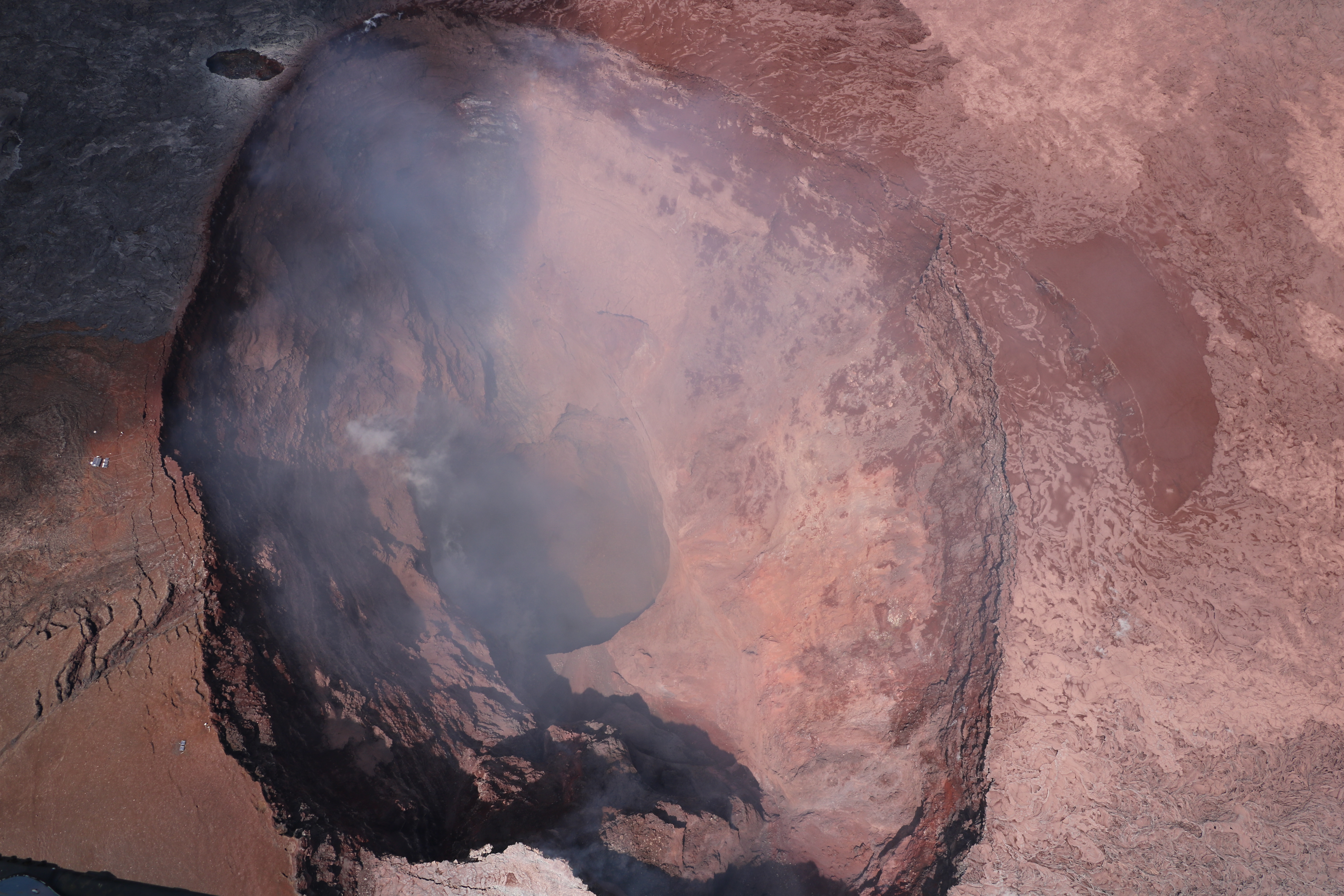

A clear view into Pu‘u ‘Ō‘ō crater. The upper part of the crater has a flared geometry, which narrows to a deep circular shaft. The deepest part of the crater is about 350 m (1150 ft) below the crater rim.


According to the U.S. Geological Survey, there were nearly 70 earthquakes of magnitude 2.5 or stronger from Tuesday to Wednesday alone.

The Monday collapse caused magma to push more than 10 miles downslope toward the populated southeast coastline of the island.

The eruption first started on Thursday, May 03, 2018 several hours after a magnitude-5.0 quake struck the Big Island. The eruption spewed lava into residential subdivisions in the Puna district of the Big Island, prompting mandatory evacuations of the Leilani Estates and Lanipuna Gardens subdivisions.

As of today, 20 fissures have opened since May 3 in Kilauea’s east rift zone, where a few small subdivisions have been built in recent years. The lava from them has shot hundreds of feet into the air, swallowed cars, destroyed about 27 homes, and forced around 2,000 residents to flee.

  • Some 37 structures have been destroyed
  • Lava has covered more than 117 acres of land in Kau and Puna district
  • At least nine roads are now impassable.
  • As many as 50 utility poles have been damaged by the lava, and hundreds have been without power since the eruptions started.
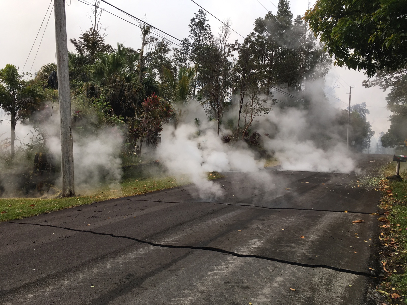
steam rising from fissure 9 on Moku Street in the Leilani Estates 

lava slowly advancing from fissure 16.

Lava spattering from an area between fissures 16 and 20

And it’s not over. The US Geological Survey (USGS) warns that “additional outbreaks of lava are likely” and that steam pressure building below the surface could cause explosions raining “ballistic projectiles and ashfall” within half a mile or more from the volcano.


On Tuesday, 15 May, the volcano’s Halemaumau Crater commanded people’s attention by a display of towering ash plume from the crater that reached 12,000 feet high and could be seen for miles.
But this is not the explosion the USGS officials are warning people about since a week.


dark ash plume rising from Halemaumau Crater


According to KHON news Michelle Coombs, a geologist with the U.S. Geological Survey, told reporters on Tuesday, “It intensified today, but it wasn’t the big one, so to speak. Does that mean that we won’t see a much bigger, more explosive event? No, not necessarily. It could plug up, and we could yet in the future have the so-called ‘big one.’ Today was more of a gradual ramp-up, and it was continuous enough that we felt it was significant to put out a public warning.”

Coombs added that geologists were not sure what had caused the intensified ash emissions Tuesday.
But A temporary flight restriction for 12 nautical miles around Kilauea’s summit has been put in place.

Hawaiian Volcano Observatory issued a statement on Tuesday regarding rumors about a tsunami in the Pacific Ocean, “There is no geologic evidence for past catastrophic collapses of Kilauea Volcano that would lead to a major Pacific tsunami, and such an event is extremely unlikely in the future based on monitoring of surface deformation.”

A volcano is considered potentially active if it has erupted in the past 10,000 years. America has 169 active volcanoes, mainly clustered in the West — in Hawaii, Alaska, Wyoming, Washington, and California.

There are about 1,900 potentially active volcanoes around the world, with 500 having erupted since humans have been around, according to the USGS. Some of these volcanoes may never erupt, some may ooze lava slowly for years, and some may one day have a massive ejection that wreaks havoc. 
Respecting the Hawaiian legend of Pele- the goddess of fire, let’s take a more scientific look at how volcanoes are formed.

How Volcanoes are formed?


A Volcanos are formed when lava and molten rocks are squeezed in the surrounding area through a rift in the earth crust.  Volcanoes vary in shapes and sizes but they all share a few key characteristics. 

All volcanoes are connected to a reservoir of molten rock, called a magma chamber, below the surface of the Earth. When the pressure inside the chamber builds up, the buoyant magma travels out a surface vent or series of vents, through a central interior pipe or series of pipes. These eruptions, which vary in size, material, and explosiveness, create different types of volcanoes. 

The earth crust is made up of huge blocks called tectonic plates that slide on top of the mantle. Most volcanoes form at the boundaries of Earth’s tectonic plates.

The mantle is the mostly-solid bulk of Earth’s interior that lies between earth’s dense, super-heated core and its thin outer layer, the crust. The mantle accounts for a whopping 84% of Earth’s total volume is about 2,900 kilometers (1,802 miles) thick.

The temperature of the mantle ranges from 1000° Celsius (1832° Fahrenheit) near its border with the crust, to 3700° Celsius (6692° Fahrenheit) near its border with the core.


A majority of the volcanoes of the world are all clustered in the Ring of Fire, a horseshoe-shaped string of about 425 volcanoes that edges the Pacific Ocean. But, some volcanoes exist in the middle of the oceans, thousands of miles away from the tectonic plate boundaries.

Hot spots are intensely hot areas within the surface of the earth and tectonic activity above the hot spot cause them to erupt to create a volcanic mound. Over millions of years, volcanic mounds can grow until they reach sea level and create a volcanic island. Hawaiian islands are the best example of a volcanic island in the world.

As the years' pass, the hot spot stay put, but the movement of tectonic plate cause the islands to drift apart become extinct and eventually erodes back into the ocean.   

The Hawaiian Emperor seamount chain is a well-known example of a large seamount and island chain created by hot-spot volcanism. Each island or submerged seamount in the chain is successively older toward the northwest. Near Hawaii, the age progression from island to island can be used to calculate the motion of the Pacific Oceanic plate toward the northwest. The youngest seamount of the Hawaiian chain is Loihi, which presently is erupting from its summit at a depth of 1000 meters. Image courtesy of U.S. Geological Survey.

Experts think this volcanic chain of Hawaiian islands has been forming for at least 70 million years over a hot spot underneath the Pacific plate. Of all the inhabited Hawaiian Islands, Kauai is located farthest from the presumed hotspot and has the most eroded and oldest volcanic rocks, dated at 5.5 million years. Meanwhile, on the “Big Island” of Hawaii—still fueled by the hot spot—the oldest rocks are less than 0.7 million years old and volcanic activity continues to create new land. 

Hawaiian Volcanoes are all exclusively made up of lava called as a shield volcano, the other being the Stratovolcanoes which are steep and conical and rising up to several thousand meters above the landscape. 

Shield volcanoes are built almost exclusively of lava, which flows out in all directions during an eruption.

Shield volcanoes make up the entirety of the Hawaiian Islands. The Kilauea and Mauna Loa shield volcanoes, located on the “Big Island” of Hawaii, rise from the ocean floor more than 4,500 meters (15,000 feet) below sea level. The summit of Mauna Loa stands at 4,168 meters (13,677 feet) above sea level and more than 8,500 meters (28,000 feet) above the ocean floor, making it the world’s largest active volcano—and, by some accounts, the world’s tallest mountain.

The smaller volcano, Kilauea, has been erupting continuously since 1983, making it one of the world’s most active volcanoes. 

Hawaiian lava eruptions are calmest and known for their steady lava eruptions known as lava fountains or fire fountains. The highly fluid lava associated with Hawaiian eruptions flows easily away from the volcano summit, often creating fiery rivers and lakes of lava within depressions on the surrounding landscape.

 Kilauea has produced lava flows covering more than 100 square kilometers (37 square miles) on the island of Hawaii. These flows continuously destroy houses and communities in their path, while also adding new coastline to the island.


Panoramic view of the lava at the end of the Chain of Craters Road, Hawaii Volcanoes National Park


History of Kilauea eruption


The Island of Hawai‘i with lava flows erupted in approximately the past 1,000 years shown in red. Located on the southeastern side, Kīlauea Volcano is 90% covered with young flows.

a 2004 Kilauea eruption, lava flowing into the sea 

The current ongoing eruption cycle began on Jan. 3, 1983, along the middle of the east rift zone. By April, the eruptions became localized at one vent. Lava fountains built a cinder and spatter cone 836 feet high (255 meters) that was named Pu`u `Ō`ō. 

The frequent short eruptions produced thick chunky lava flows that usually cooled and halted before reaching the coast. However, in July 1983, the lava made its inexorable advance into the nearby Royal Gardens subdivision and destroyed 16 homes. The expensive subdivision was largely abandoned.


Lava erupting from the PuʻʻŌʻō vent in June 1983

Previous to the 1983 eruptions, there were 2 more eruptions in 1955 and 1960. The eruption in 1955 lasted 88 days while the one in 1960 lasted 36 days.

Kilauea also erupted in 1986 and 1990. In 1986, lava flows cut through the town of Kalapana, on it’s way to the sea. As the lava field spread, cooled and spread again over the next three years it destroyed many homes and the Visitor Center in Hawai`i Volcanoes National Park. In March 1990, Kilauea entered its most destructive eruption period in modern history. Over the summer more than 100 homes, a church, and a store were buried beneath 50 to 80 feet (15 to 24 meters) of lava.


A stream of lava from Pu‘u ‘Ō‘ō flowing through the forest in the Royal Gardens subdivision, February 28, 2008. The lava stream is about 3 m (10 ft) wide. Kīlauea Volcano, Hawai‘i.
Sulfur dioxide emissions from the Halemaʻumaʻu vent in April 2008

In October 2012, Lava in Halema`uma`u crater overflowed the crater's ledge and lava reached the ocean in November when it flooded the ledge of the crater. Lava flowed over the ledge again in January 2013 and continues to flow into the ocean, according to USGS.

Volcanoes are some of Earth’s most potent natural hazards and agents of change. They release enormous amounts of energy and material, engaging natural processes that can modify landscapes at a local, regional, and even global scale.
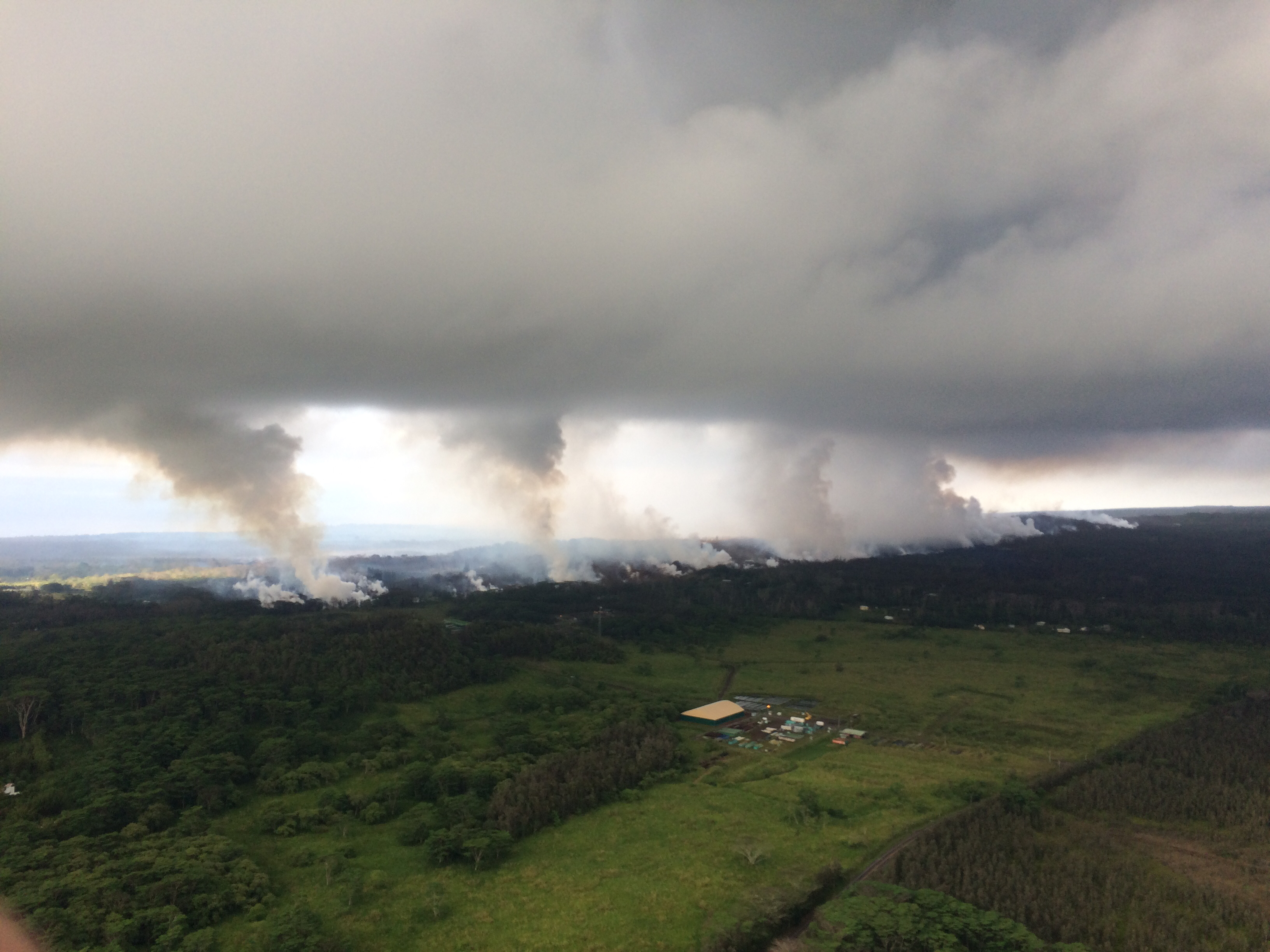

View upright from the Hawaiian Volcano Observatory overflight this morning at 8:25 a.m