Showing posts with label Hawaii Volcano Eruption. Show all posts

Tuesday, July 10, 2018

Lower East Rift Zone eruption continues unabated

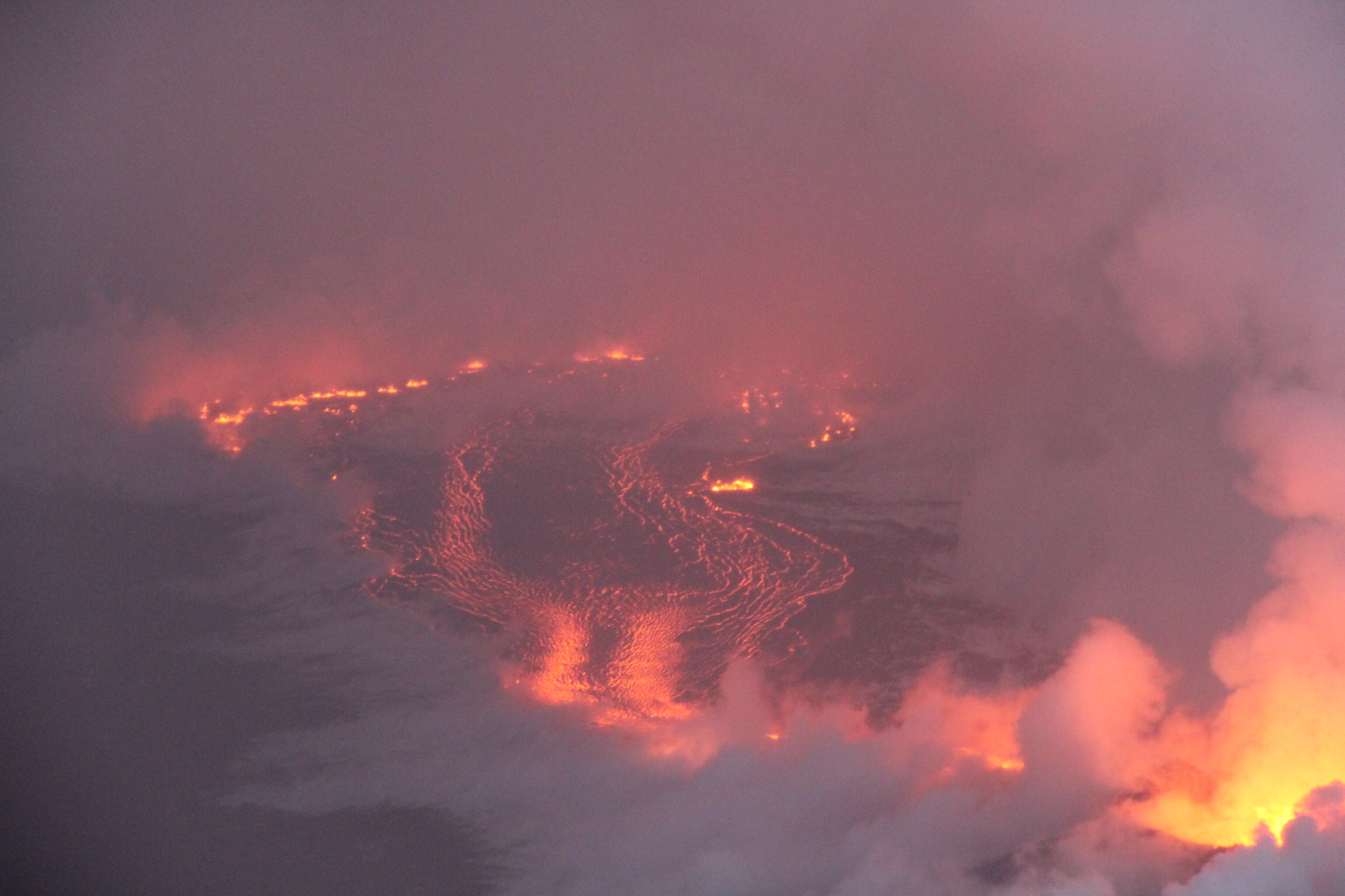
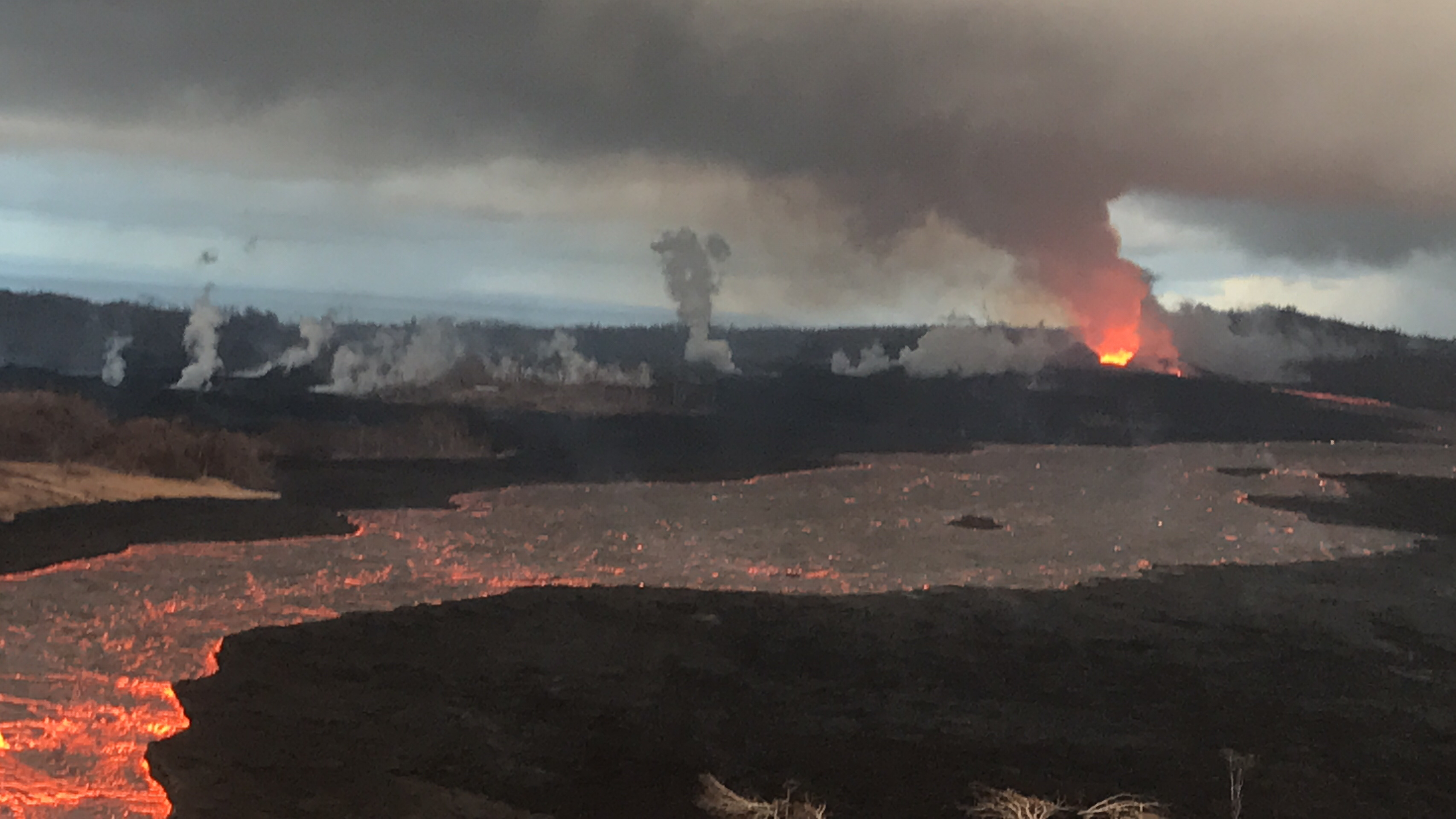
View of Fissure 8 and channel during the morning overflight on July 7.

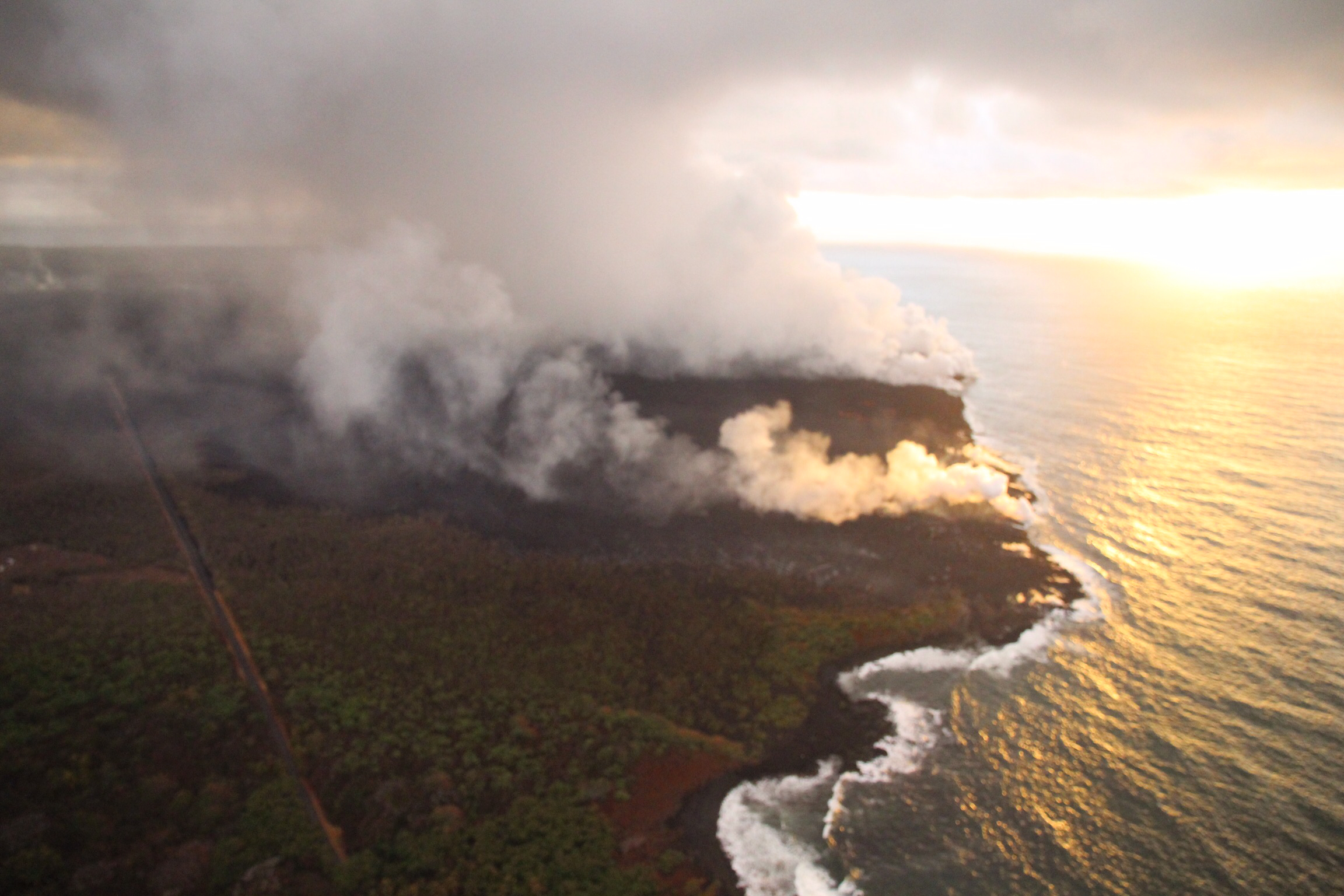
Lava entering the ocean as seen through steam and rain early this morning.

Fissure 8 continues to erupt lava steadily into the perched channel leading northeastward from the vent. Disruptions to the mid-channel occurred yesterday afternoon producing localized overflows along the margins of the flow field, mostly atop earlier lavas. A significant overflow north of the cinder quarry advancing yesterday and last night towards Cinder Rd. has stalled. An overflow lobe moving around the west side of Kapoho Cone remains active this morning and small brushfires are reported along the margins. Downstream, lava appears to be reoccupying the channel leading to the ocean entry were multiple fingers of lava are active. The southern margin of the ocean entry shows little sign of movement.

Yesterday's channel disruption and overflows were caused by blockages that developed along the channel. Additional blockages and resulting overflows are likely to occur as long as the activity continues.

Fissure 22 continues to exhibit weak spattering. No other fissures are active.

Pele's hair and other lightweight volcanic glass fragments from the lava fountain at Fissure 8 continue to fall downwind of the fissure, dusting the ground within a few hundred meters (yards) of the vent. High winds may waft lighter particles to greater distances. Residents are urged to minimize exposure to these volcanic particles, which can cause skin and eye irritation similar to volcanic ash.
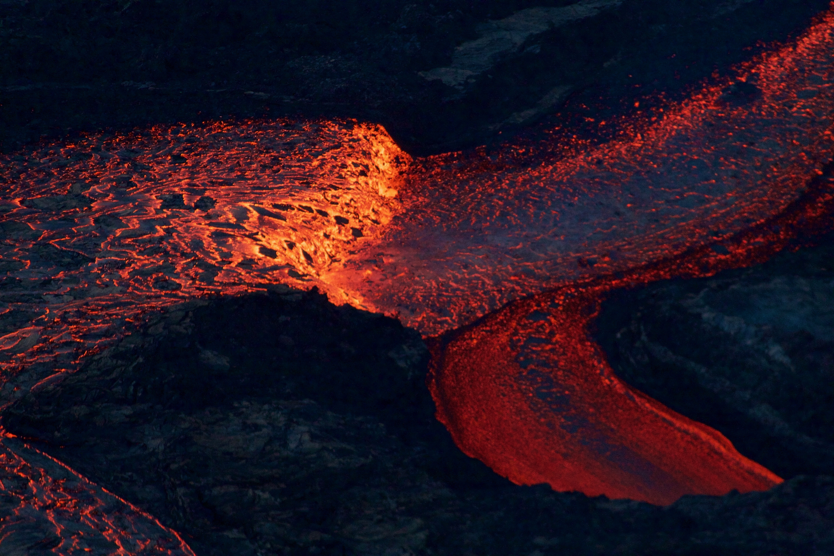
Near the Kapoho Crater, in the area called Four Corners, the lava channel makes a 90-degree bend. After lava exits the bend, it makes a short drop to form a lavafall. A side channel makes a short surface diversion before rejoining the existing channel.

Southern end of the active fissure 8 flow margin north of the Ahalanui Beach Park, known as the warm ponds. The flow margin is estimated to be about 500 m (0.3 mi) from the par


Monday, June 4, 2018

Lava from fissure 8 meets ocean at the Kapoho bay

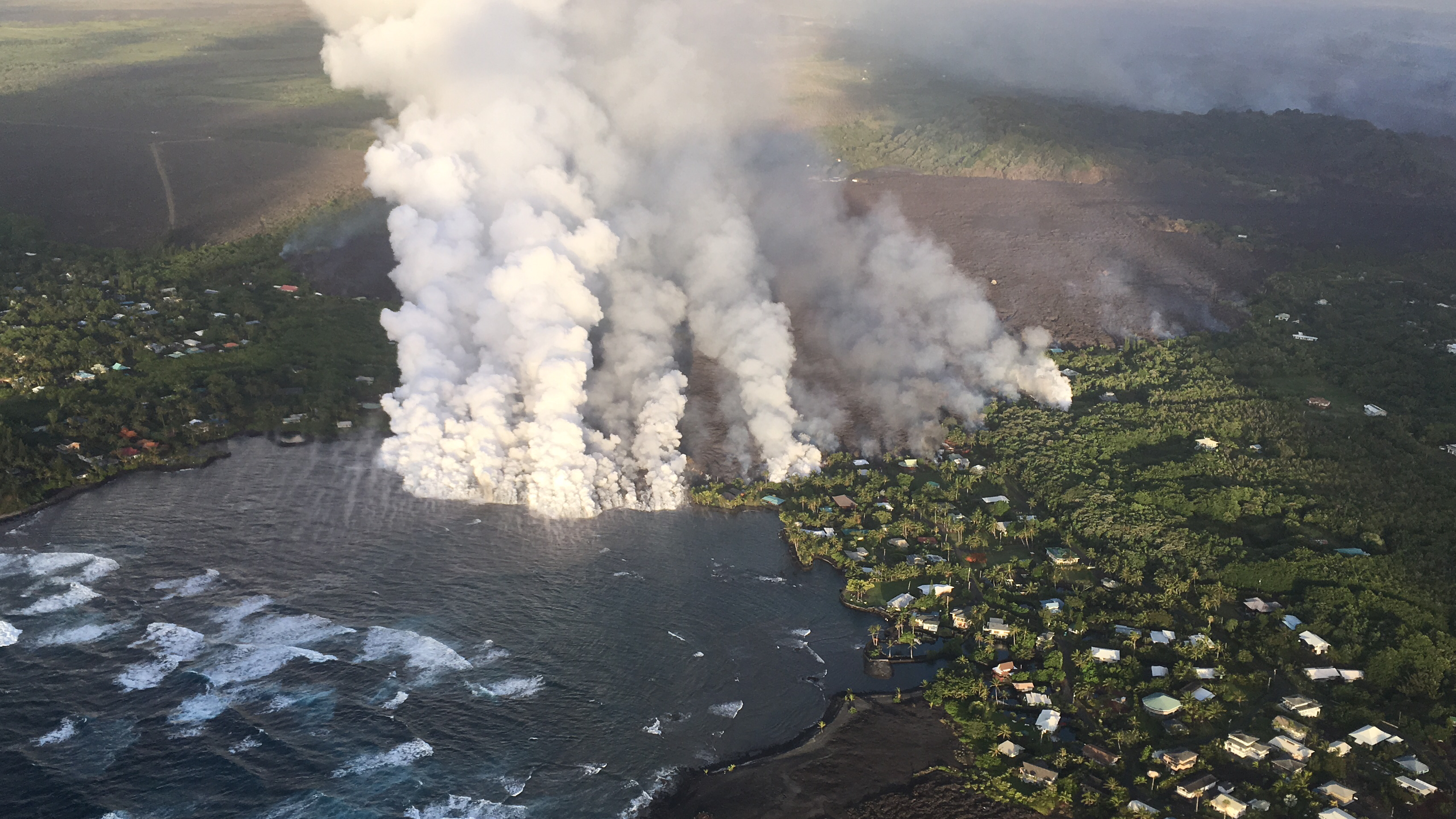
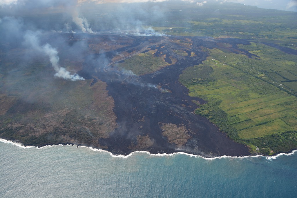
Overflight photograph at approximately 6:13 a.m. HST shows the lava flow originating from Fissure 8 (not visible in photograph) entering Kapoho Bay. The ocean entry was reported to have occurred by 10:30 p.m. on the night of June 3, 2018.

The lava from fissure 8 entered the ocean at  Kapoho Bay at about 10:30 PM HST on June 3 generating a laze plume that is blowing inland but dissipating quickly. As of today morning, the lava is also constructing a delta in Kapoho Bay extending a few hundred yards into the bay.

The lava flow front is half a mile wide. A sluggish lava flow was observed in the vicinity of fissure 18 and rest of the fissures are all inactive.

Volcanic gas emissions remain very high from the fissure eruptions and also at the summit. Trade wind conditions are bringing vog to the south and west sides of the Island of Hawaii. Afternoon easterly winds may bring vog to communities in the Volcano area.

Inward slumping of the rim and walls of the walls of Halema`uma`u continues in response to persistent subsidence.

The USGS is predicting an increased earthquake activity in the coming days.

Some of the photos from USGS update today:

Video from helicopter overflight of Kīlauea Volcano's lower East Rift Zone on June 4, 2018, shows lava from fissure 8 entering the ocean at Kapoho Bay. View to the north.


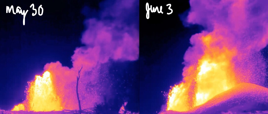
What a difference four days makes! These thermal images of fissure 8 fountains erupting on Kīlauea's lower East Rift Zone show a few things: 1) The lava fountains have gained height—with the tallest one growing from 150 ft to over 250 ft. 2) A pu‘u (cone) has built up downwind. 3) The amount of material wafting downwind is greater. Scientifically, we know the fountain temperatures are reaching up to about 2040 degrees F (1115 C). The composition of the lava erupted has high MgO (magnesium oxide) values, which comes from olivine crystals that are being pulled from deep in the rift zone.

Tuesday, May 29, 2018

Immediate evacuation ordered as advancing lava threatens shut down of Highway 132

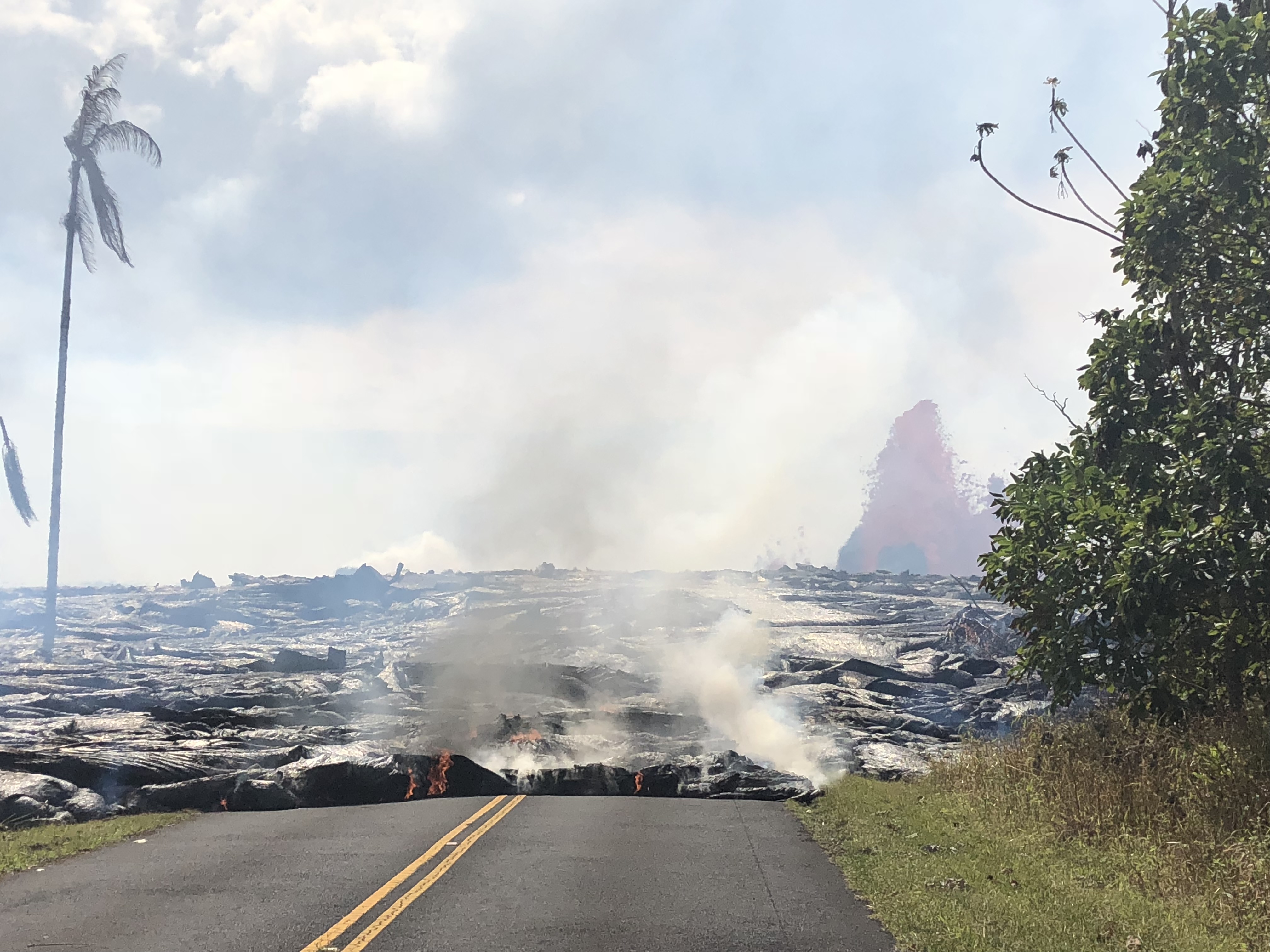
Lava flow near Highway 132
Fast moving lava approaching Highway 132 at Lava Tree State Park to Four Corners prompts more evacuations in Leilani estate in Puna, Big Island of Hawaii. If the Highway is completely shut down, Beach road will be the only escape route left for residents in lower Puna.

The Hawaiian Volcano Observatory reports an additional lava flow has crossed Pohoiki Road south of the Highway 132 junction.  


Late Monday afternoon, Fissure 8 erupted into volcanic fountain reaching a height of 100-150 feet, spawning a fast-moving flow that moved north along Luana Street. According to Hawaiian legend, this has led to Pele's hair being transported downwind with some strands falling in Pahoa. The United States Geological Survey (USGS) has urged the residents to minimize exposure to Pele's hair (volcanic glass), which can cause skin and eye irritation similar to volcanic ash.


Here is a YouTube video in which the Hawaii Volcanoes National Park Ranger, Adrian Boone explains the origin of "Pele's Hair" at Kilauea Volcano.


Lava Fountain at Fissure 7
Kīlauea Volcano — Fissure 7 Activity

Rapidly advancing lava consuming houses and trees

Since last reported 16, 18, 22,13, and 20 were active, with a flow moving south from Fissures 16/18.
An ash eruption at Halemaumau crater last night produced ash plume 15,000 feet in the air.  Light winds are blowing toward the northwest and ash fall may affect the Volcano and Pahala areas. Earthquakes continue in the summit region as the area is adjusting to the flow of magma.

A car being engulfed by the lava stream


Kīlauea Volcano — Pāhoehoe Flows on Kaupili Street

Here is a YouTube video by a resident as Lava surrounds his house 


Monday, May 28, 2018

A vigorous eruption of lava prompts more evacuation from Leilani estate


Fast moving lava flow from fissures 7 and 8 made its way into the eastern portion of Leilani Estates prompting evacuations in advance of this dangerous, rapidly moving stream of lava.

The US Geological Survey said Sunday that fissure 7 was "very active, producing a large spatter rampart over 100 feet tall from fountains reaching 150-200 feet."

One more fissure (24) has also opened on Sunday but it not actively spewing lava yet.
Ocean entry of lava continues at 3 minor points, with fissure 13 being the dominant source. Activity at fissure 22 has waned while fountaining continues at fissure 8.

Aerial view of the ocean-entry areas at about 12:30 p.m. HST. Lava flowing into the ocean diminished overnight and this morning (note lack of obvious plume at the entry areas). View is toward the northwest. Photograph courtesy of Civil Air Patrol


Pāhoehoe lava advancing west from fissure 7 (lava fountain in background) on Leilani Avenue. Fissure 7 activity increased overnight, with lava fountains reaching 50 to 60 m (164 to 197 ft) high

"Lava flow from Fissures 7 and 21 crossed into PGV property overnight and has now covered one well that was successfully plugged. That well, along with a second well 100 feet away, are stable and secured, and are being monitored. Also due to preventative measures, neither well is expected to release any hydrogen sulfide," it said.

Hawaii County Civil Defense said that lava had reached the Puna Geothermal Venture Plant, covering a well.

Volcanic gas emissions also remained very high, the USGS said. "Tradewinds are expected to diminish Sunday evening, which could expand the area impacted by vog," it said in a statement.

Since Sunday noon, no significant ash column has been produced, said USGS, "Additional explosive events that could produce minor amounts of ashfall downwind are possible at any time.”

Aerial view of Kīlauea Volcano's summit caldera and an ash plume billowing from Halema‘uma‘u, a crater within the caldera. The USGS–Hawaiian Volcano Observatory and Hawai‘i Volcanoes National Park's Jaggar Museum are visible on the caldera rim (center right); Kīlauea Military Camp can be seen in the lower right. Photo courtesy of the Civil Air Patrol.
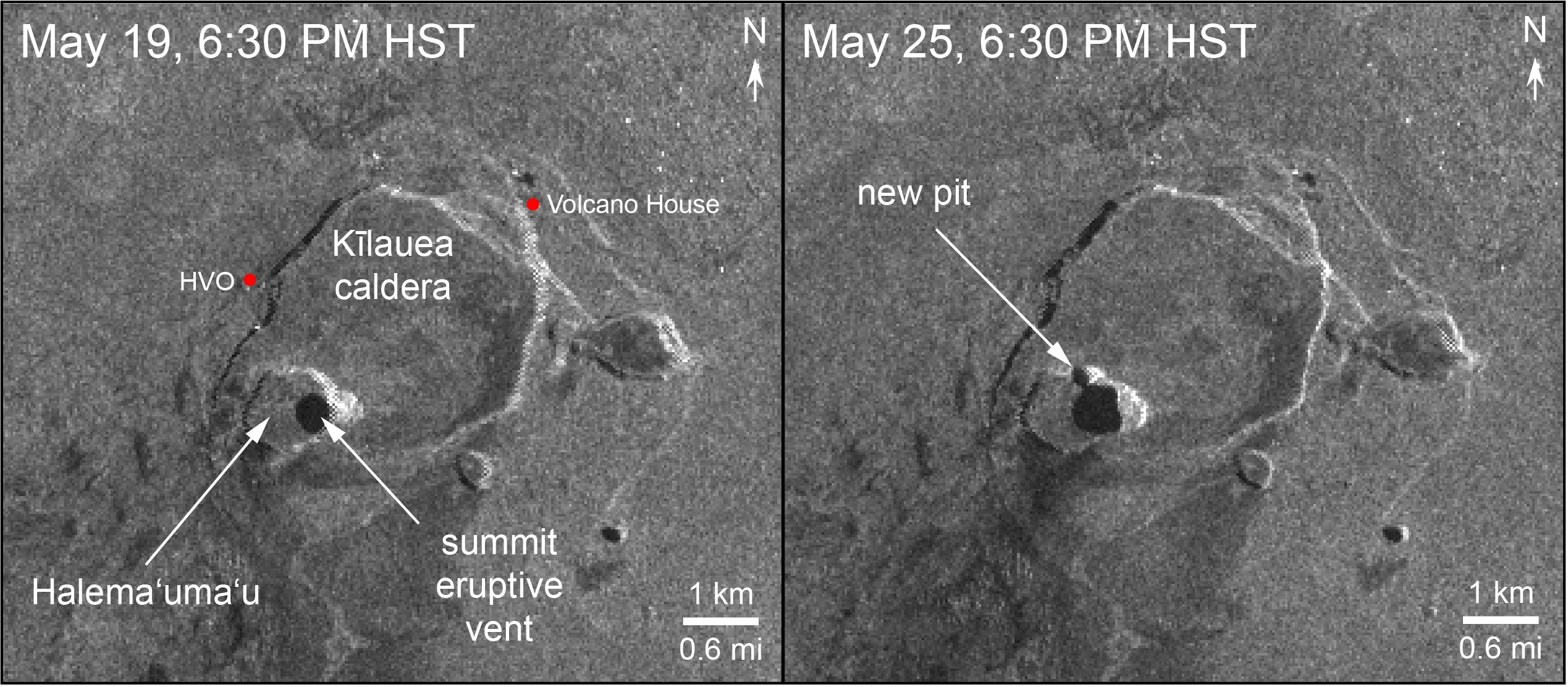
Radar data acquired by the European Space Agency's Sentinel-1 satellite over Kīlauea Volcano shows that the summit eruptive vent continues to expand as the unsupported conduit walls collapse. The vent area is now approximately 90 acres, and the scientist at Space Agency anticipate further enlargements over the coming days to weeks as subsidence of Kīlauea caldera, rockfalls, and small explosions continue.


As of Friday, the oozing lava had destroyed 82 structures on the Big Island, of which 41 are homes Hawaii County Civil Defense Administrator Talmadge Magno said.

About 2,400 acres had been covered in lava since the Kilauea volcano eruptions began May 3, Magno said.                                      
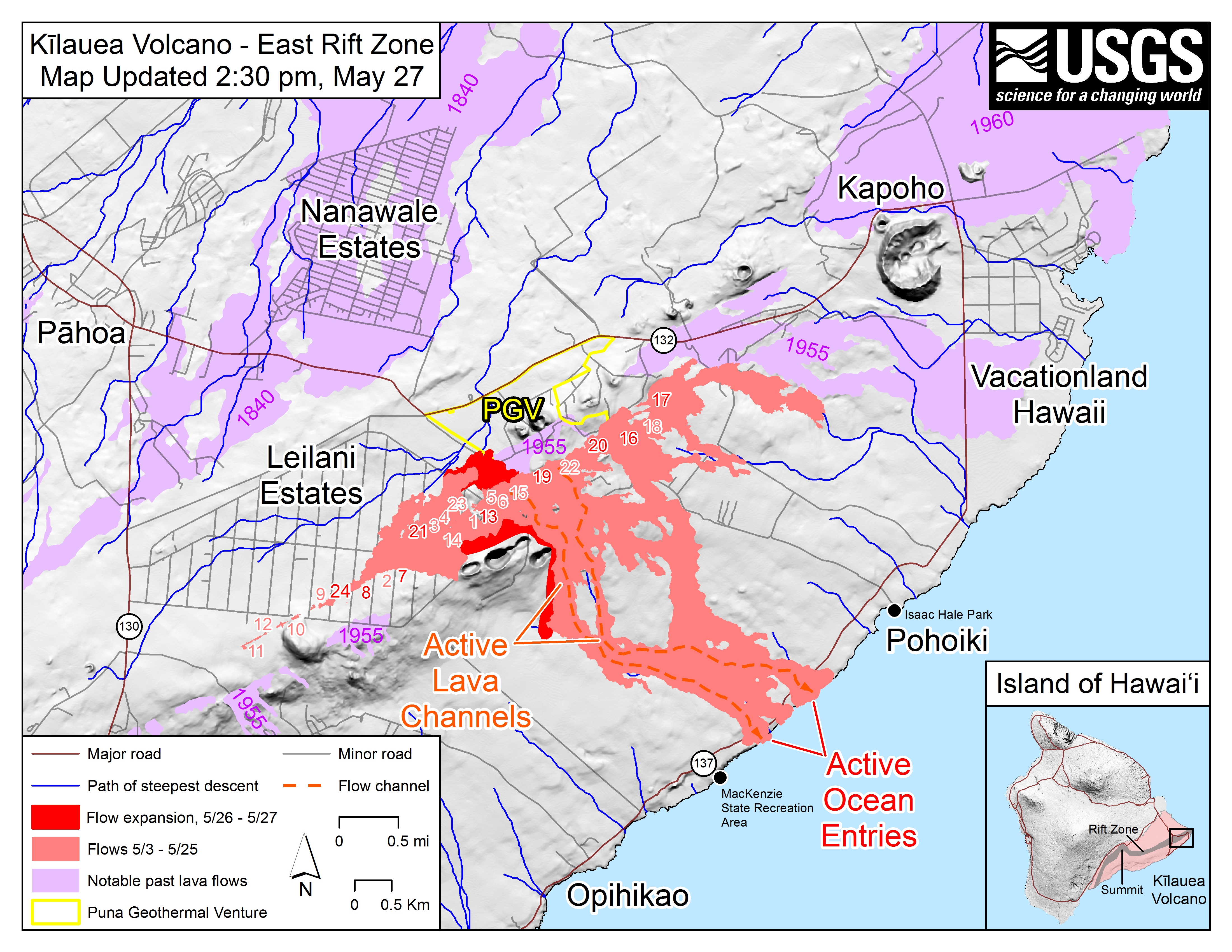
   Kīlauea Lower East Rift Zone Fissures and Flows
Map as of 2:30 p.m. HST, May 27, 2018. Shaded purple areas indicate lava flows erupted in 1840, 1955, 1960, and 2014-2015.

Friday, May 25, 2018

Three short videos of Kilauea from helicopter overflights


Compilation of three short videos from helicopter overflights of the fissure complex, in Kīlauea Volcano's lower East Rift Zone on May 22, 2018. Fissure 22 is the dominant fissure, with lava fountaining to 50 m (about 160 ft) or more in height.

A moderate-level eruption of lava continues from multiple points along the central and northeast end of the active fissure system.

Fissure 6 through 22 are erupting lava fountains. The fountains from Fissure 22 feed a single lava channel that reaches the coast just north of MacKenzie State Park. The actual point of entry has been shifting to the west today. Spattering continues from Fissures 5, 6, and 19 that fed a lava flow to the south that is now stalled and a smaller flow to the north along and south of Pohoiki Rd. Fissures 17 continue weak spattering.

Thursday, May 17, 2018

Explosion at the summit of Hawaii's Kilauea volcano creates a 30,000 feet tall ash plume

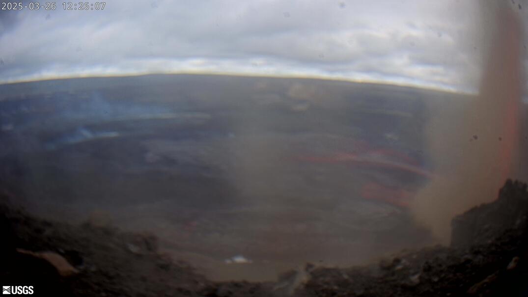
Webcam image shows the plume of ash from Thursday morning's explosive eruption at Kilauea (Image: USGS)

Hawaii Volcano Observatory officials confirmed that there was an explosive eruption at around 4:15 a.m., at the summit of Kilauea which created a massive volcanic cloud reaching 30,000 feet. That's a little below the cruising altitude of a jetliner.

Huge plumes of ash poured from Halemaumau Crater as volcanic activity at the summit continued. (Image: Janice Wei)

"At any time, the activity may again become more explosive, increasing the intensity of ash production and producing ballistic projectiles near the vent," the USGS said. "Ballistic projectiles may be produced should steam-driven explosions occur. Impacts will be limited to an area around Halemaumau."

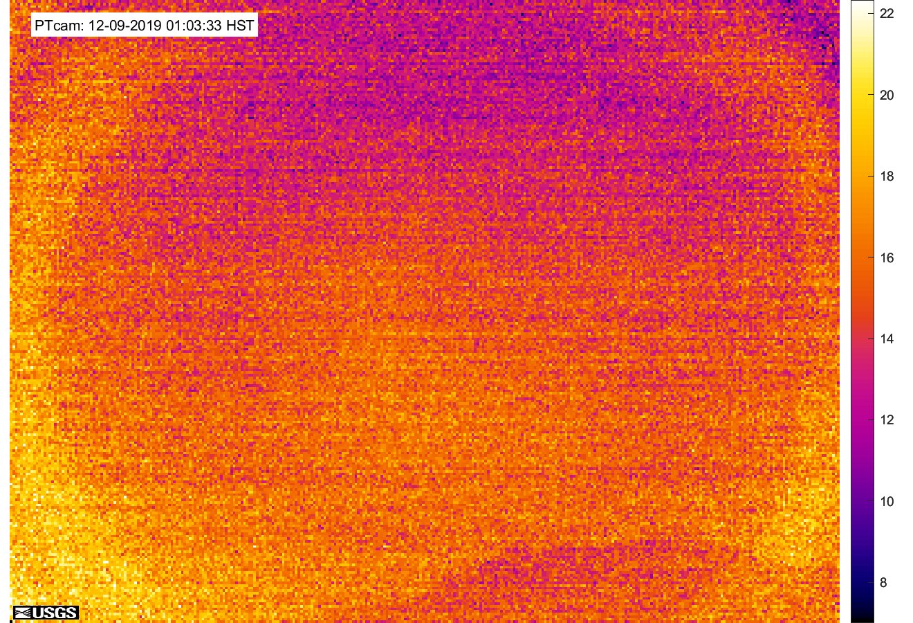
image from a temporary thermal camera positioned on the northwest flank of Puʻu ʻŌʻō showing the heat map


Earlier, the ash plume rose to 12,000 feet on Tuesday, covering the surrounding areas in a thick blanket of smoke and ash.

The National Weather Service has issued an ashfall advisory after radar showed the massive plume. The wind is expected to carry the ash plume toward Ka'u, Volcano, Mountain View, Keaau and as far as Hilo.

The explosion followed a series of 125 shallow quakes that rattled Kilauea's summit and neighboring communities since 1 day.

Michelle Coombs, of the U.S. Geological Survey, said the situation remains "very, very active and very dynamic. Scientists were not surprised by the volcano explosion that sent a cloud of volcanic ash up to 30,000 feet above sea level Thursday. She said even more powerful events could follow.


Michelle Coobs with U.S. Geological Survey says scientists were not surprised by the volcano explosion that sent a cloud of volcanic ash up to 30,000 feet above sea level Thursday. She said even more powerful events could follow.

The quakes are being caused by the ongoing deflation at the summit and as lava levels continue to plummet. As of Wednesday afternoon, the floor of the Kilauea caldera has dropped about 3 feet.

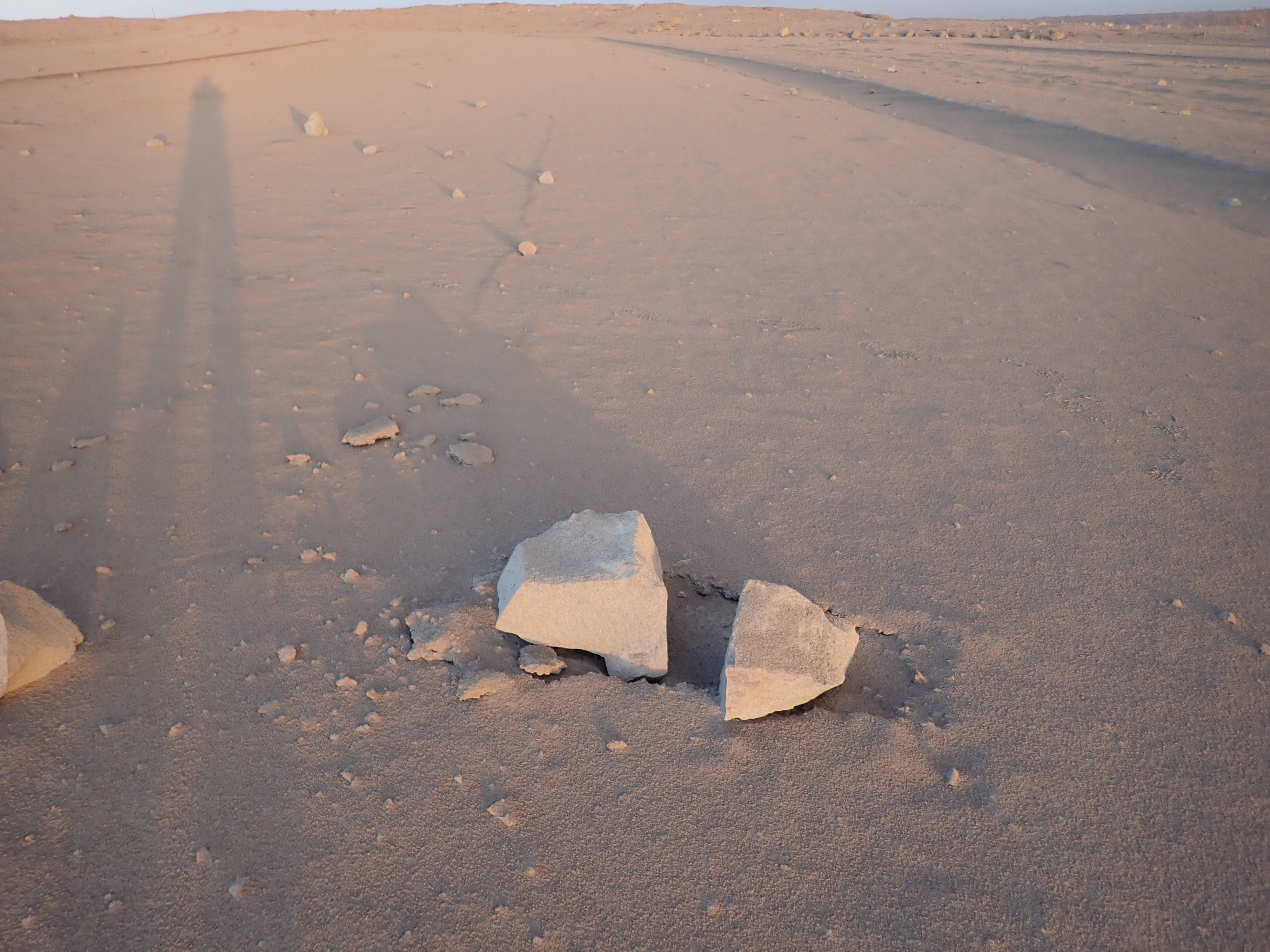
Close view of rock hurled from the Overlook crater during an explosive event last evening. The rock broke apart on impact and was about 60 cm (24 in) before it hit the ground.


Also on Wednesday, Hawaiian Volcano Observatory said rocks up to 2 feet wide were hurled from the crater to a parking lot hundreds of yards away. The hurling of these ballistic rocks could reflect the onset of a steam-driven explosion that the officials are expecting since long. This will happen as the lava level continue falling and touch the water table beneath the Kilauea caldera, creating a massive explosion.

Researchers don't know when the explosive activity will occur, how large the explosions could be or how long they'd last.

Don Swanson, of the Hawaiian Volcano Observatory said, "If an explosion happens, there's a risk at all scales. If you're near the crater within a half a mile or so, then you would be subject to a bombardment by ballistic blocks weighing as much as 10 or 12 tons."

Wednesday, May 16, 2018

Hawaii Volcano Eruption Update - Wednesday Night (May 16, 2018)

Ash emission from the Overlook crater within Halema`uma`u has generally decreased since yesterday. Although varying in intensity, at times the plume contains enough ash to be gray in color. The cloud is rising an estimated 3 to 4,000 feet above the ground, but altitudes are varying with pulses of emission. The ash cloud is drifting slowly northward from the Kilauea summit and ashfall may occur in Hawai`i Volcanoes National Park and Volcano Village. Communities downwind may receive ashfall and should take necessary precautions.

Strong earthquakes within the summit of Kīlauea Volcano continue in response to ongoing deflation and lava column drop. As of the afternoon of May 16, the floor of Kīlauea caldera has dropped approximately 3 feet (90 cm). This movement is stressing faults around the caldera of Kilauea, causing them to move and resulting in strong earthquakes of up to magnitude 4.4 thus far.

Employees at the Hawaiian Volcano Observatory, Hawai`i Volcanoes National Park, and nearby residents are reporting frequent ground shaking and damage to roads and buildings. Hawaii County Police reports cracks across Highway 11 between mile markers 28 and 29. Although these are passable, motorists are urged to use caution.

As deflation continues, strong earthquakes in the area around Kilauea Volcano's summit are expected to continue and may become more frequent. Areas further from these earthquakes may feel some ground motion as well, but much less severe.


The shallow depths of these earthquakes make them more damaging in the immediate vicinity of the epicenter, and individuals need to take precautions to minimize damage from the shaking, including the removal of unstable items from walls and shelves. Steep slopes should be avoided as they may become destabilized during strong earthquakes.


U.S. Geological Survey