Showing posts with label Kapoho Bay. Show all posts

Wednesday, June 6, 2018

Lava tide from fissure 8 almost completely fills the Kapoho Bay

Kapoho Bay before the Kilauea eruption. Source: Google Maps


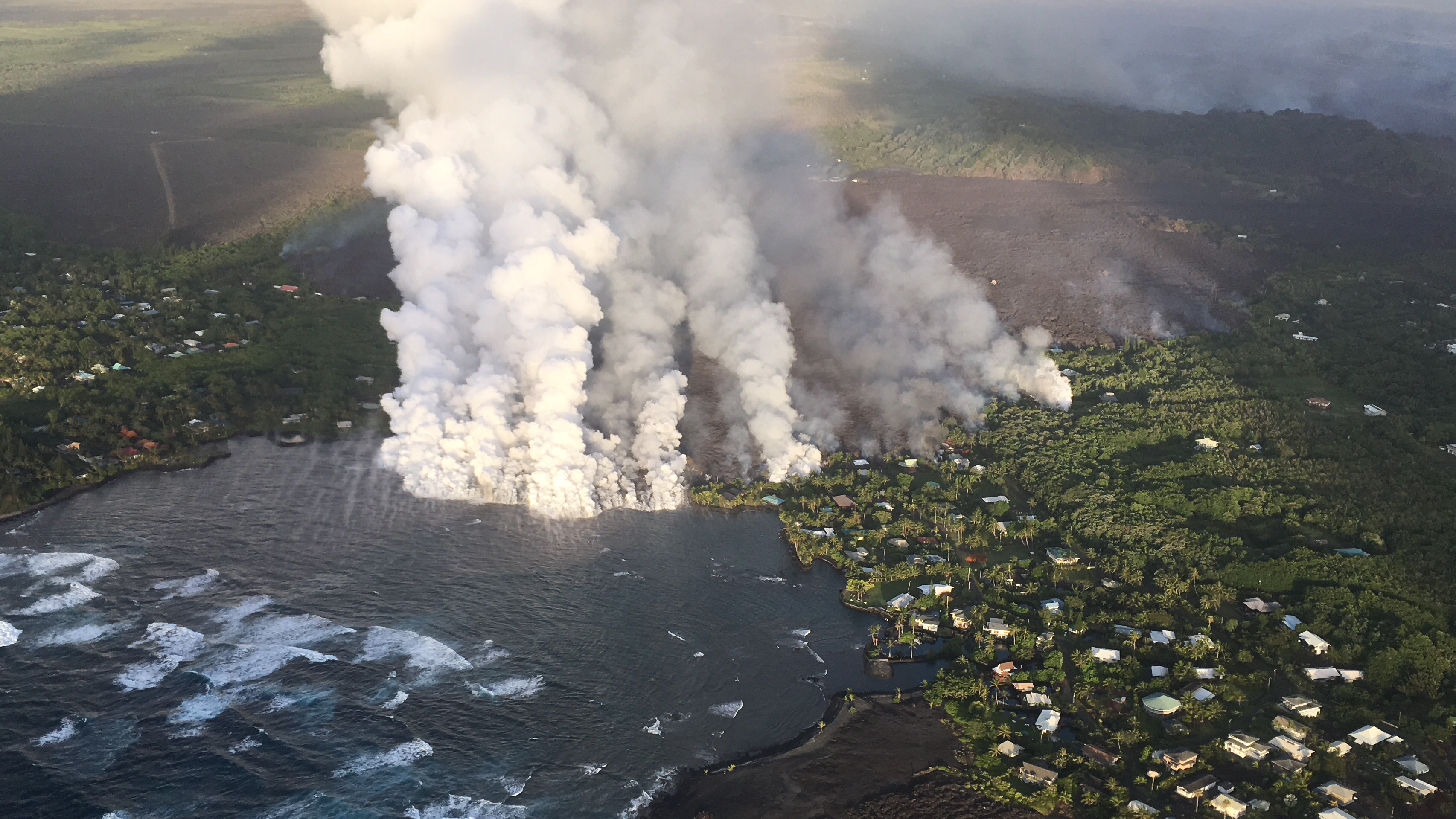
Kapoho Bay completely filled by lava on the morning of June 5, 2018. Source : USGS
Images from the United States Geological Survey (USGS) show that lava tide from fissure 8  has completely filled the beloved Kapoho Bay and destroyed homes in greater part of the Vacation Land.

The destructive fissure 8 flow entered the ocean at approximately 10:30 p.m. Sunday evening to produce a delta that began to fill in Kapoho Bay in lower Puna. According to Jim Kauahikaua of the USGS, the bay already was halfway filled in by noon Monday, and the flow reached the north side of the bay, where Champagne Ponds is located, by Monday evening.

It is estimated that a total of159 homes were destroyed till now, which includes 42 homes recently destroyed in Kapoho Bay.

Janet Babb, the spokeswoman for the Hawaiian Volcano Observatory, said more than 20 square kilometers, or 5,000 acres, have been covered by lava since the eruption in the lower East Rift Zone began May 3.

The ocean entry of  fissure 8 lava is about half a mile wide in some places,  contributing to the high amount of lava haze called laze. Laze contains high amounts of hydrochloric acid along with tiny fragments of volcanic glass which can cause skin and eye irritation and difficulty in breathing. 


Big Island has experienced more than 12,000 earthquakes since the Kilauea started spewing lava about a month back.


Here are some of the recent aerial photographs of Kapoho Bay and Kilauea
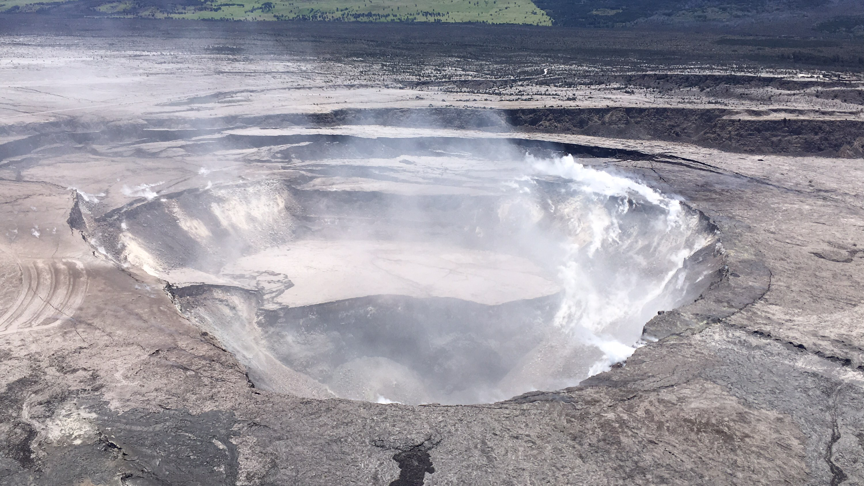
HVO scientists captured this aerial view of a much-changed Halema‘uma‘u during their overflight of the summit this afternoon. Explosions and collapse within Halema‘uma‘u have enlarged the crater (foreground) that previously hosted the summit lava lake, and the far rim of Halema‘uma‘u has dropped with continued summit deflation. The parking area for the former Halema‘uma‘u Overlook (closed since early 2008 due to volcanic hazards) can be seen to the left of the crater.

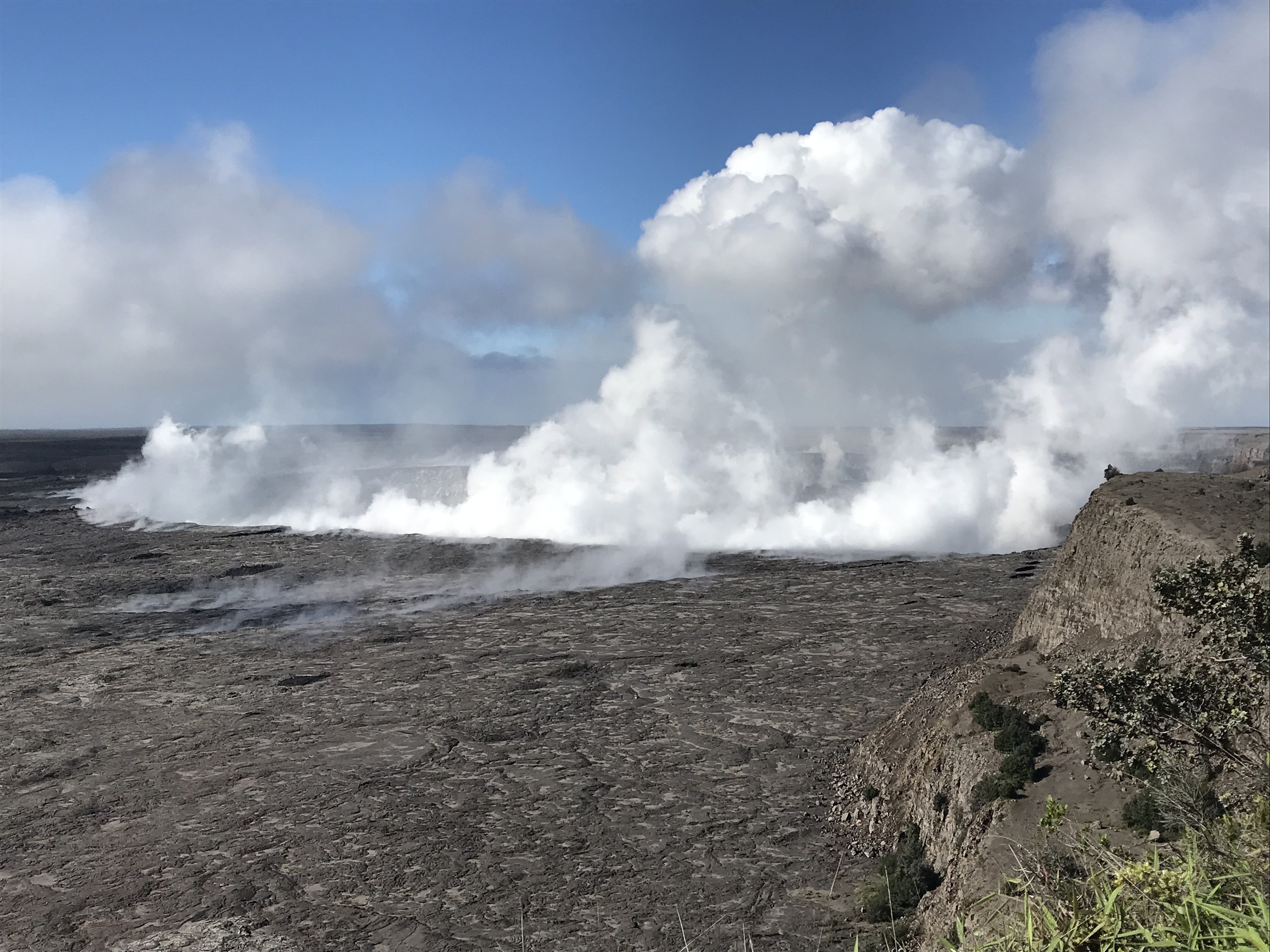
Morning view of Halema‘uma‘u and the adjacent caldera floor from the Kīlauea overlook. Heavy steam dominates the view, and strong winds are blowing the plume to the southwest.


Monday, June 4, 2018

Lava from fissure 8 meets ocean at the Kapoho bay

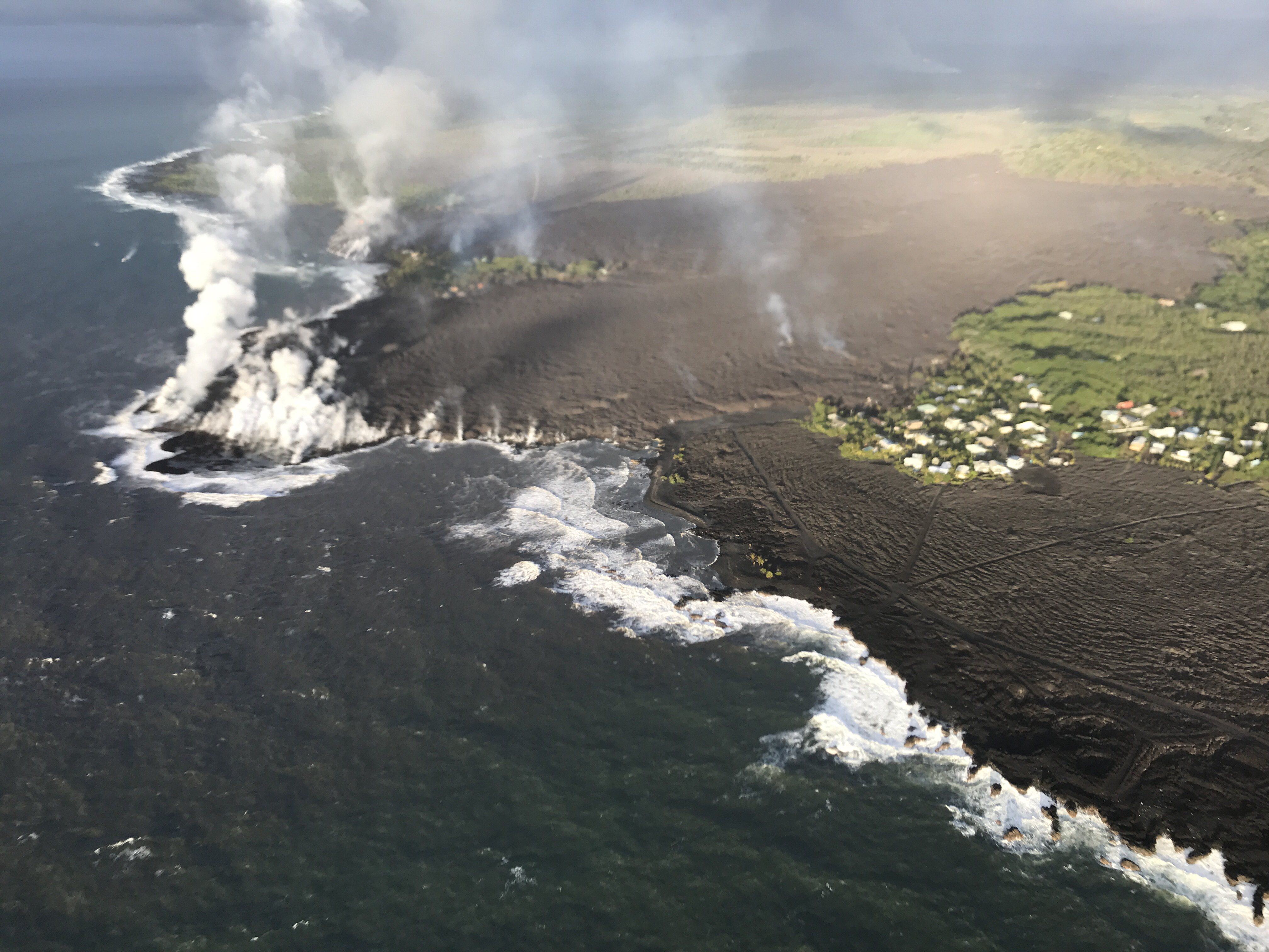
Overflight photograph at approximately 6:13 a.m. HST shows the lava flow originating from Fissure 8 (not visible in photograph) entering Kapoho Bay. The ocean entry was reported to have occurred by 10:30 p.m. on the night of June 3, 2018.

The lava from fissure 8 entered the ocean at  Kapoho Bay at about 10:30 PM HST on June 3 generating a laze plume that is blowing inland but dissipating quickly. As of today morning, the lava is also constructing a delta in Kapoho Bay extending a few hundred yards into the bay.

The lava flow front is half a mile wide. A sluggish lava flow was observed in the vicinity of fissure 18 and rest of the fissures are all inactive.

Volcanic gas emissions remain very high from the fissure eruptions and also at the summit. Trade wind conditions are bringing vog to the south and west sides of the Island of Hawaii. Afternoon easterly winds may bring vog to communities in the Volcano area.

Inward slumping of the rim and walls of the walls of Halema`uma`u continues in response to persistent subsidence.

The USGS is predicting an increased earthquake activity in the coming days.

Some of the photos from USGS update today:

Video from helicopter overflight of Kīlauea Volcano's lower East Rift Zone on June 4, 2018, shows lava from fissure 8 entering the ocean at Kapoho Bay. View to the north.


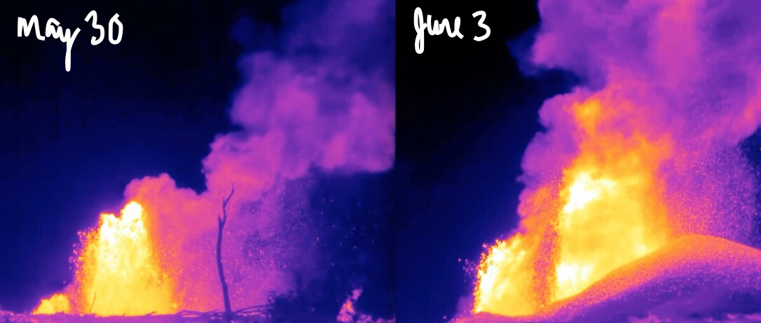
What a difference four days makes! These thermal images of fissure 8 fountains erupting on Kīlauea's lower East Rift Zone show a few things: 1) The lava fountains have gained height—with the tallest one growing from 150 ft to over 250 ft. 2) A pu‘u (cone) has built up downwind. 3) The amount of material wafting downwind is greater. Scientifically, we know the fountain temperatures are reaching up to about 2040 degrees F (1115 C). The composition of the lava erupted has high MgO (magnesium oxide) values, which comes from olivine crystals that are being pulled from deep in the rift zone.