Fast moving lava flow from fissures 7 and 8 made its way into the eastern portion of Leilani Estates prompting evacuations in advance of this dangerous, rapidly moving stream of lava.
The US Geological Survey said Sunday that fissure 7 was "very active, producing a large spatter rampart over 100 feet tall from fountains reaching 150-200 feet."
One more fissure (24) has also opened on Sunday but it not actively spewing lava yet.
Ocean entry of lava continues at 3 minor points, with fissure 13 being the dominant source. Activity at fissure 22 has waned while fountaining continues at fissure 8.
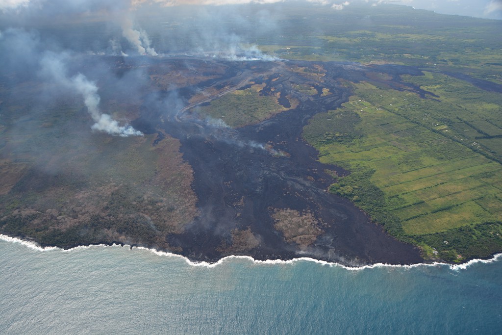 |
Aerial view of the ocean-entry areas at about 12:30 p.m. HST. Lava flowing into the ocean diminished overnight and this morning (note lack of obvious plume at the entry areas). View is toward the northwest. Photograph courtesy of Civil Air Patrol
|
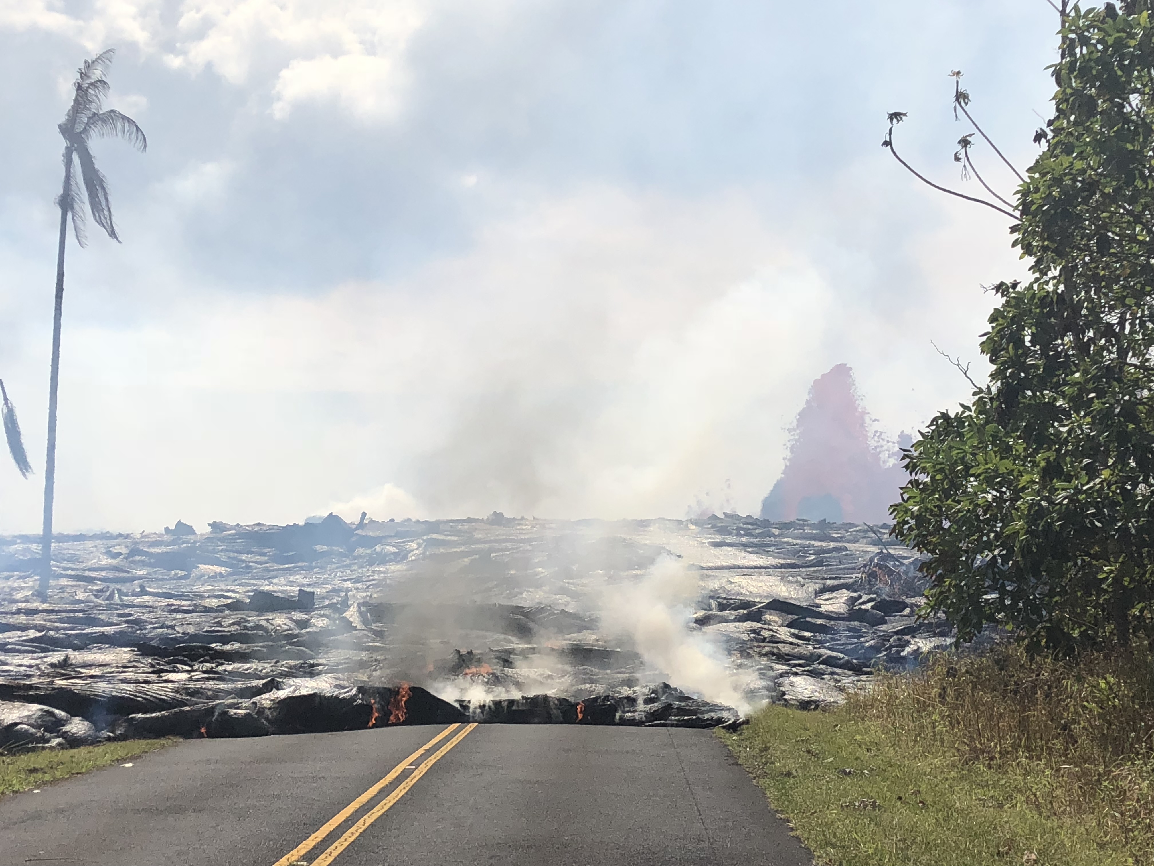 |
| Pāhoehoe lava advancing west from fissure 7 (lava fountain in background) on Leilani Avenue. Fissure 7 activity increased overnight, with lava fountains reaching 50 to 60 m (164 to 197 ft) high |
"Lava flow from Fissures 7 and 21 crossed into PGV property overnight and has now covered one well that was successfully plugged. That well, along with a second well 100 feet away, are stable and secured, and are being monitored. Also due to preventative measures, neither well is expected to release any hydrogen sulfide," it said.
Hawaii County Civil Defense said that lava had reached the Puna Geothermal Venture Plant, covering a well.
Hawaii County Civil Defense said that lava had reached the Puna Geothermal Venture Plant, covering a well.
Volcanic gas emissions also remained very high, the USGS said. "Tradewinds are expected to diminish Sunday evening, which could expand the area impacted by vog," it said in a statement.
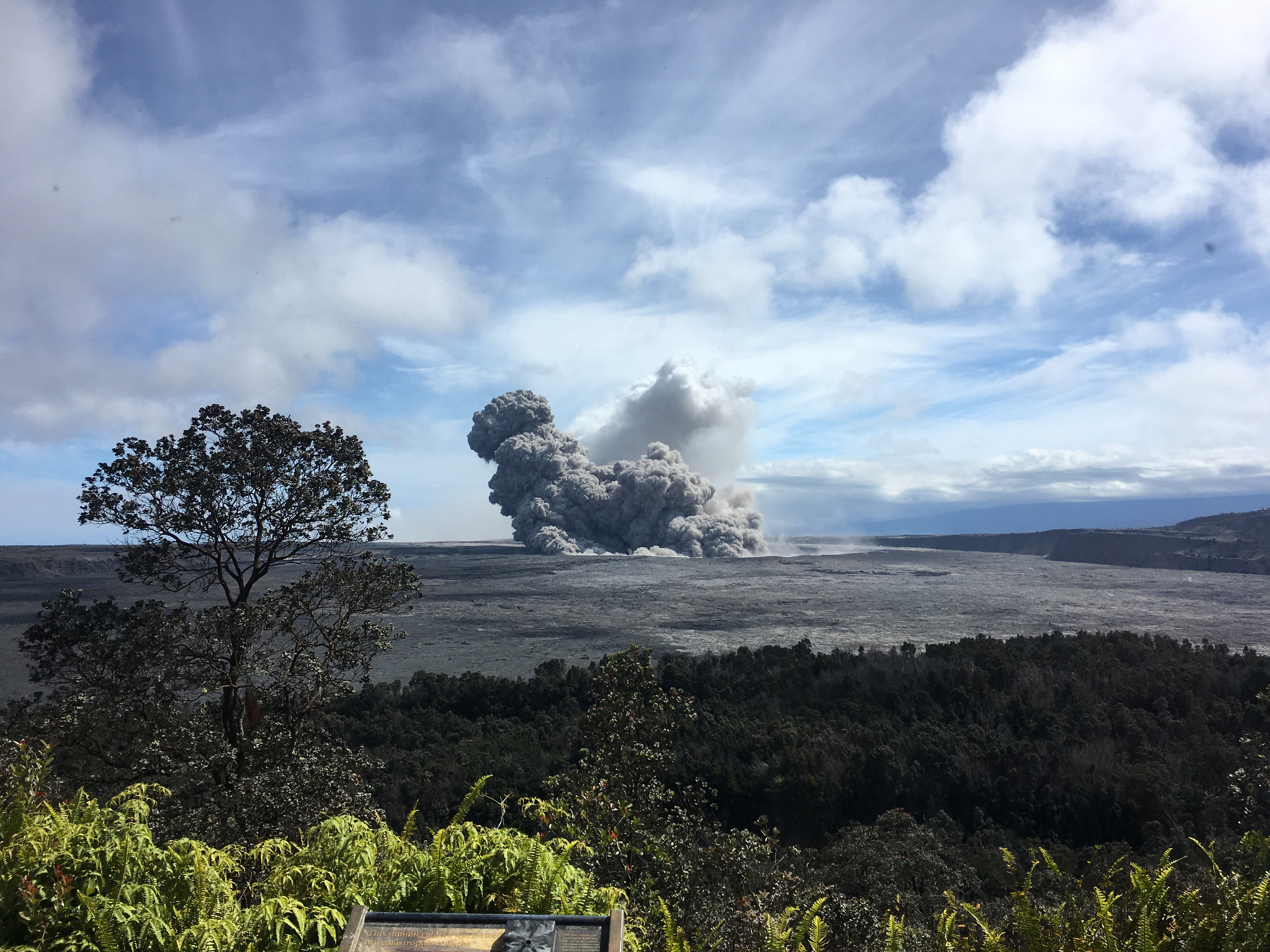
Since Sunday noon, no significant ash column has been produced, said USGS, "Additional explosive events that could produce minor amounts of ashfall downwind are possible at any time.”
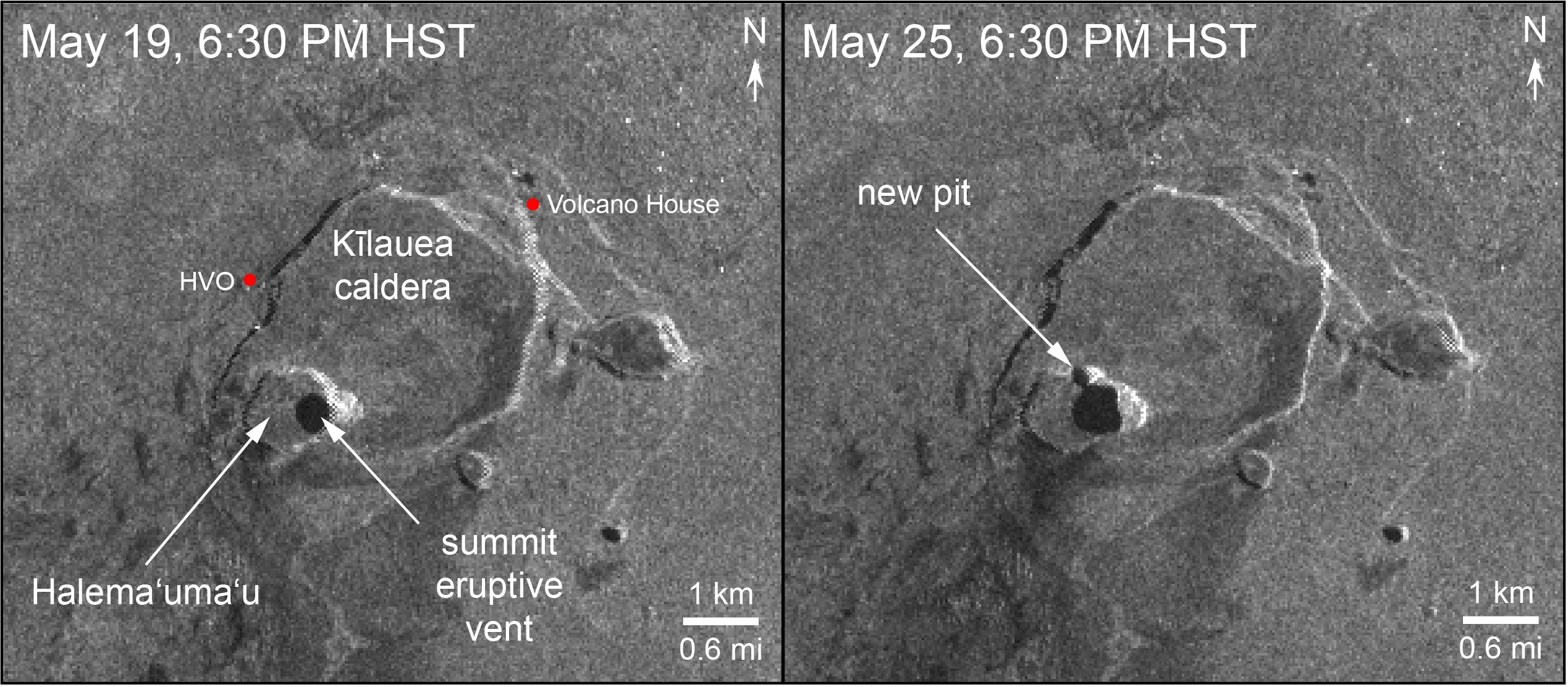
Radar data acquired by the European Space Agency's Sentinel-1 satellite over Kīlauea Volcano shows that the summit eruptive vent continues to expand as the unsupported conduit walls collapse. The vent area is now approximately 90 acres, and the scientist at Space Agency anticipate further enlargements over the coming days to weeks as subsidence of Kīlauea caldera, rockfalls, and small explosions continue.
 |
Aerial view of Kīlauea Volcano's summit caldera and an ash plume billowing from Halema‘uma‘u, a crater within the caldera. The USGS–Hawaiian Volcano Observatory and Hawai‘i Volcanoes National Park's Jaggar Museum are visible on the caldera rim (center right); Kīlauea Military Camp can be seen in the lower right. Photo courtesy of the Civil Air Patrol.
|
As of Friday, the oozing lava had destroyed 82 structures on the Big Island, of which 41 are homes Hawaii County Civil Defense Administrator Talmadge Magno said.
About 2,400 acres had been covered in lava since the Kilauea volcano eruptions began May 3, Magno said.
Kīlauea Lower East Rift Zone Fissures and Flows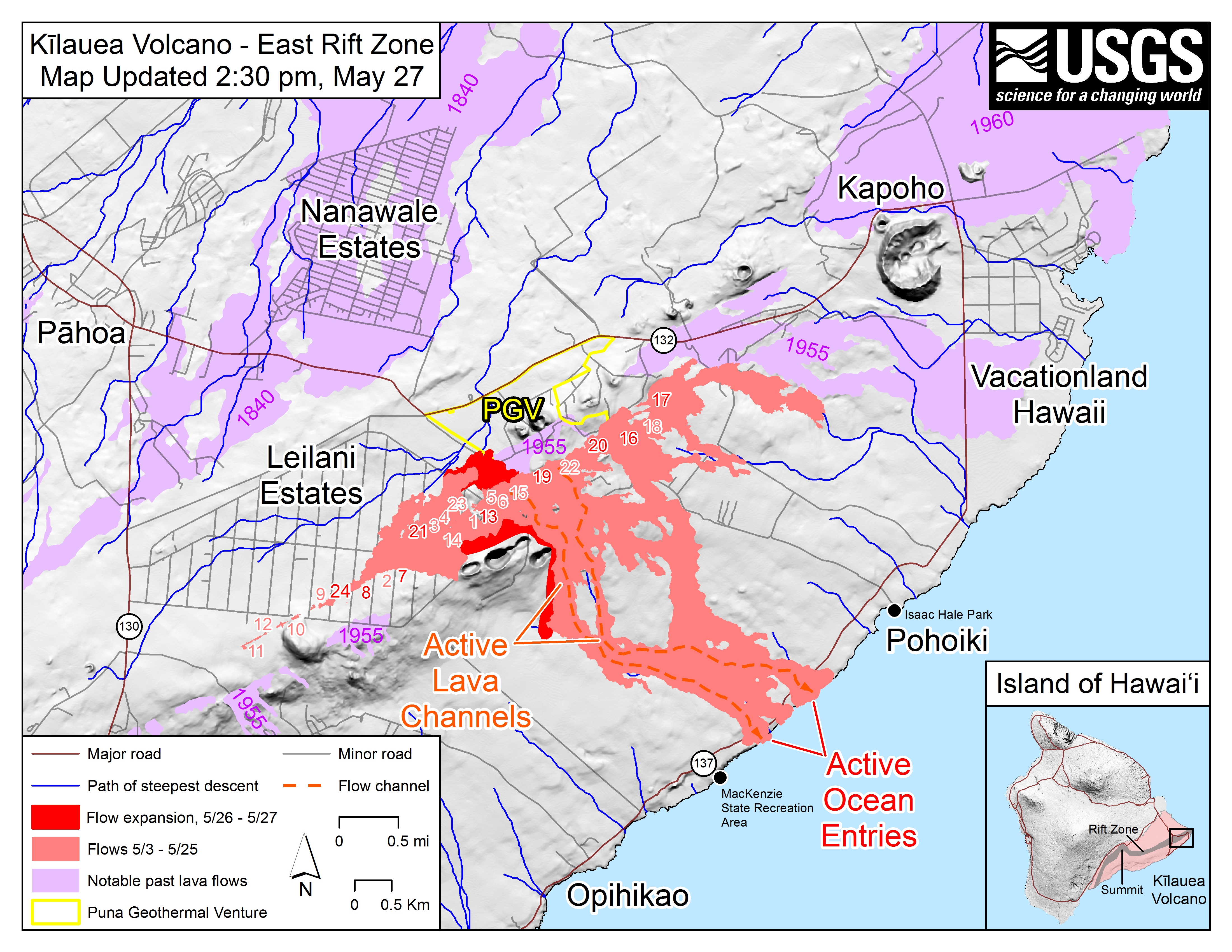 |
| Map as of 2:30 p.m. HST, May 27, 2018. Shaded purple areas indicate lava flows erupted in 1840, 1955, 1960, and 2014-2015. |