Showing posts with label Hawaii. Show all posts

Thursday, July 4, 2019

Care for an autograph-meet the autograph tree


The autograph tree, botanical name Clusia rosea was introduced in Hawaii as an ornamental plant. The plant is a close relative of Mangosteens tree and belongs to the family ‘Clusiaceae,named in the honor of 16th century Netherlands botanist Carolus Clusius.

The plant is native to Florida and the Caribbean. Other names for the plant are signature tree, pitch apple, and monkey apple tree.

The tree gets its name from the ability of its leaves to retain any scratch or writing for a very long time. Each leaf is 5-8 inches in length, oval, thick and sturdy and shaped like a paddle. The leaves resemble that of Magnolia. If you scratch the leaf with your nails or a sharp object, the upper dark green layer is peeled off and the lighter greenish/white underneath layer is exposed, creating a contrast that is retained till the life of the leaf.

Another unique thing about this species is it is part of the only genus of plants capable of absorbing carbon dioxide at night.

The plant is long-lived perennial that can grow to 25-30 feet in height, but it really depends upon the trimming and potting and the ground conditions. Its drought and salt tolerant nature makes it an ideal choice for landscaping in areas with less rainfall or sea-side homes.

The flowers are white or pink and mostly bloom during the night, they sometimes remain open all morning, especially on a cloudy day. The flowers turn orangish-brown as they mature and fall.


By Dick Culbert from Gibsons, B.C., Canada - Clusia rosea, the Autograph Tree flower., CC BY 2.0, https://commons.wikimedia.org/w/index.php?curid=34450558

The flowers are followed by green to tan, fleshy, rounded, up to 3 inches (8 cm) in diameter fruits. They turn brown to black on maturation and split open like a wood rose to reveal bright red seeds between black resinous material.


The fruits 
Dried Fruit on the ground
The black resinous material was used in the early days to fill in the seams and crack of the boats. The red seeds are very attractive to birds which also help in the dispersion of the seeds.


The seed pods open up


The autograph tree is a strangler tree. The tree is hemiepiphyte and can grow as an epiphyte or from the ground. The seeds are dispersed by birds in the crotch of other trees sometimes as high as 20-25 feet. The seeds germinate and send long banyan-like aerial roots toward the ground and establish other roots into the interior of the host tree. Slowly the host tree is cut-off from receiving nutrients and perish eventually.

https://www.flickr.com/photos/starr-environmental/24549985985/


[[File:Starr 011205-0021 Clusia rosea.jpg|Starr 011205-0021 Clusia rosea]]

Hence, the Autograph tree is classified as an invasive tree in Hawaii. Gardeners are advised to remove autograph trees from their property and not to plant new ones.

According to the Food and Drug Administration database, Clusia rosea is a poisonous plant. The green fruits are mildly poisonous, and so are the leaves. Consumption of fruits and sap will lead to stomach and intestinal irritation, vomiting, and diarrhea.


The autograph tree
The autograph tree


Tuesday, July 10, 2018

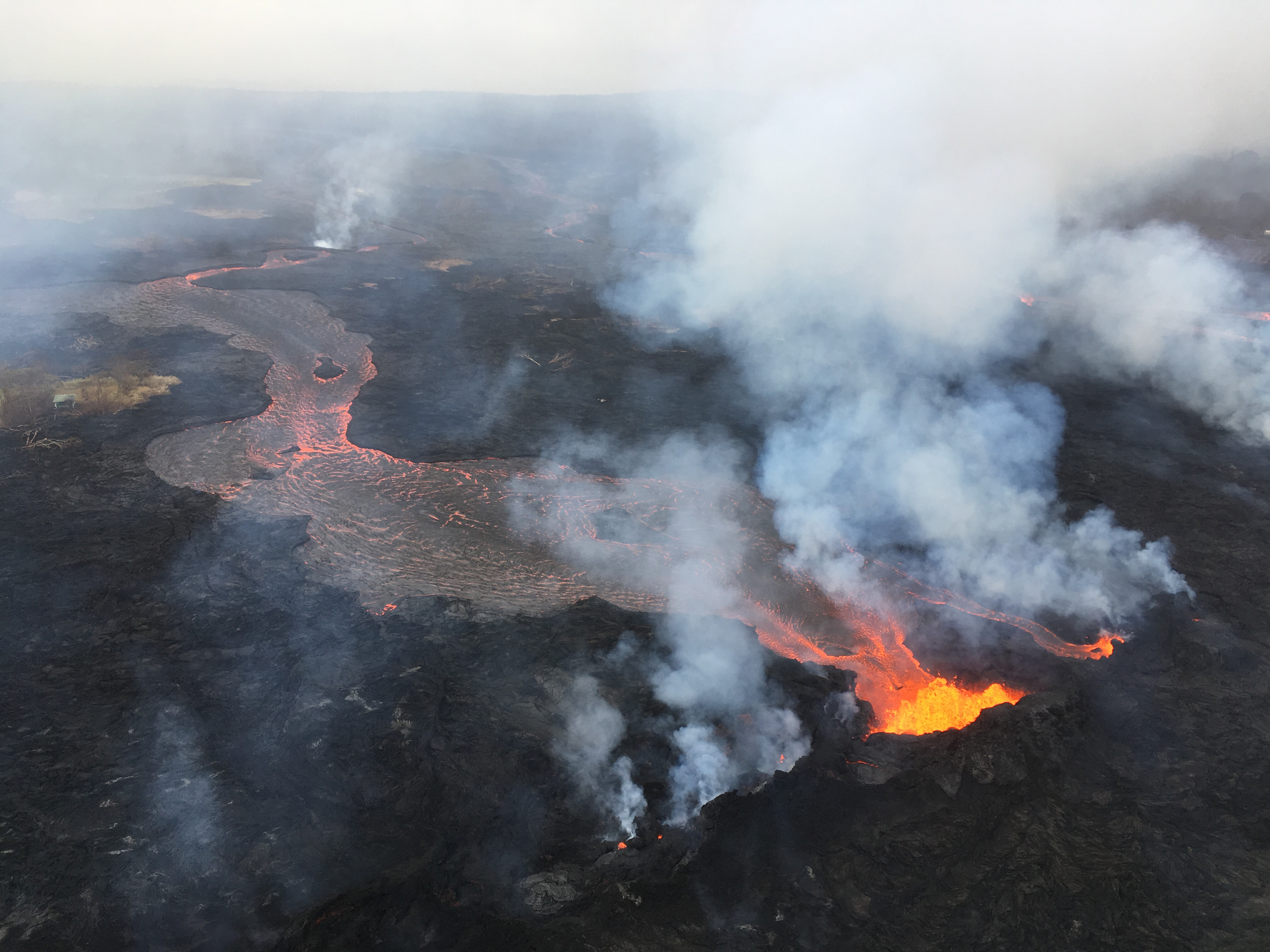
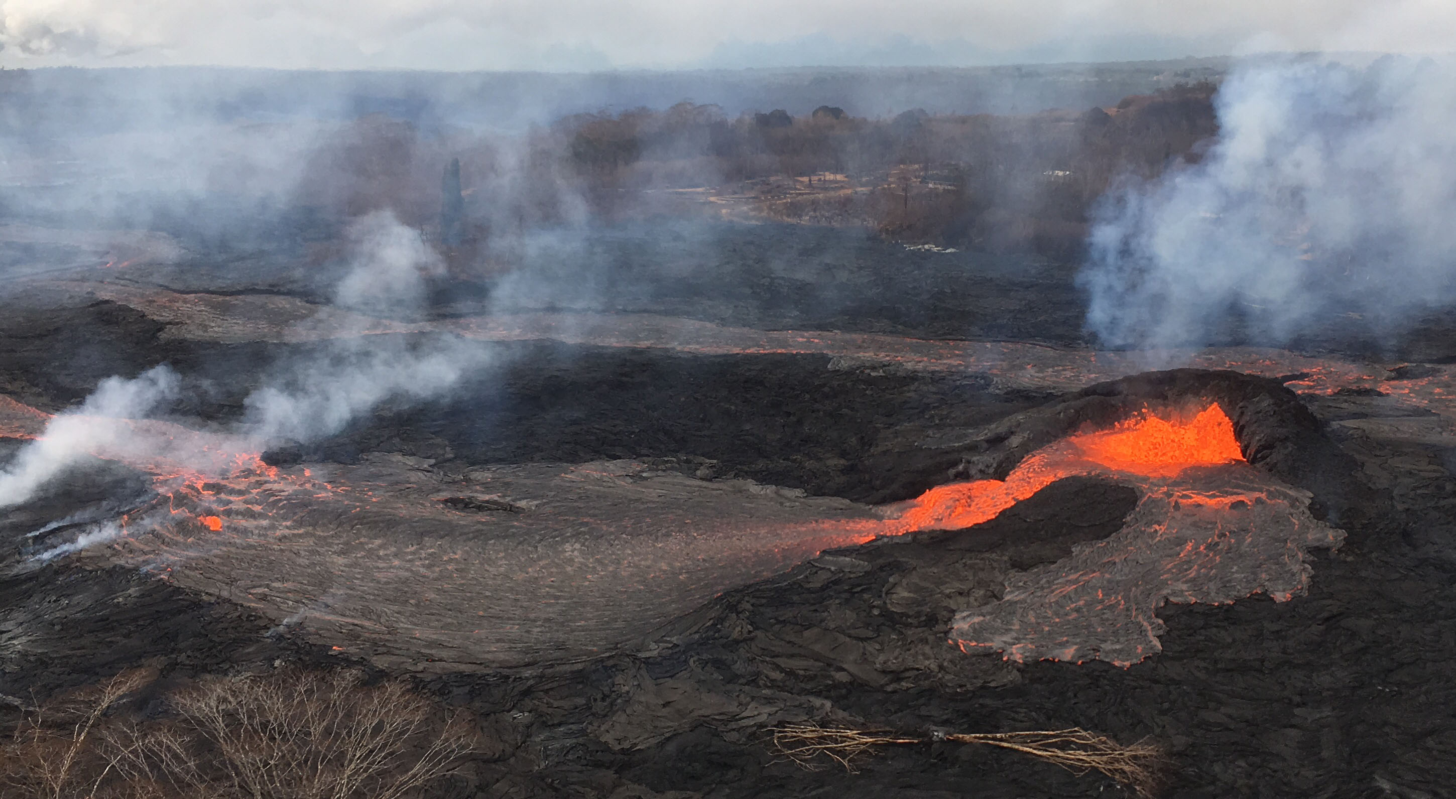
Lower East Rift Zone eruption continues unabated

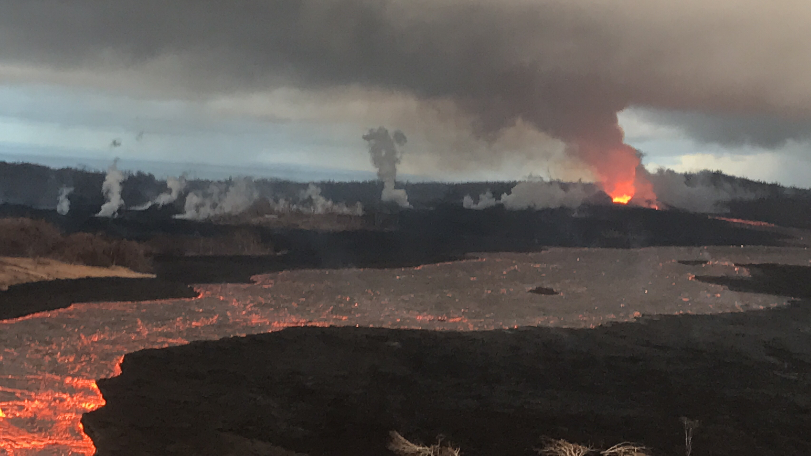
View of Fissure 8 and channel during the morning overflight on July 7.

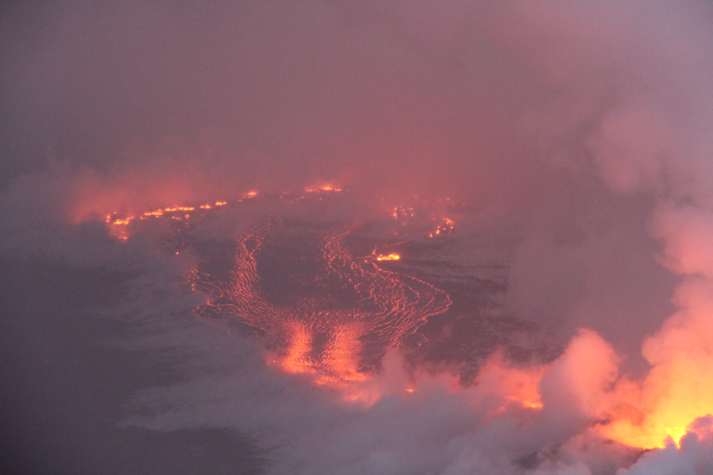
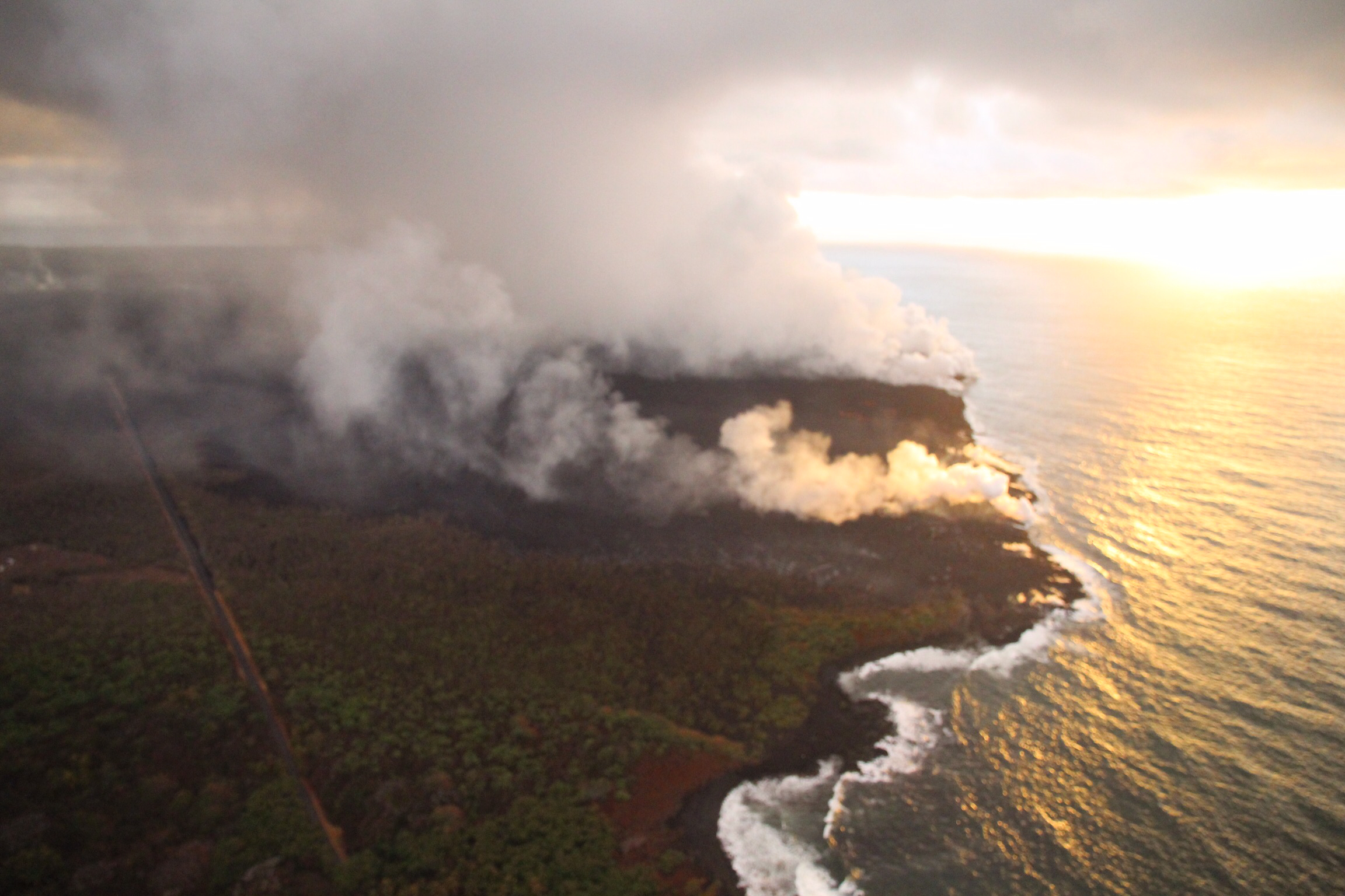
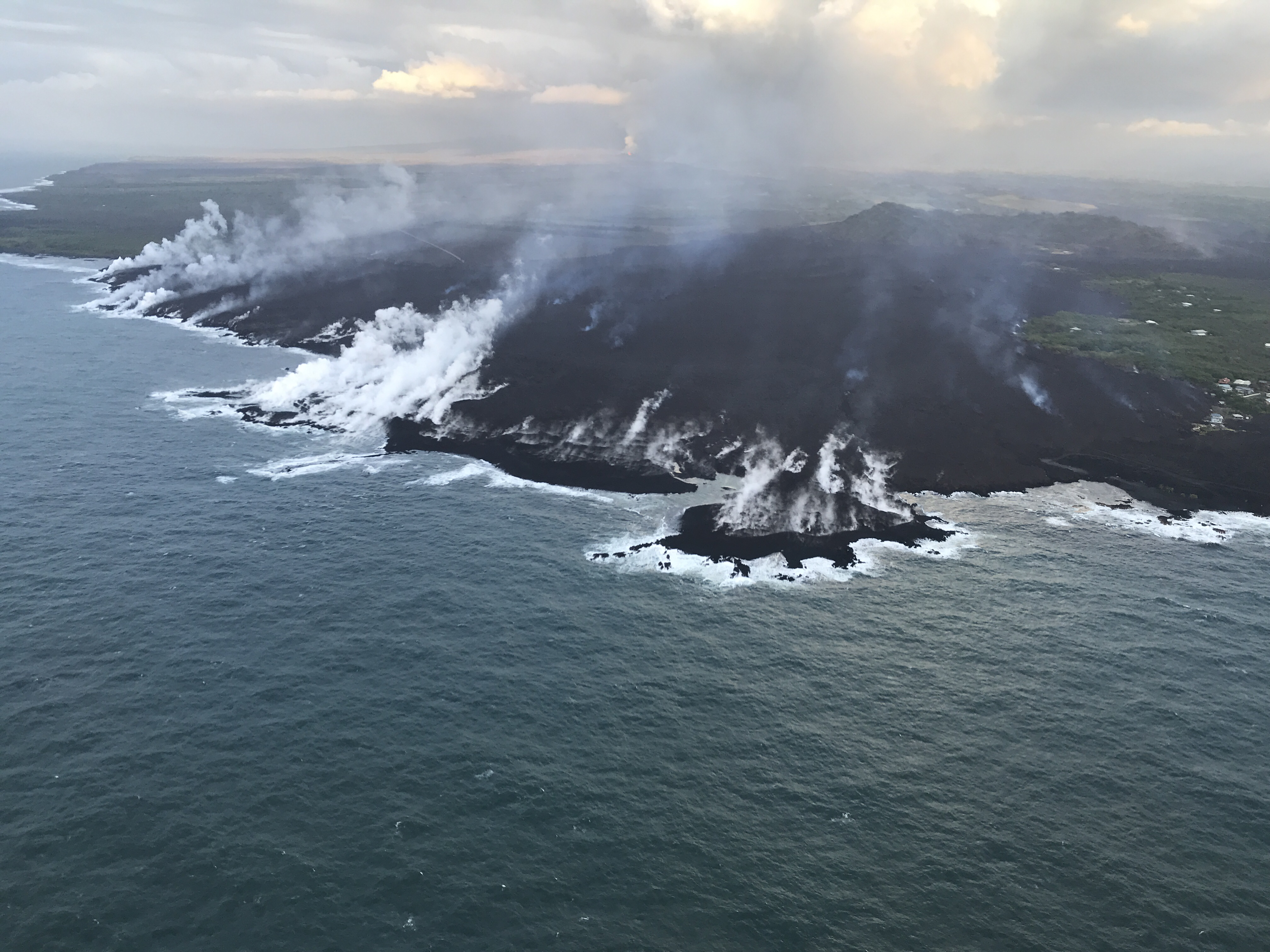
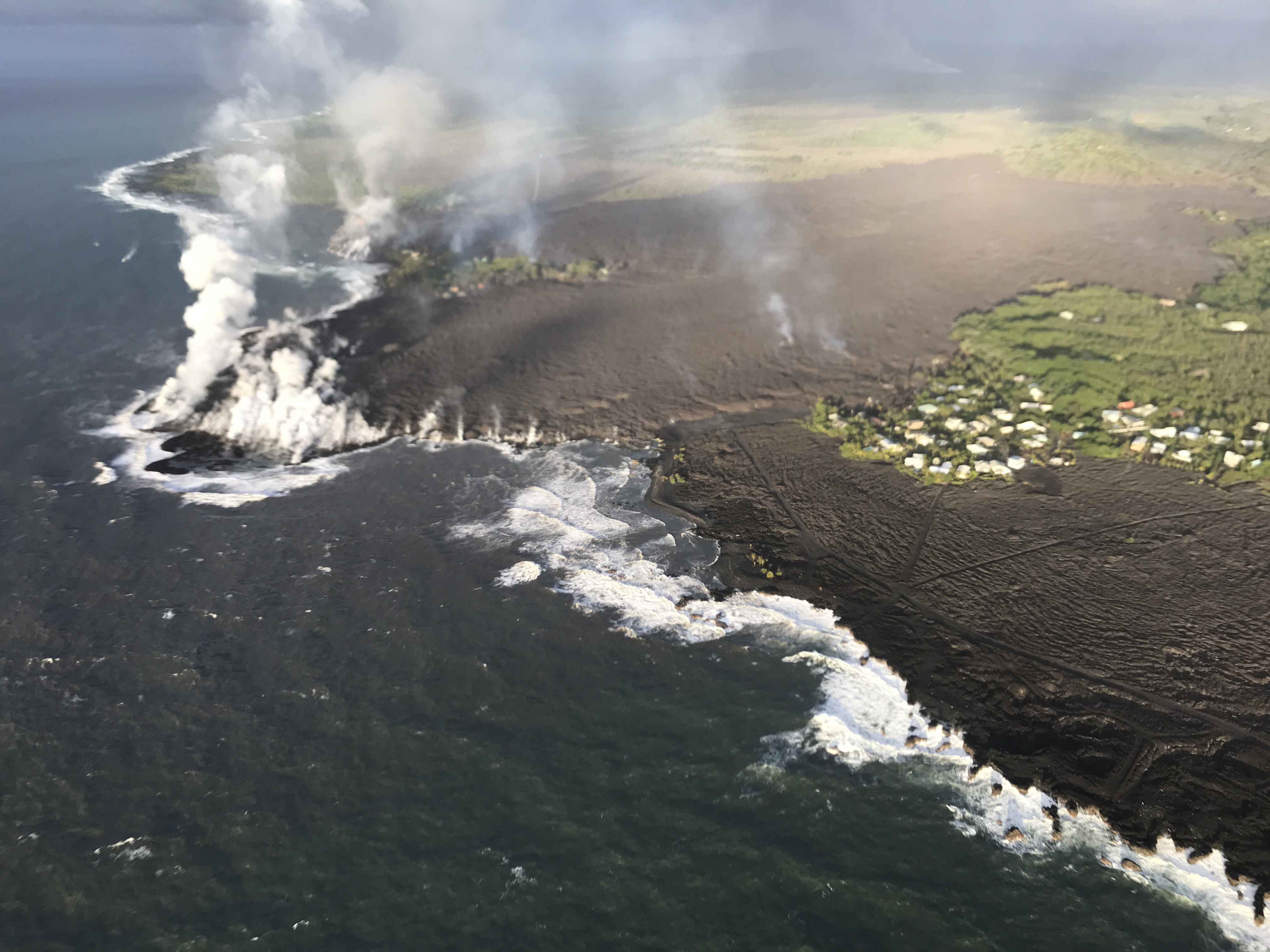
Lava entering the ocean as seen through steam and rain early this morning.

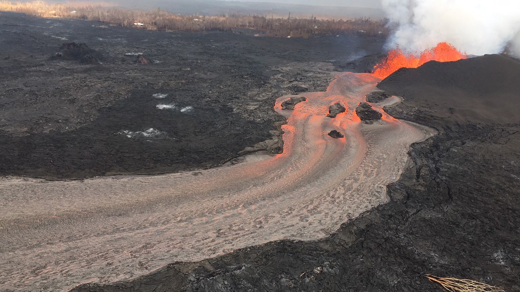
Fissure 8 continues to erupt lava steadily into the perched channel leading northeastward from the vent. Disruptions to the mid-channel occurred yesterday afternoon producing localized overflows along the margins of the flow field, mostly atop earlier lavas. A significant overflow north of the cinder quarry advancing yesterday and last night towards Cinder Rd. has stalled. An overflow lobe moving around the west side of Kapoho Cone remains active this morning and small brushfires are reported along the margins. Downstream, lava appears to be reoccupying the channel leading to the ocean entry were multiple fingers of lava are active. The southern margin of the ocean entry shows little sign of movement.

Yesterday's channel disruption and overflows were caused by blockages that developed along the channel. Additional blockages and resulting overflows are likely to occur as long as the activity continues.

Fissure 22 continues to exhibit weak spattering. No other fissures are active.

Pele's hair and other lightweight volcanic glass fragments from the lava fountain at Fissure 8 continue to fall downwind of the fissure, dusting the ground within a few hundred meters (yards) of the vent. High winds may waft lighter particles to greater distances. Residents are urged to minimize exposure to these volcanic particles, which can cause skin and eye irritation similar to volcanic ash.

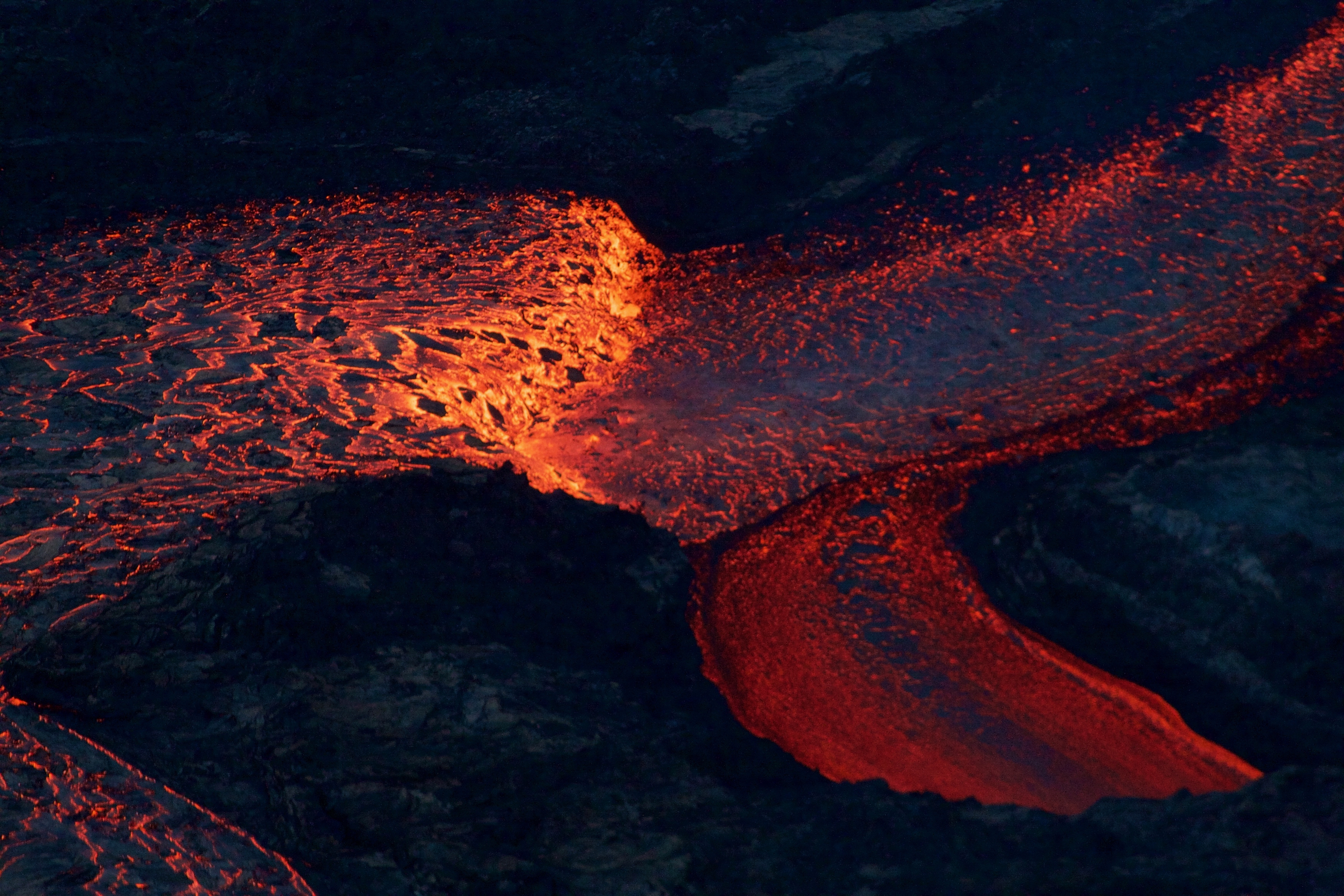
Near the Kapoho Crater, in the area called Four Corners, the lava channel makes a 90-degree bend. After lava exits the bend, it makes a short drop to form a lavafall. A side channel makes a short surface diversion before rejoining the existing channel.

Southern end of the active fissure 8 flow margin north of the Ahalanui Beach Park, known as the warm ponds. The flow margin is estimated to be about 500 m (0.3 mi) from the par


Friday, June 15, 2018

Wall collapse at Halema‘uma‘u crater continues as Kīlauea vent lava unabated


This recent United States Geological Survey Video on June 13, 2018, filmed details of the dramatic changes occurring within Halema‘uma‘u Crater at Kīlauea's summit since explosive eruptions of ash and gas and ongoing wall collapse began in mid-May.

The video shows steep crater walls that continue to slump inward and downward in response to the ongoing subsidence of the summit area. This video was taken from a UAS (Unmanned Aircraft Systems). Limited UAS flights into this hazardous area are conducted with permission and in coordination with Hawai'i Volcanoes National Park.

The video is used to assess hazards at the summit and the information is shared with the National Park Service and emergency managers.

Thursday, June 14, 2018

Fissure 8: The journey of lava from vent to sea


The journey: From vent to the sea.
A helicopter overflight video of the lower East Rift Zone of Kilauea eruption on June 14, 2018, around 6:00 AM. The video shows lava fountaining at fissure 8 feeding and feeding the channelized flows that flow into the ocean. Lava is still flowing out of fissure 8 unabated and the channel is full.

At the start of the video, standing waves in the lava channel can be seen near the vent exit. The channel appears crust-free from vent to the bend around Kapoho Crater. A surface crust forms over the channel as it spreads out during its approach to the ocean. The overflight along the ocean entry is from north to south along the coastline. The ocean entry is active along the whole length - approximately 1 mile. Small litoral explosions are occurring and there are several plumes of laze.


Sunday, June 10, 2018

Recent photo updates on Kilauea eruption

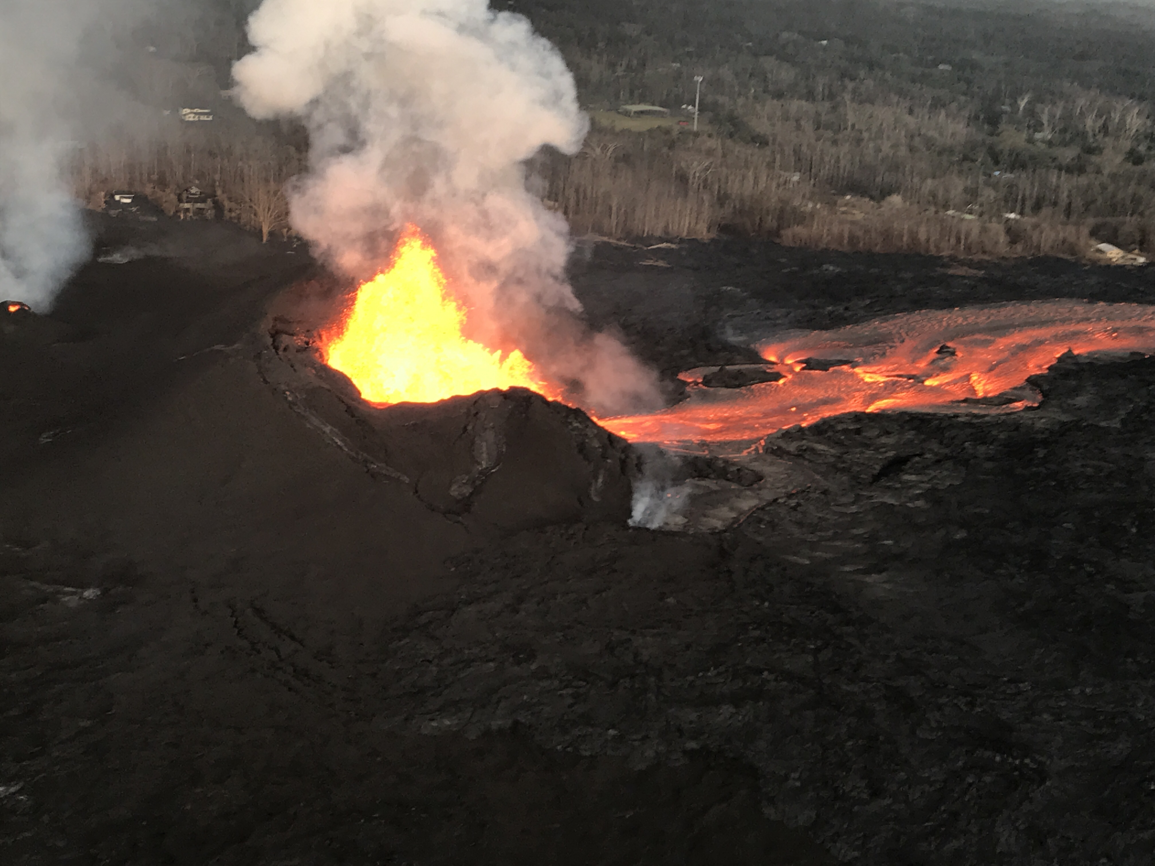
As of 6:30 a.m. HST today, fissure 8 continued to feed a vigorous channelized lava flows to the east of the vent. Overnight, fountain heights were generally 40–50 m (130-160 ft) high, with occasional bursts up to 60 m (just under 200 ft) high. The fallout from the fountains has built an asymmetric cinder-and-spatter cone around the vent, with the southwest side of the cone slightly higher (about 115 feet) than the northeast side (about 65 feet). This asymmetry reflects the prevailing trade winds, with more lava piling up on the downwind side of the fountains.


Fissure 8 and lava channel in the lower East Rift Zone of Kīlauea Volcano during this afternoon's overflight, with no apparent slowing in the eruption rate. The lava channel remained incandescent all the way around Kapoho Crater before entering the ocean.


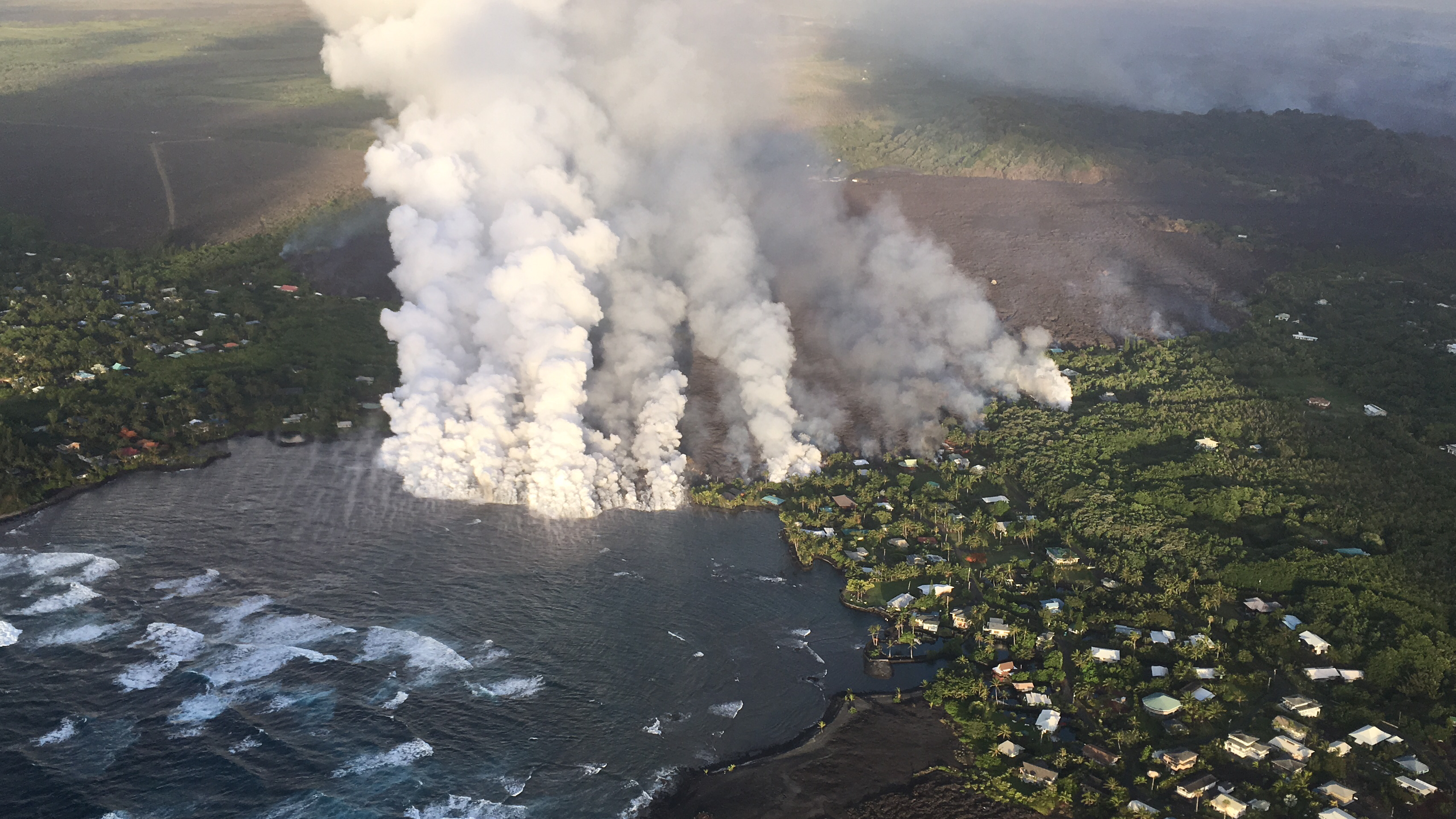
An aerial view of the Kapoho ocean entry, as of 6:30 a.m. HST today, shows the extent of the lava delta, now about 200 acres in size, that has formed over the past six days (lava first entered the ocean on the night of June 3). Across the front of the delta, plumes of laze—created by molten lava interacting with seawater—appeared diminished this morning, but was probably due to a change in atmospheric conditions rather than a change in the amount of fissure 8 lava reaching the ocean. Laze, a mixture of seawater steam, hydrochloric acid, and tiny volcanic glass particles, can irritate eyes, lungs, and skin, and should be avoided.
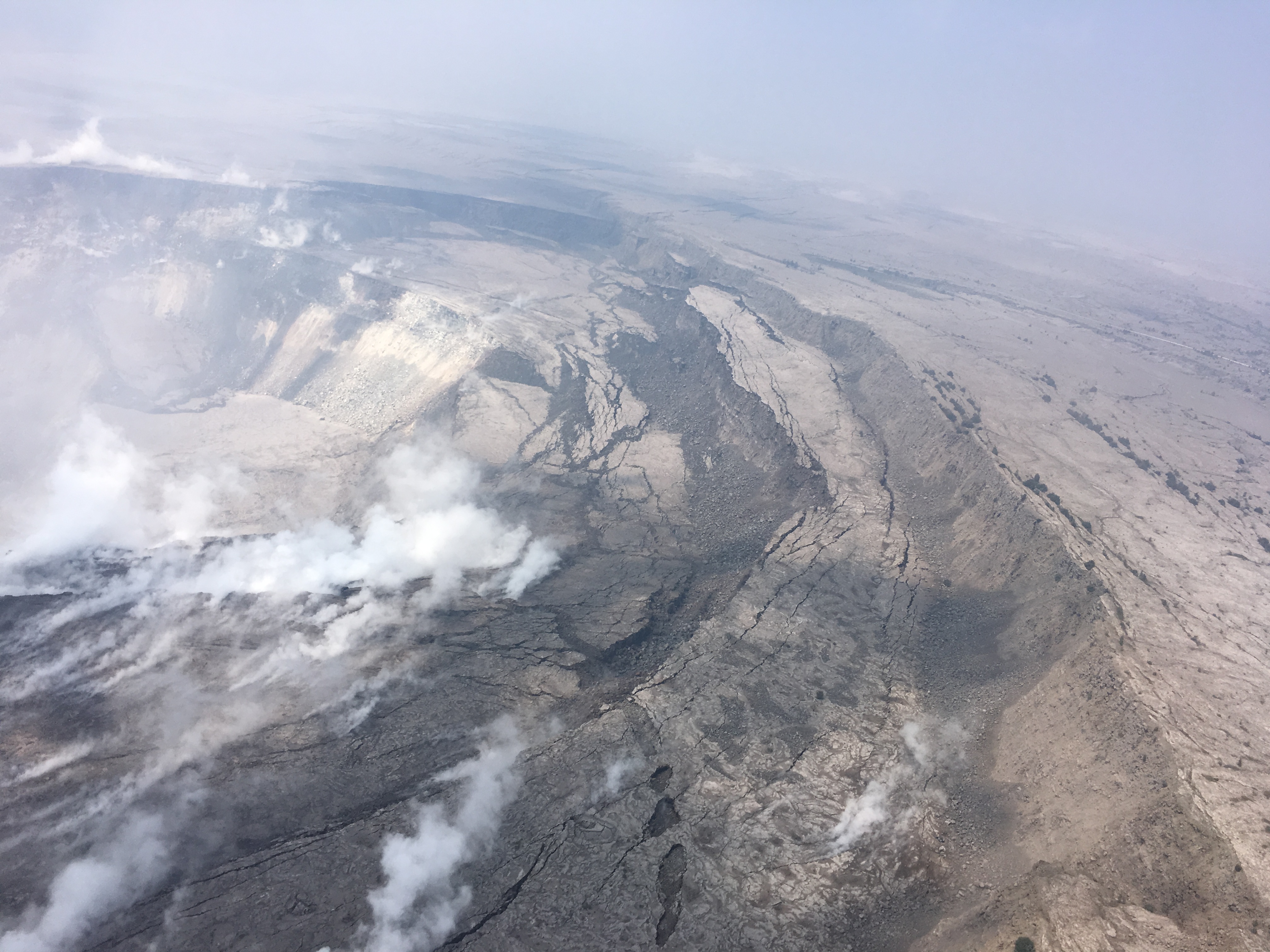
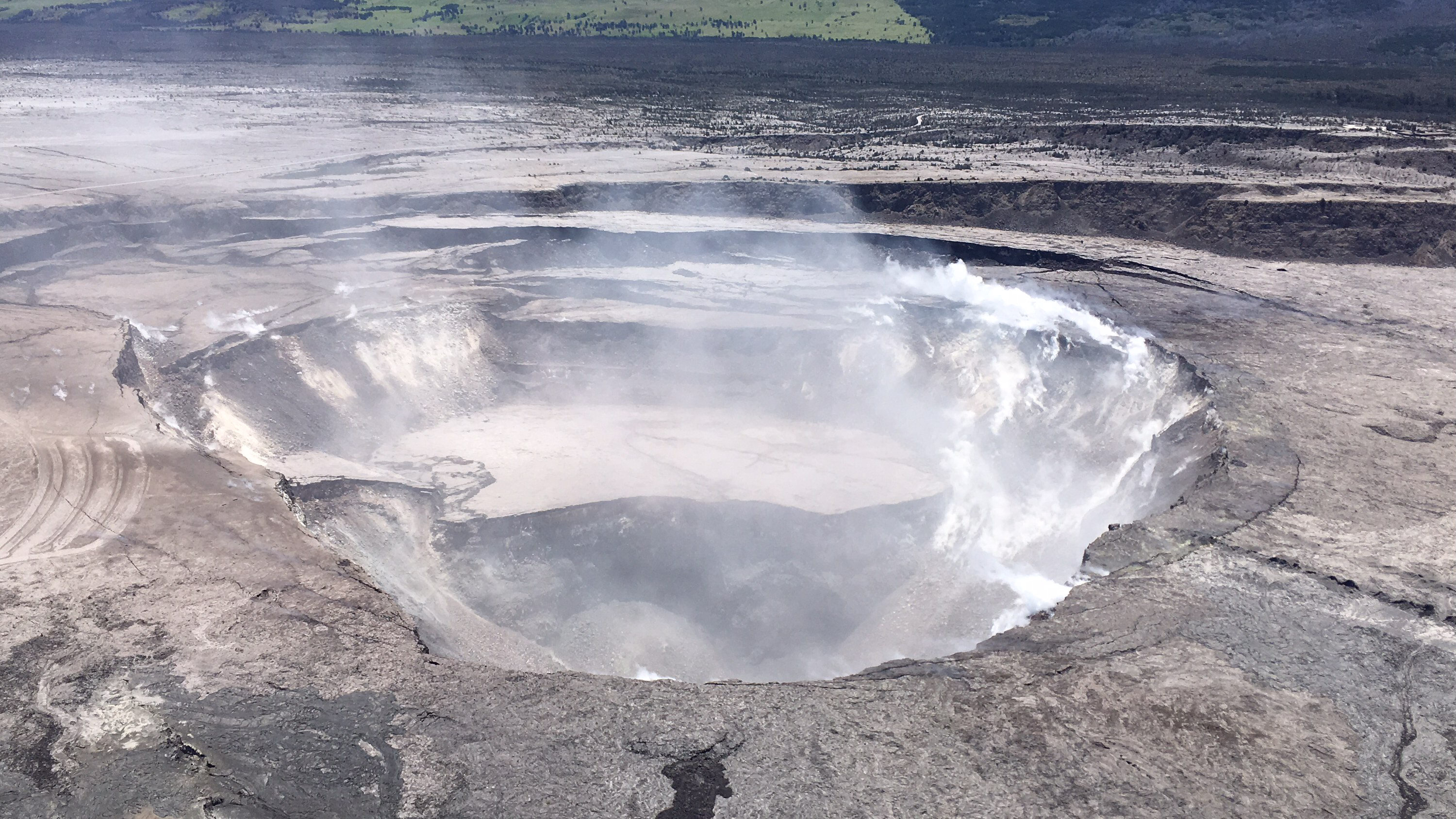
Cracking and slumping of the Halema‘uma‘u crater walls are clearly evident in this aerial view captured during HVO's overflight of Kīlauea's summit this morning. Steam plumes have been rising from within the crater, as well as from cracks adjacent to the crater. 
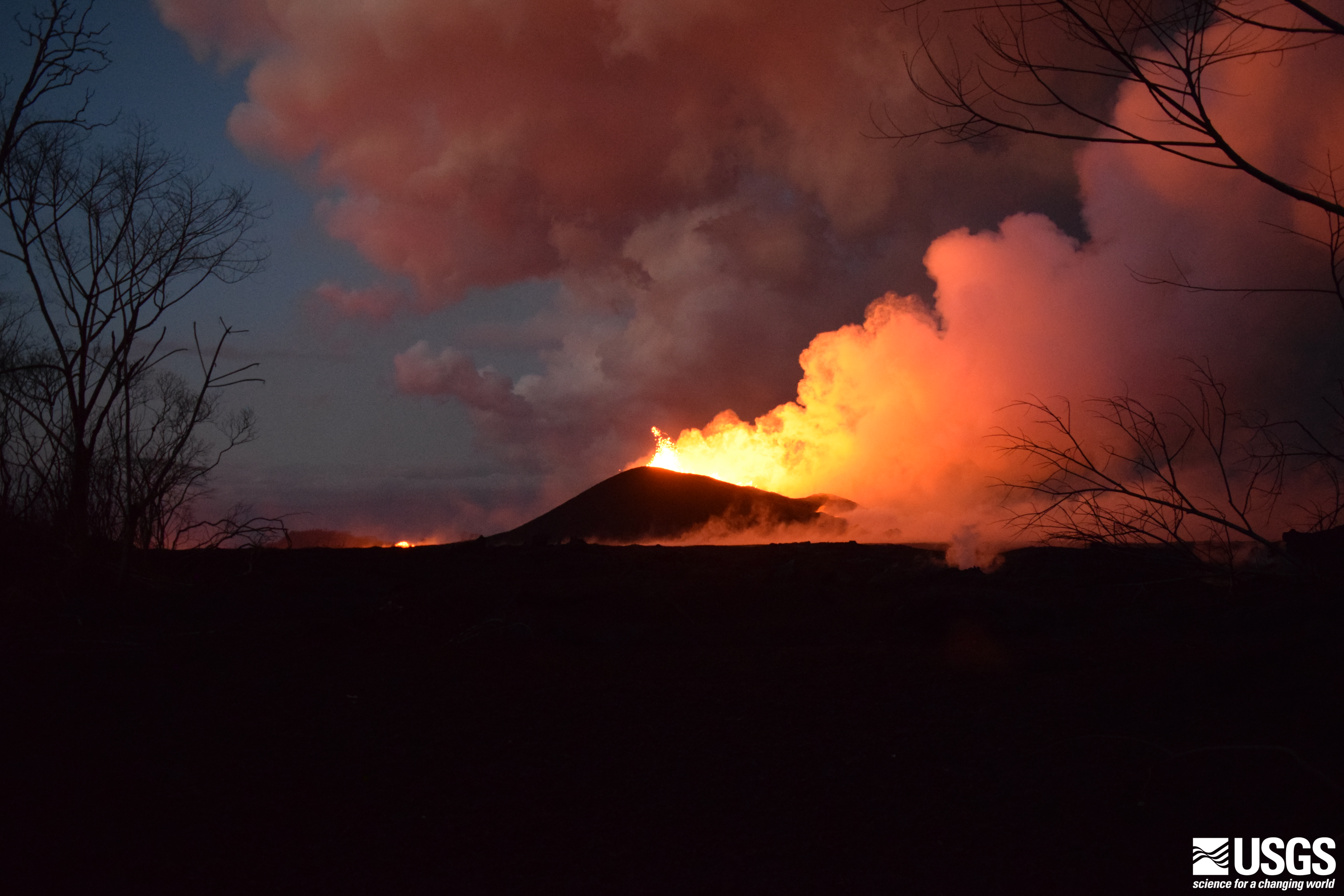
Fissure 8 lava fountaining as viewed from Kupono Street at 8:00 p.m. HST on June 9. The incandescence to the left is from the active lava channel.

Wednesday, June 6, 2018

Kīlauea Volcano — USGS Video Compilation of Kapoho Bay Ocean Entry


This short video compilation shows conditions at Kapoho Bay during a helicopter overflight on June 4, 2018, around 6:15 a.m. HST and again around 1:38 p.m. HST. By 6:15 a.m., lava from fissure 8 had entered the ocean for over seven hours. The flow front was about a half-mile wide, with lava building a delta a few hundred yards into the bay. The ocean entry sends a large laze plume into the air along the coastline. In the second video, taken about seven hours later (around 1:38 p.m.), lava had nearly filled the shallow bay.

Lava tide from fissure 8 almost completely fills the Kapoho Bay

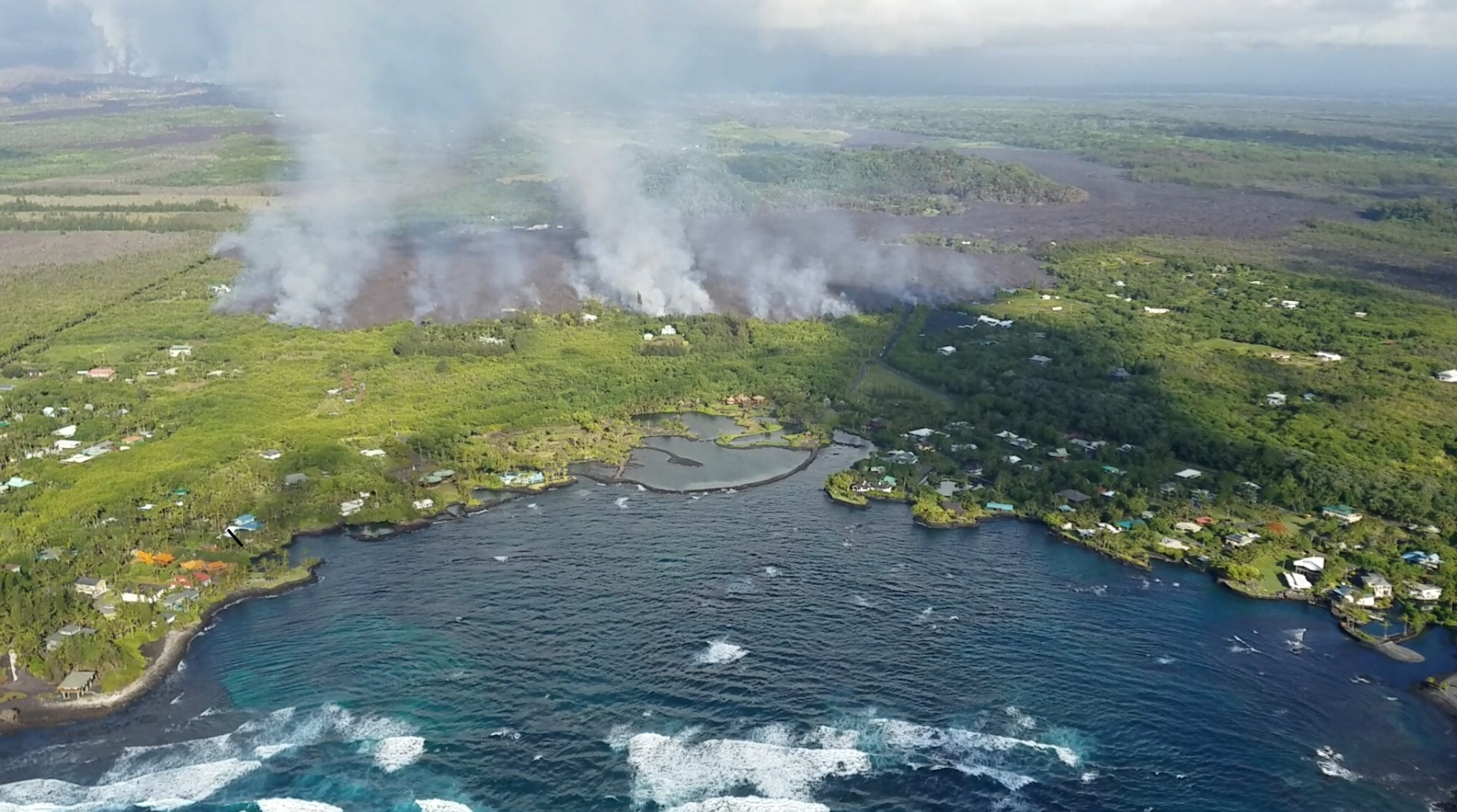
Kapoho Bay before the Kilauea eruption. Source: Google Maps


Kapoho Bay completely filled by lava on the morning of June 5, 2018. Source : USGS

Images from the United States Geological Survey (USGS) show that lava tide from fissure 8  has completely filled the beloved Kapoho Bay and destroyed homes in greater part of the Vacation Land.

The destructive fissure 8 flow entered the ocean at approximately 10:30 p.m. Sunday evening to produce a delta that began to fill in Kapoho Bay in lower Puna. According to Jim Kauahikaua of the USGS, the bay already was halfway filled in by noon Monday, and the flow reached the north side of the bay, where Champagne Ponds is located, by Monday evening.

It is estimated that a total of159 homes were destroyed till now, which includes 42 homes recently destroyed in Kapoho Bay.

Janet Babb, the spokeswoman for the Hawaiian Volcano Observatory, said more than 20 square kilometers, or 5,000 acres, have been covered by lava since the eruption in the lower East Rift Zone began May 3.

The ocean entry of  fissure 8 lava is about half a mile wide in some places,  contributing to the high amount of lava haze called laze. Laze contains high amounts of hydrochloric acid along with tiny fragments of volcanic glass which can cause skin and eye irritation and difficulty in breathing. 


Big Island has experienced more than 12,000 earthquakes since the Kilauea started spewing lava about a month back.


Here are some of the recent aerial photographs of Kapoho Bay and Kilauea
HVO scientists captured this aerial view of a much-changed Halema‘uma‘u during their overflight of the summit this afternoon. Explosions and collapse within Halema‘uma‘u have enlarged the crater (foreground) that previously hosted the summit lava lake, and the far rim of Halema‘uma‘u has dropped with continued summit deflation. The parking area for the former Halema‘uma‘u Overlook (closed since early 2008 due to volcanic hazards) can be seen to the left of the crater.

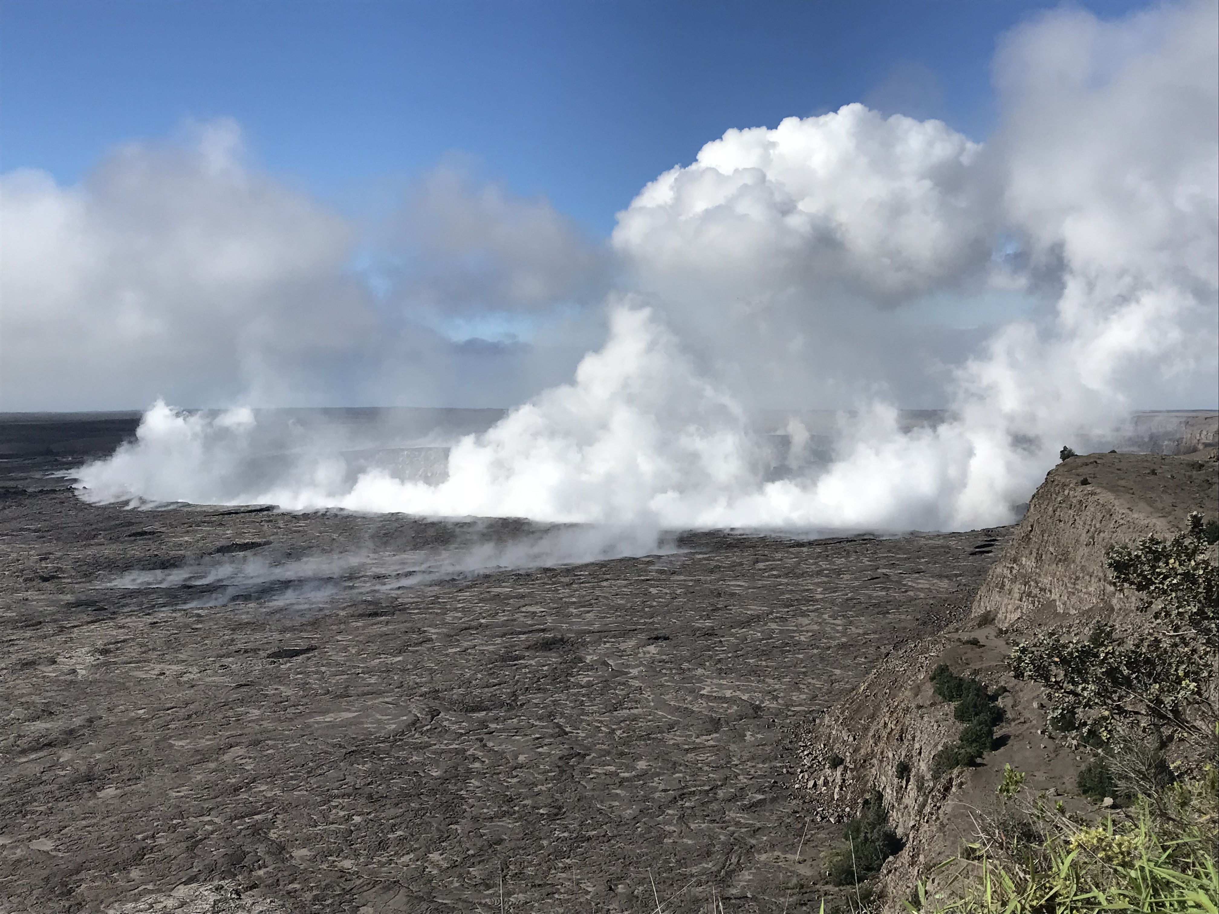
Morning view of Halema‘uma‘u and the adjacent caldera floor from the Kīlauea overlook. Heavy steam dominates the view, and strong winds are blowing the plume to the southwest.


Monday, June 4, 2018

Lava from fissure 8 meets ocean at the Kapoho bay

Overflight photograph at approximately 6:13 a.m. HST shows the lava flow originating from Fissure 8 (not visible in photograph) entering Kapoho Bay. The ocean entry was reported to have occurred by 10:30 p.m. on the night of June 3, 2018.

The lava from fissure 8 entered the ocean at  Kapoho Bay at about 10:30 PM HST on June 3 generating a laze plume that is blowing inland but dissipating quickly. As of today morning, the lava is also constructing a delta in Kapoho Bay extending a few hundred yards into the bay.

The lava flow front is half a mile wide. A sluggish lava flow was observed in the vicinity of fissure 18 and rest of the fissures are all inactive.

Volcanic gas emissions remain very high from the fissure eruptions and also at the summit. Trade wind conditions are bringing vog to the south and west sides of the Island of Hawaii. Afternoon easterly winds may bring vog to communities in the Volcano area.

Inward slumping of the rim and walls of the walls of Halema`uma`u continues in response to persistent subsidence.

The USGS is predicting an increased earthquake activity in the coming days.

Some of the photos from USGS update today:

Video from helicopter overflight of Kīlauea Volcano's lower East Rift Zone on June 4, 2018, shows lava from fissure 8 entering the ocean at Kapoho Bay. View to the north.


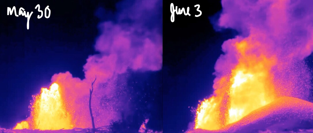
What a difference four days makes! These thermal images of fissure 8 fountains erupting on Kīlauea's lower East Rift Zone show a few things: 1) The lava fountains have gained height—with the tallest one growing from 150 ft to over 250 ft. 2) A pu‘u (cone) has built up downwind. 3) The amount of material wafting downwind is greater. Scientifically, we know the fountain temperatures are reaching up to about 2040 degrees F (1115 C). The composition of the lava erupted has high MgO (magnesium oxide) values, which comes from olivine crystals that are being pulled from deep in the rift zone.

Sunday, June 3, 2018

UAS mission films astonishing details of changes occurring within Halema‘uma‘u crater at Kīlauea's summit


This new U.S. Geological Survey aerial video reveals the astonishing changes within Halema‘uma‘u Crater and the vent that housed a 12-acre lava lake up until a few weeks ago. The vent is now about 100 acres and is devoid of lava as far as the eye can tell. Where did all that lava go? Is the vent capped in rock material now? When, or how could it, explode? These are the questions scientists will try to answer by studying this video and other data they are collecting about the ongoing changes with the #KilaueaEruption.

A UAS mission on May 31, 2018, filmed details of the dramatic changes occurring within Halema‘uma‘u Crater at Kīlauea's summit since explosive eruptions of ash and gas and ongoing wall collapse began in mid-May.

Clearly visible are steep, and in places, overhung crater walls, new cracks and faults that reflect ongoing subsidence of the area and intense steaming from a new collapse pit on the north margin of Halema‘uma‘u. Footage also shows yellow sulfur precipitate on the rubble-covered floor and a scattering of large ballistic blocks around the crater rim.

This video was taken from a UAS (Unmanned Aircraft Systems). Limited UAS flights into this hazardous area are conducted with permission and coordination with Hawai‘i Volcanoes National Park. The overflights collect visual information on what is happening at this rapidly changing eruption site. Scientists will be examining the footage in detail to understand how the expanding collapse area is evolving, the extent of ballistic debris, and other clues as to what is happening at Kīlauea's summit. 

This information informs the assessment of hazards, which is shared with the National Park Service and emergency managers. Video by the U.S. Geological Survey and Office of Aviation Services, Department of the Interior, with support from the Hawaiian Volcano Observatory and Hawai‘i Volcanoes National Park.

Vigorous lava eruption continues from lower east rift zone of Kilauea

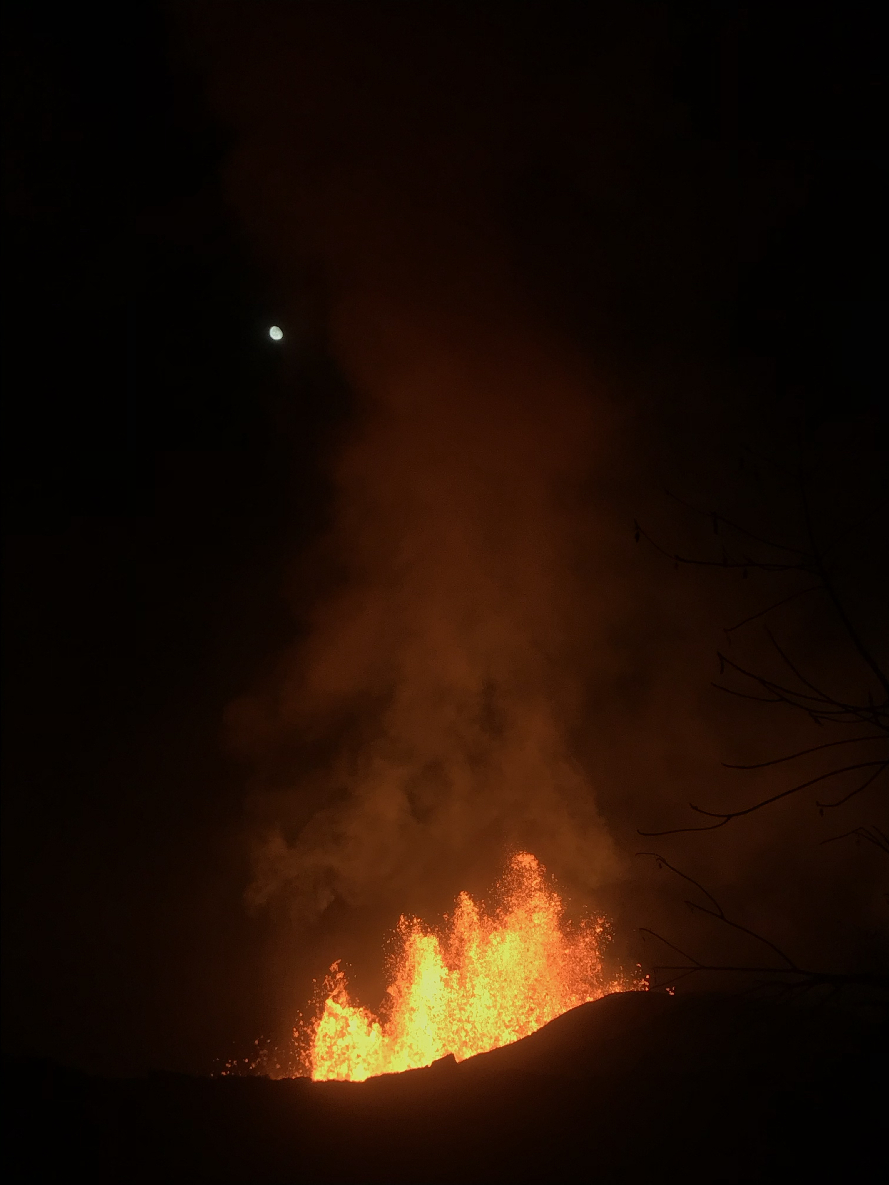
Overnight (June 1-2), fissure 8 lava fountains decreased to heights of about 50 m (164 feet). The moon can be seen in the upper left.


Photo from 7AM helicopter overflight, hovering offshore and looking up the flowfront. Nearly all of the front was active and advancing; advance rates were estimated at an average of 250 feet/hour (76 m/hr), and as of 7AM the flow was 500 yards (457 m) from the ocean.

This video was taken on the June 3 7AM HST helicopter overflight, hovering offshore and looking up the flow front. Nearly all of the front was active and advancing; advance rates were estimated at an average of 250 feet/hour (76 m/hr), and as of 7AM the flow was 500 yards (457 m) from the ocean.

Mount Kilauea continues to erupt lava one month after it all started on May 3, 2018.  Fissure 8 is persistently fountaining since a week delivering lava northeast along Highway 132 to the Kapoho area. The lava stream was about 430 yards from the ocean at the Kapoho Bay between Kapoho Beach Road and Kapoho Kai Drive.

All other fissures are silent now, although Fissure 9 is steaming heavily.

Pele's hair and other lightweight volcanic glass from high fountaining of Fissure 8 are falling downwind of the fissure and accumulating on the ground within Leilani Estates.

Earthquake activity at the summit was high overnight, and it is possible that a small explosion, much like those that have occurred during the past two weeks, will take place in the next day. Ash emissions are low as revealed by webcam views this morning. Volcanic gas emissions at the summit remain high.


Here are some of the latest photos by United States Geological Survey 
As fissure 8 lava flowed into Green Lake, the lake water boiled away, sending a white plume high into the sky—visible from afar between around 11:30 a.m. and 1:30 p.m. HST. This aerial photo, taken a couple of hours later by the Hawai‘i County Fire Department, shows still-steaming lava within Green Lake, located near the intersection of Highways 132 and 137.
Summit plume at 8:40AM HST on June 3. A slight mist in the air softens the look of the plume, which is predominantly white steam with very minor amounts of ash.

Overflight photo at 7AM HST from offshore looking up the flowfront. Nearly all of the front was active and advancing/spreading.

Overnight (June 1-2), fissure 8 lava fountains decreased to heights of about 50 m (164 feet). The moon can be seen in the upper left.


Wednesday, May 30, 2018

What’s going on with the Kilauea Volcano?


Fissure 8 was active throughout Tuesday and into Wednesday morning sending fountains of lava at a sustained height of 200 feet with multiple secondary fountains that reached 60-feet.

This increased activity continued feeding a lava flow that moved towards Highway 132 at the rate of approximately 600 yards/hour. The flow moved north of Highway 132 in the vicinity of Noni Farms and Halekamahina roads, advancing along the steepest descent path that could take the flow to the Four Corners area.

Adding on to yesterday’s eruption, flow from fissure 18 increased further moving downslope toward Highway 137 at rates of less than 100 yards per hour. Overnight, sporadic bursts of activity were also observed from Fissures 7 and 15.

Pele's hair and other lightweight volcanic glass from high fountaining of Fissure 8 are falling to the west of the fissure and continue accumulating on the ground within Leilani Estates. Winds may waft lighter particles to greater distances. Residents are urged to minimize exposure to these volcanic particles, which can cause skin and eye irritation similar to volcanic ash.

On the other hand, Kīlauea Volcano Summit saw relatively few activities on Tuesday and into Wednesday. Ash continued to erupt intermittently from the vent within Halemaʻumaʻu crater, but vertically high ash plumes were not recorded.

USGS warns that explosive events that could produce minor amounts of ash fall downwind are possible at any time. Volcanic gas emissions at the summit remain high and will combine with wind conditions to produce widespread vog across the Island of Hawaii on Wednesday.


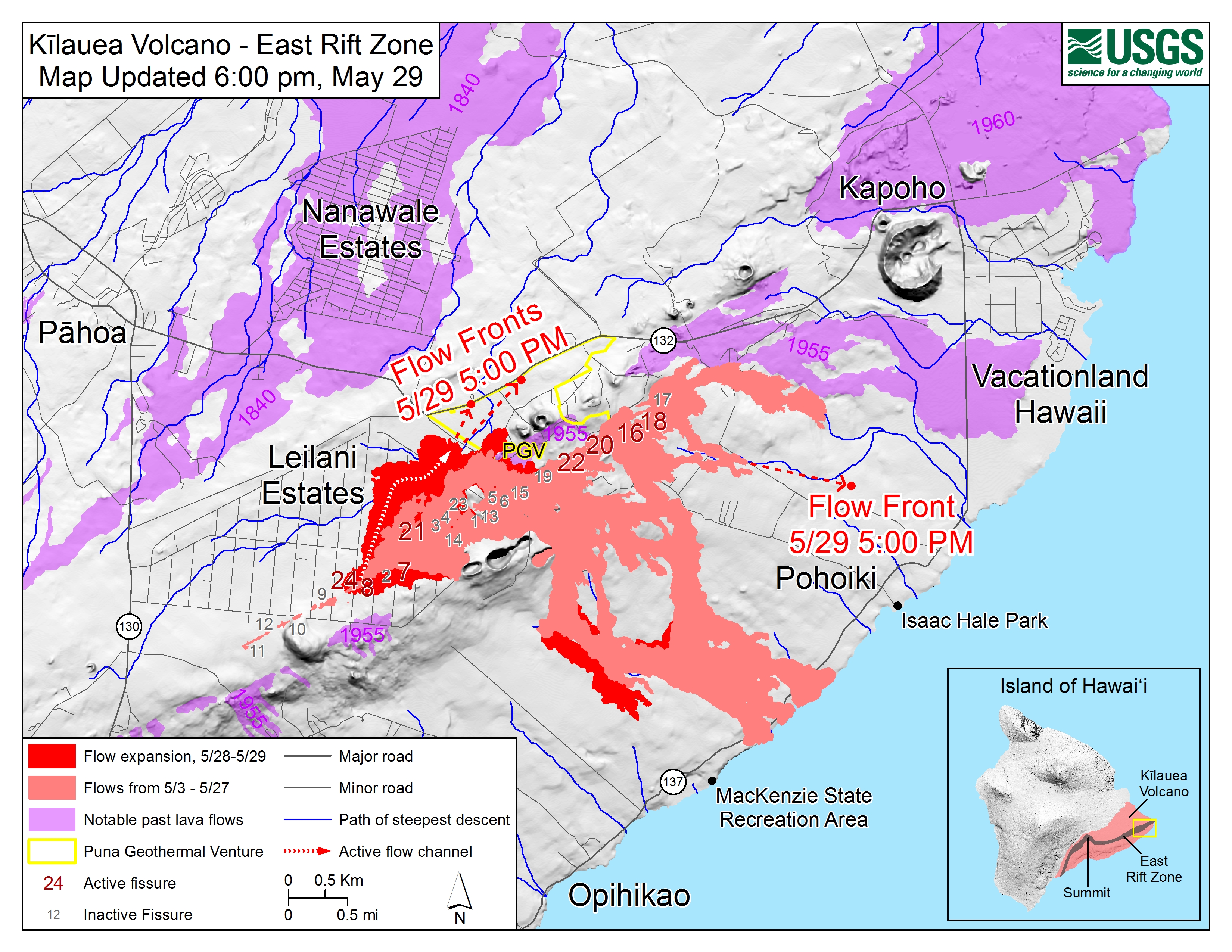
Kīlauea Lower East Rift Zone Fissures and Flows, May 29, 6:00 p.m. HST. Shaded purple areas indicate lava flows erupted in 1840, 1955, 1960, and 2014-2015.
Map Courtesy USGS - Hawaiian Volcano Observatory


Tuesday, May 29, 2018

Fissure 8 reactivated to create 200-feet high lava fountains


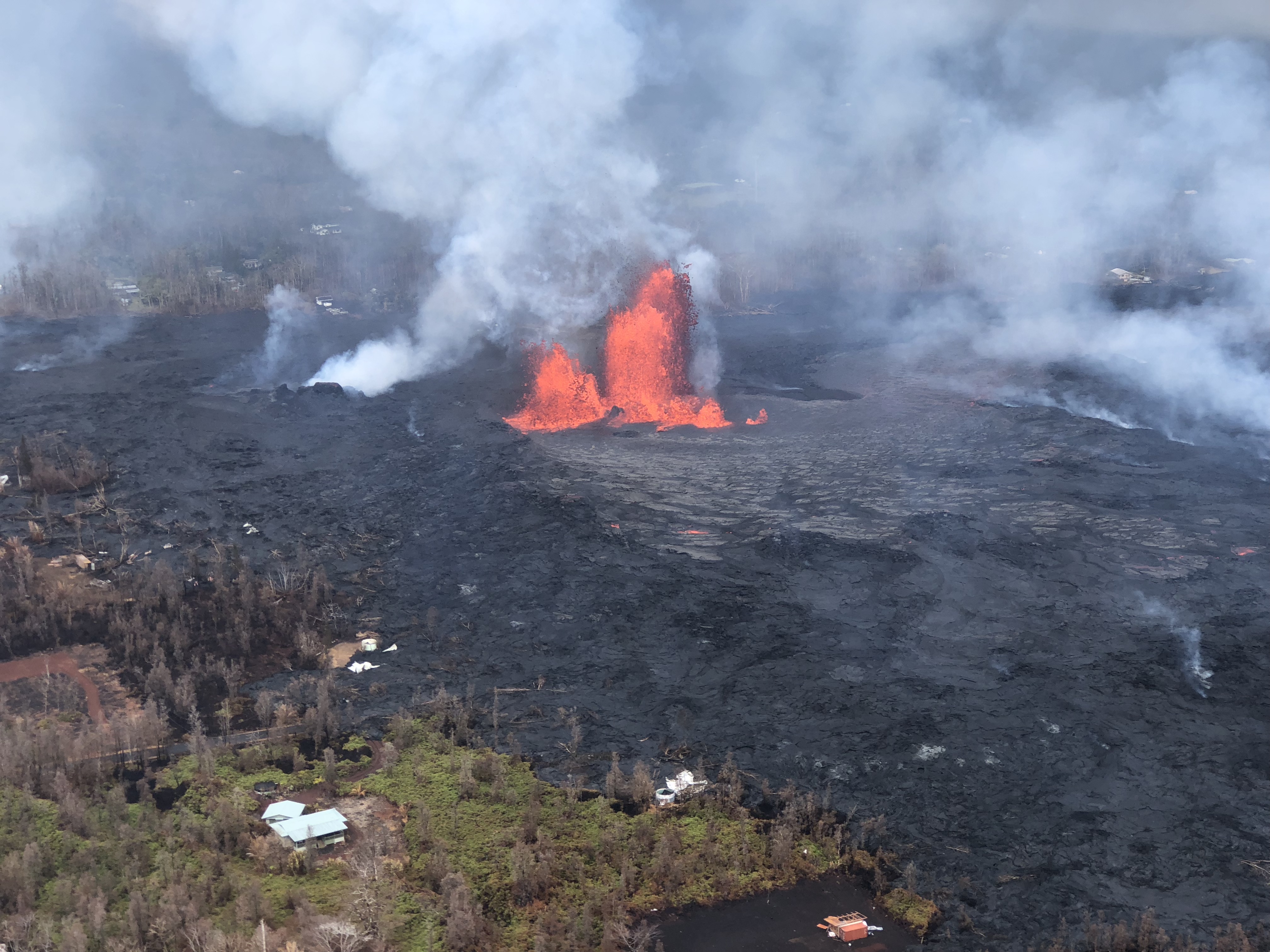
Lava eruption and gas emission continue unabated from the lower East Rift Zone (LERZ) fissure system in the area of Leilani Estates and Lanipuna Gardens. Today, fissure 8 remained very active, at times fountaining to the height of 200-feet. The lava flowed atop the Fissure 8 ʻaʻā flow that was active Sunday night/Monday morning to cross the highway 132 just before 2 pm HST Tuesday.

This voluminous activity of fissure 8 has produced Pele's hair and other lightweight volcanic glass that is being transported downwind and falling to the west of the fissure.

Tuesday also saw weak activity at fissure 18 and 19, but fissure 18 eruption has created a lava channel which has advanced 1.6 miles towards the coast.

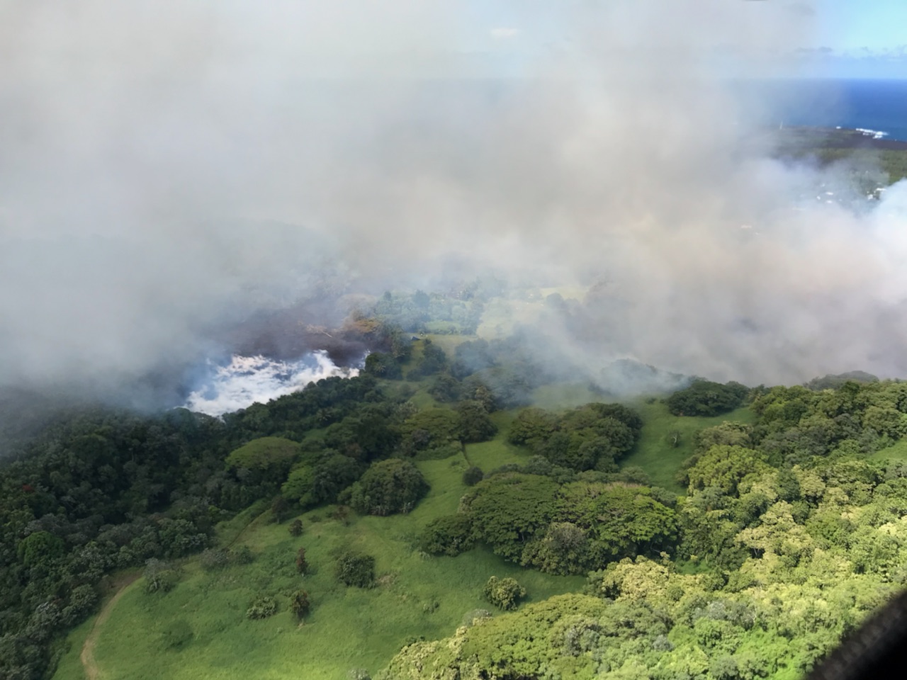
Ash and gas eruption are continued from the summit, while ocean entry of lava has diminished significantly as viewed from this overflight photo.


Tephra (airborne lava fragments) erupted by the high lava fountains of fissure 8 was carried downwind, where the frothy rock fragments fell on Leilani Street, just past Kupono Street, in the Leilani Estates subdivision. Courtesy: USGS

Here is a video of fissure 8 reactivation


Immediate evacuation ordered as advancing lava threatens shut down of Highway 132

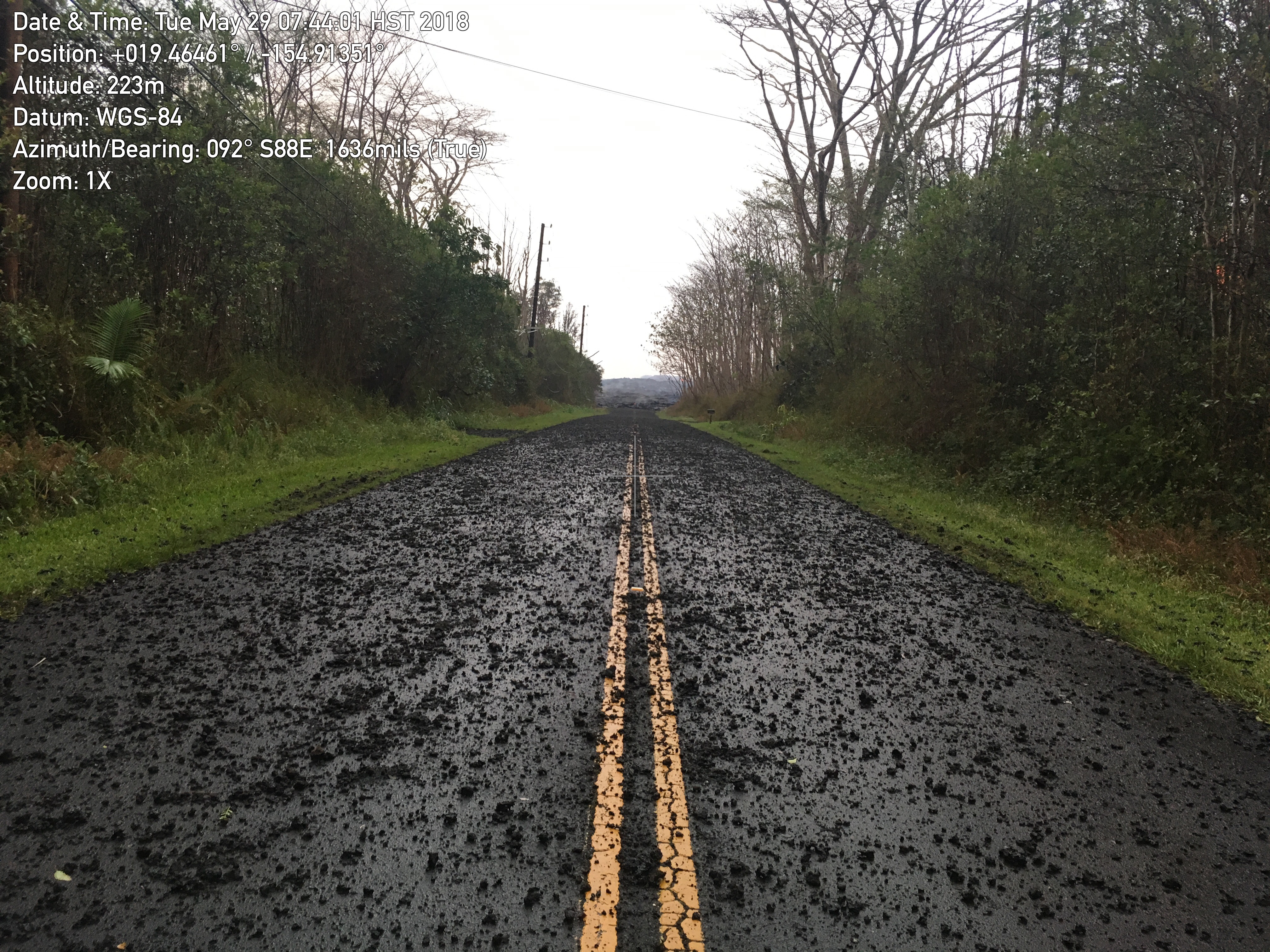
Lava flow near Highway 132
Fast moving lava approaching Highway 132 at Lava Tree State Park to Four Corners prompts more evacuations in Leilani estate in Puna, Big Island of Hawaii. If the Highway is completely shut down, Beach road will be the only escape route left for residents in lower Puna.

The Hawaiian Volcano Observatory reports an additional lava flow has crossed Pohoiki Road south of the Highway 132 junction.  


Late Monday afternoon, Fissure 8 erupted into volcanic fountain reaching a height of 100-150 feet, spawning a fast-moving flow that moved north along Luana Street. According to Hawaiian legend, this has led to Pele's hair being transported downwind with some strands falling in Pahoa. The United States Geological Survey (USGS) has urged the residents to minimize exposure to Pele's hair (volcanic glass), which can cause skin and eye irritation similar to volcanic ash.


Here is a YouTube video in which the Hawaii Volcanoes National Park Ranger, Adrian Boone explains the origin of "Pele's Hair" at Kilauea Volcano.


Lava Fountain at Fissure 7
Kīlauea Volcano — Fissure 7 Activity

Rapidly advancing lava consuming houses and trees

Since last reported 16, 18, 22,13, and 20 were active, with a flow moving south from Fissures 16/18.
An ash eruption at Halemaumau crater last night produced ash plume 15,000 feet in the air.  Light winds are blowing toward the northwest and ash fall may affect the Volcano and Pahala areas. Earthquakes continue in the summit region as the area is adjusting to the flow of magma.

A car being engulfed by the lava stream


Kīlauea Volcano — Pāhoehoe Flows on Kaupili Street

Here is a YouTube video by a resident as Lava surrounds his house 


Sunday, May 27, 2018

Destructive fury of Kilauea continues unabated: 270 earthquakes felt in one day


Mount Kilauea shows no sign of abatement since its started erupting lava since May 3. With 270 earthquakes recorded at the summit yesterday, here is the latest in what’s going on at Big Island of Hawaii.
The flurry of earthquakes caused four massive explosions from the volcano’s summit, sending ash clouds up to 4,500 meters into the atmosphere.

Lava from the main summit lava lake continues to seep underground into tunnels and explodes through the fissures in the ground.

According to United States Geological Survey (USGS), fissures 22, 6, and 13 are feeding lava flows moving southeast to the coast southwest of Pohoiki. At midday today, two ocean entries were active.
 Over the past 24 hours, channels feeding these ocean entries have diminished somewhat in vigor, however, the laze plume generated remains significant.

Fissure 21 is feeding an 'a'ā flow that has advanced to the northeast and this afternoon crossed Pahoa Pohoiki Road onto PGV property. Fissure 7 is feeding a flow that has turned south toward the coast, and at dusk, the lava was cascading into the Pawaii crater, adjacent to the western margin of the fissure 6 flow that feeds one of the ocean entries.

U.S. Marine Corps and National Guard helicopters are on standby for an air evacuation near Highway 130, the last exit route for coastal residents.


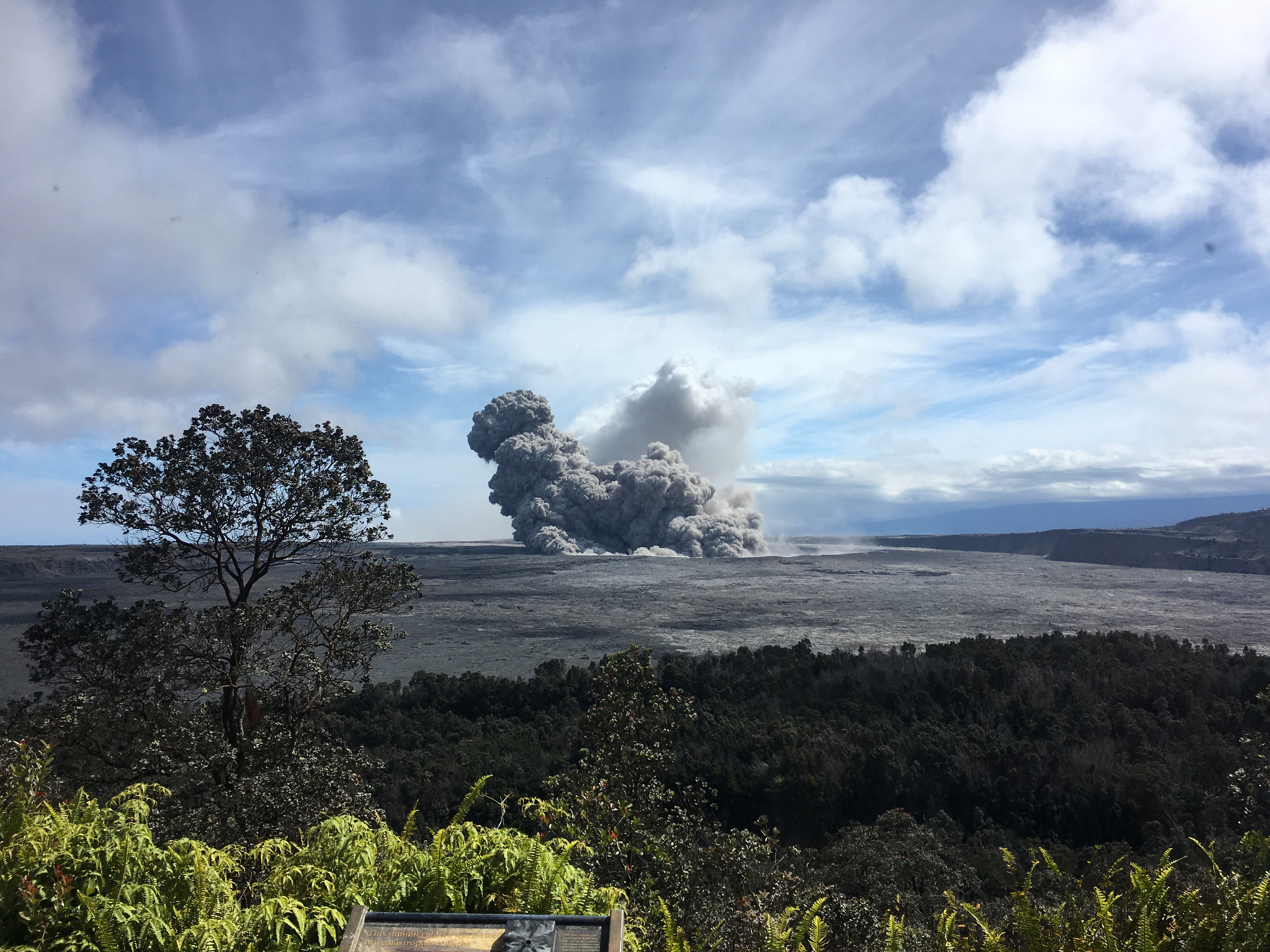
View of a rising ash plume from Halema‘uma‘u, a crater at the summit of Kīlauea, late yesterday

The summit area is adjusting to the withdrawal of magma and the walls of the Overlook crater are retreating. Ash continued to erupt intermittently from the Overlook crater and gas emissions also remain high. 


Friday, May 25, 2018

Some New Photos of Kilauea Eruption

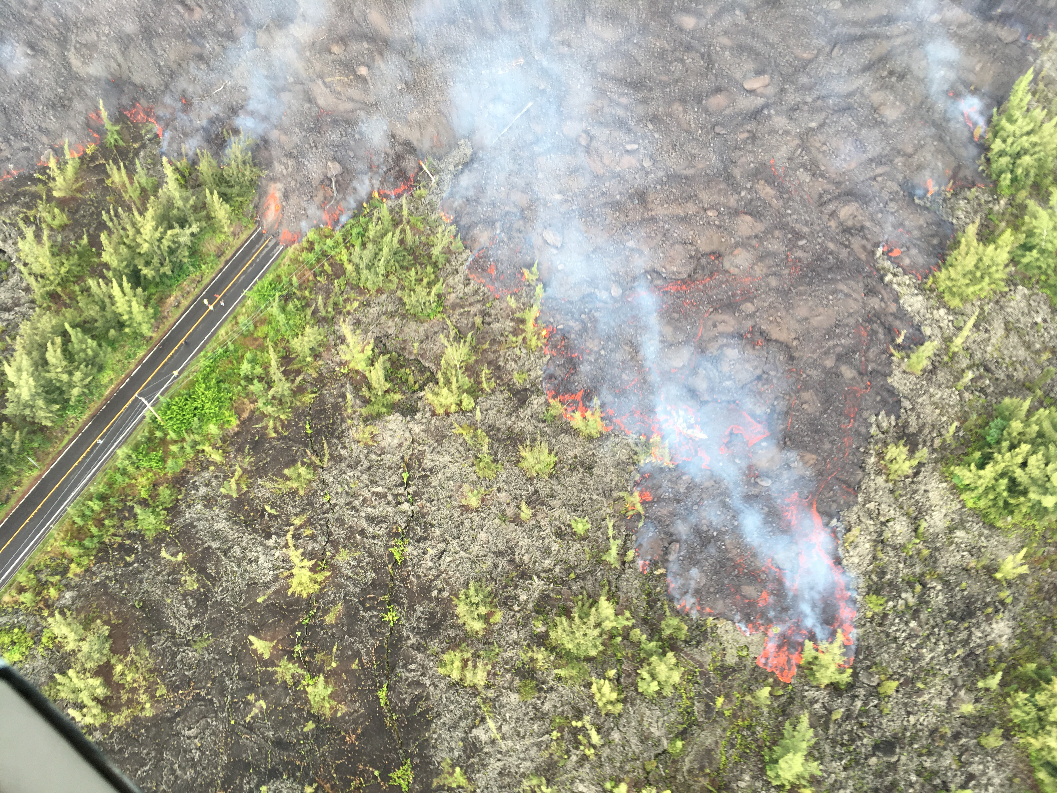
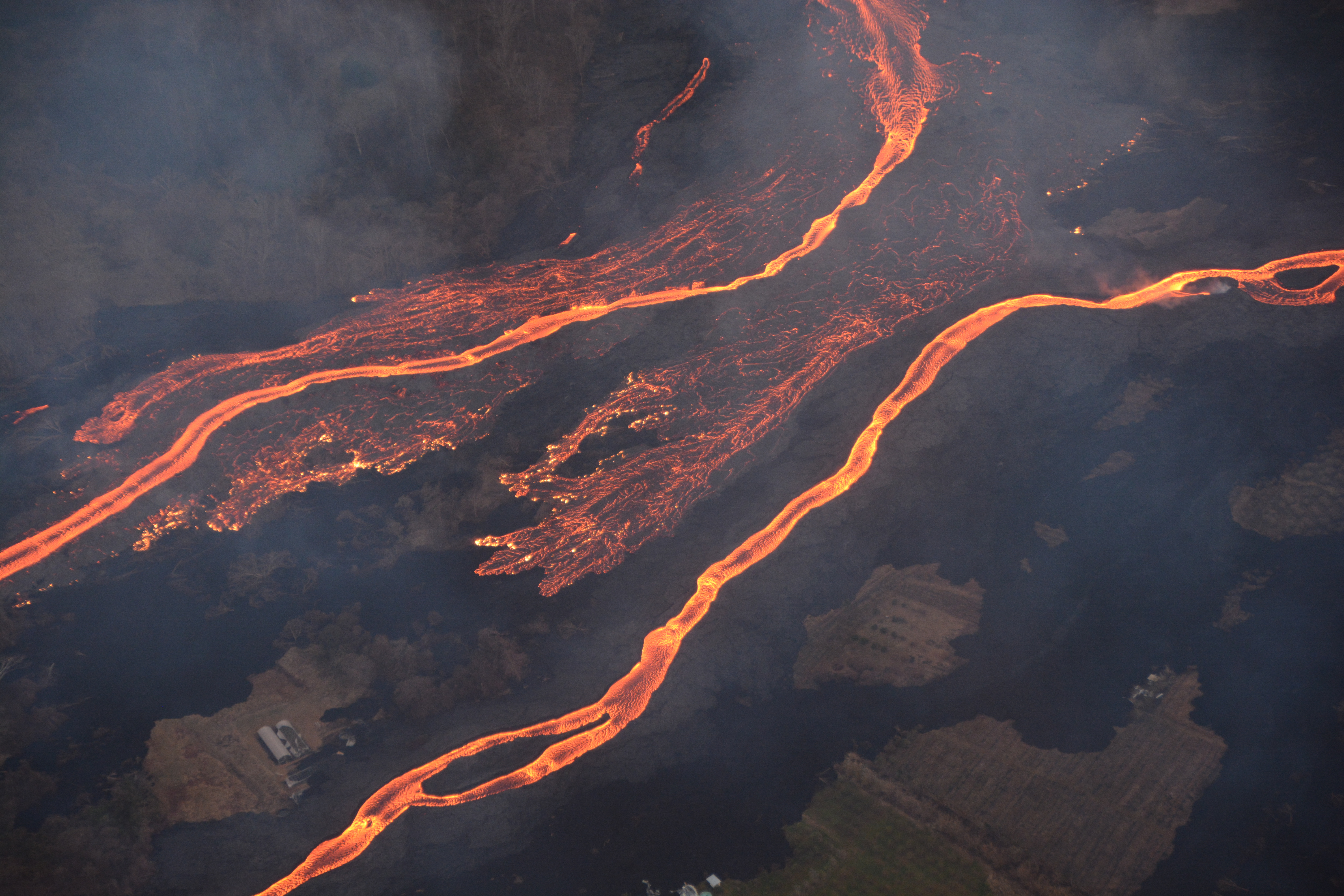
This image shows the scale of the lava channels feeding the ocean entries. Note that lava is overflowing the channels and is on top of slightly older, black lava flows. The visible haze is sulfur dioxide gas that's being emitted from the fissures. Photo courtesy of J. Ozbolt, Hilo Civil Air Patrol.


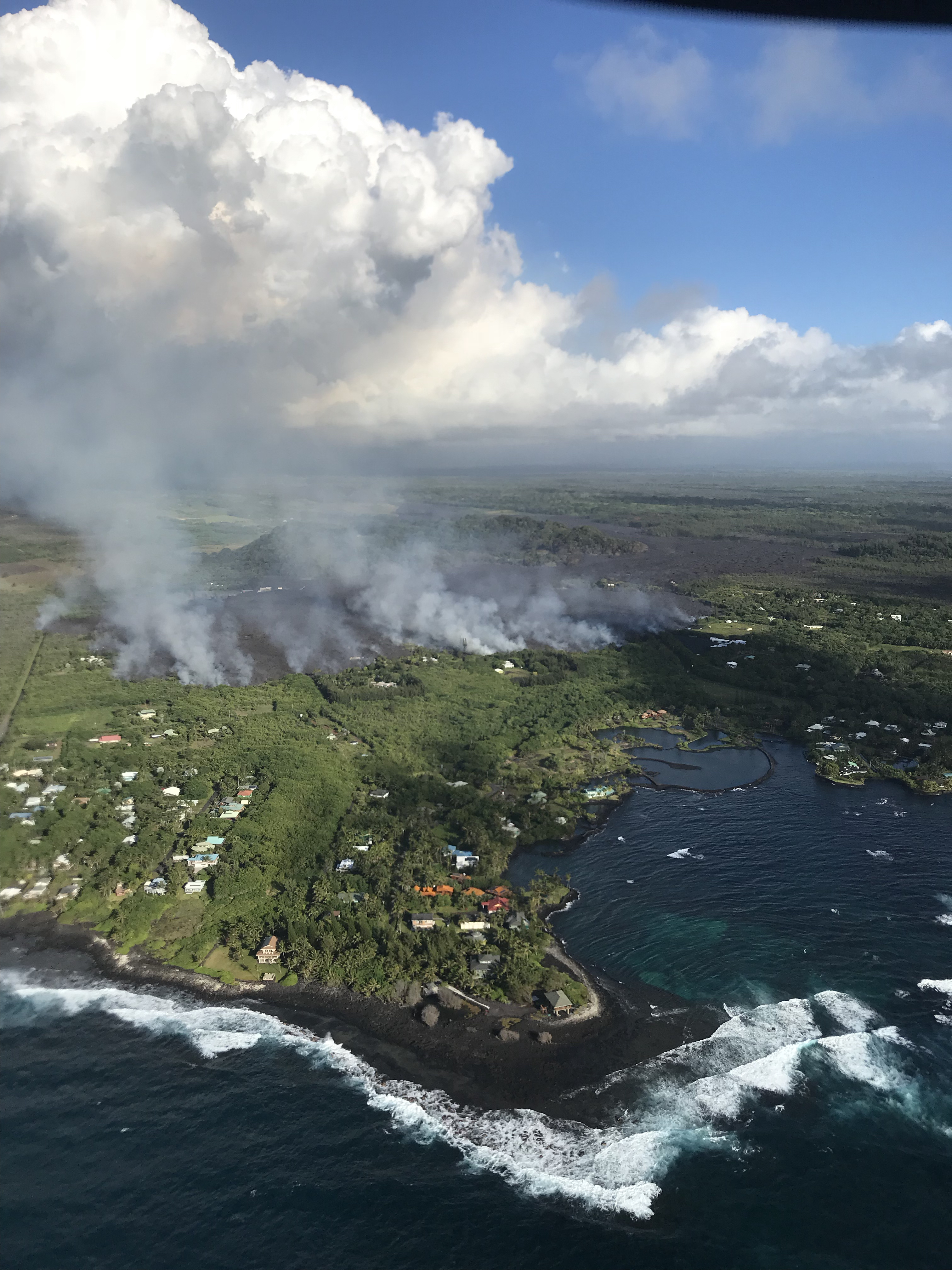
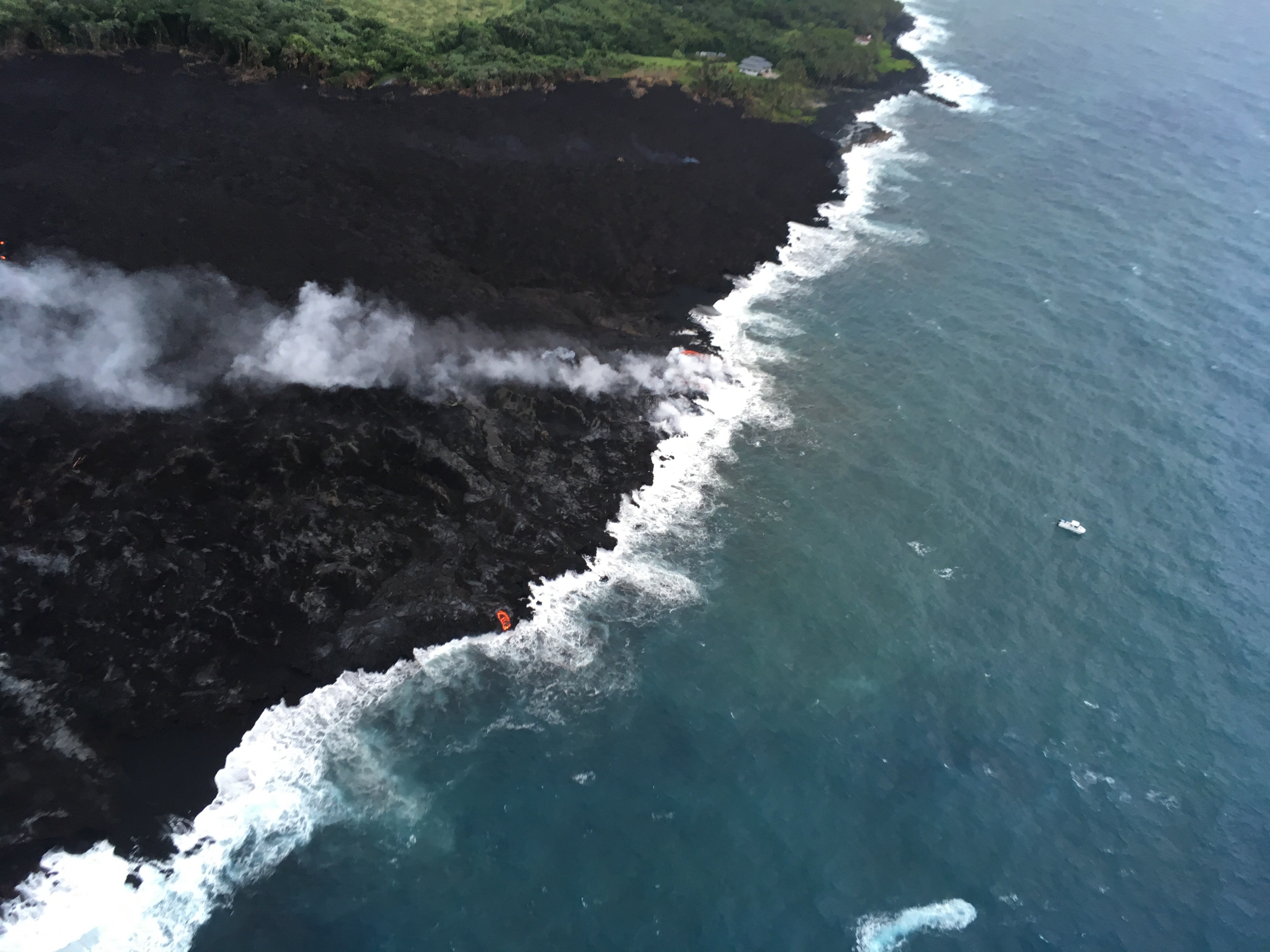
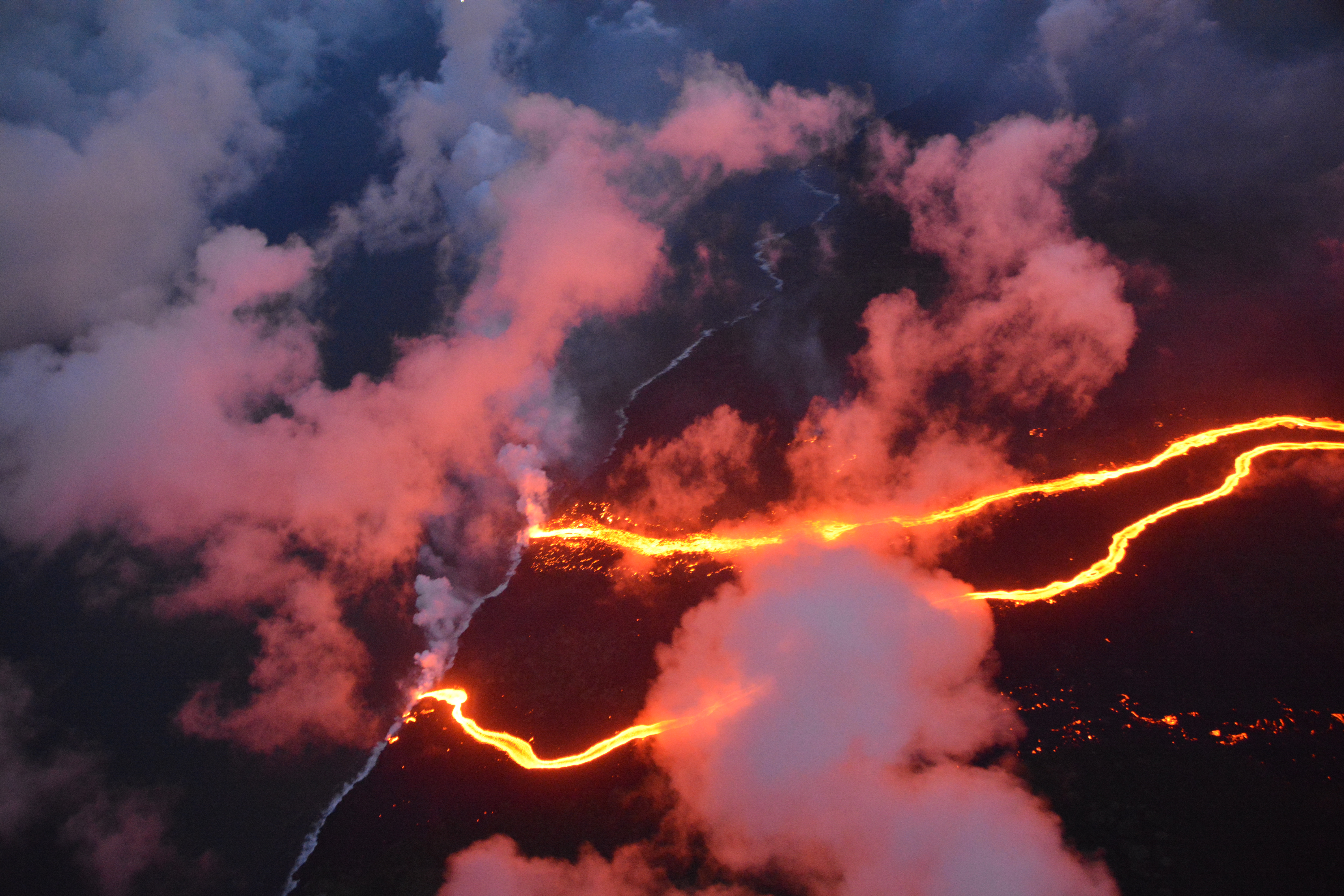
Photograph of the coastline where lava flows are entering the sea. There are currently three primary ocean entry points, which have evolved over the course of the eruption. Photo courtesy of J. Ozbolt, Hilo Civil Air Patrol.

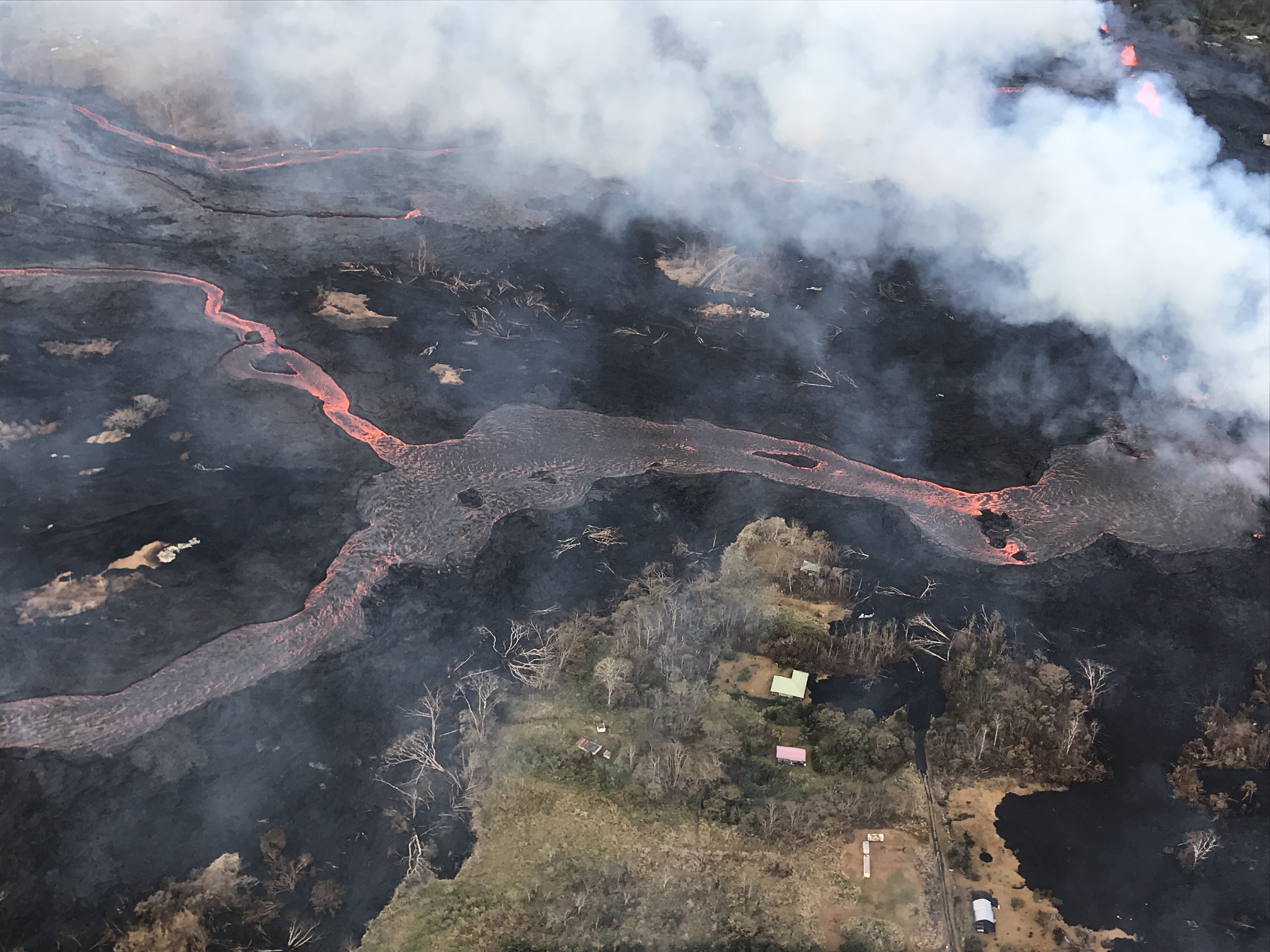
Helicopter overflight of Kīlauea Volcano's lower East Rift Zone shows the lava channel emerging from Fissure 22 (not visible but to the center, far right of the image). The lava is flowing downhill, from right to left in the photo.


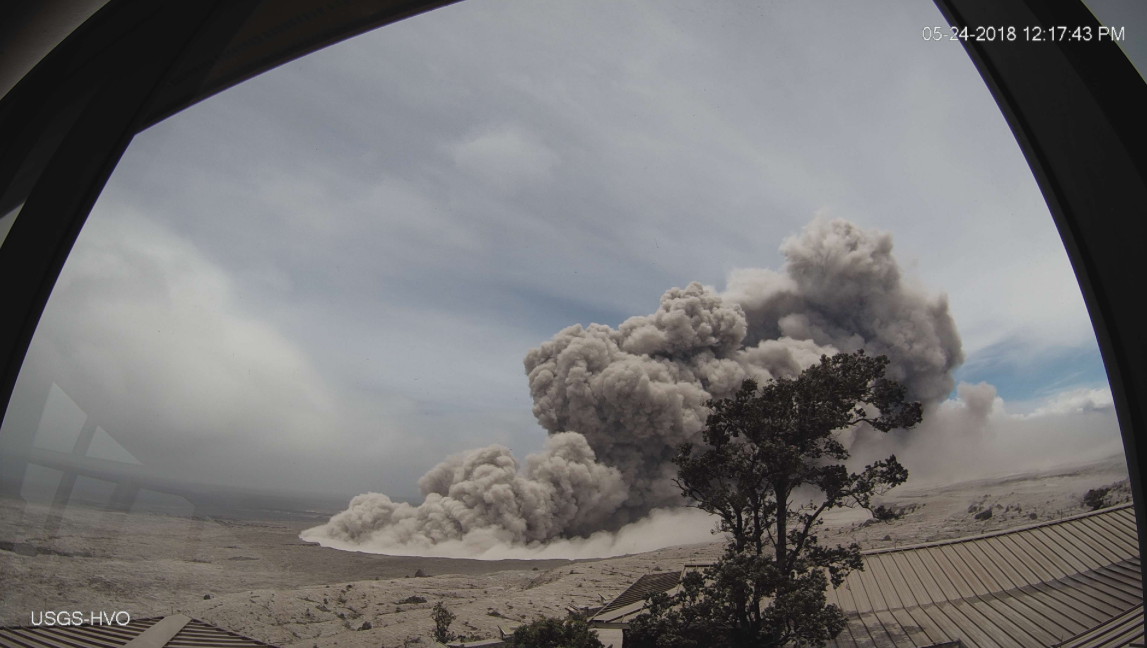
HVO's webcam capture of the image of an ash plume rising from the crater


 Fissure 22 fountain is not as high as several days ago but is still erupting significant lava.


Activity at fissure 6 this morning (May 25, 2018). Lava fountains have built a small spatter cone (black mound) from which lava was spilling out onto the surface and flowing into a small pond (left of the cone).

All these photos are sourced from United States Geological Survey (USGS) or flights conducted by the Hilo Civil Air Patrol.