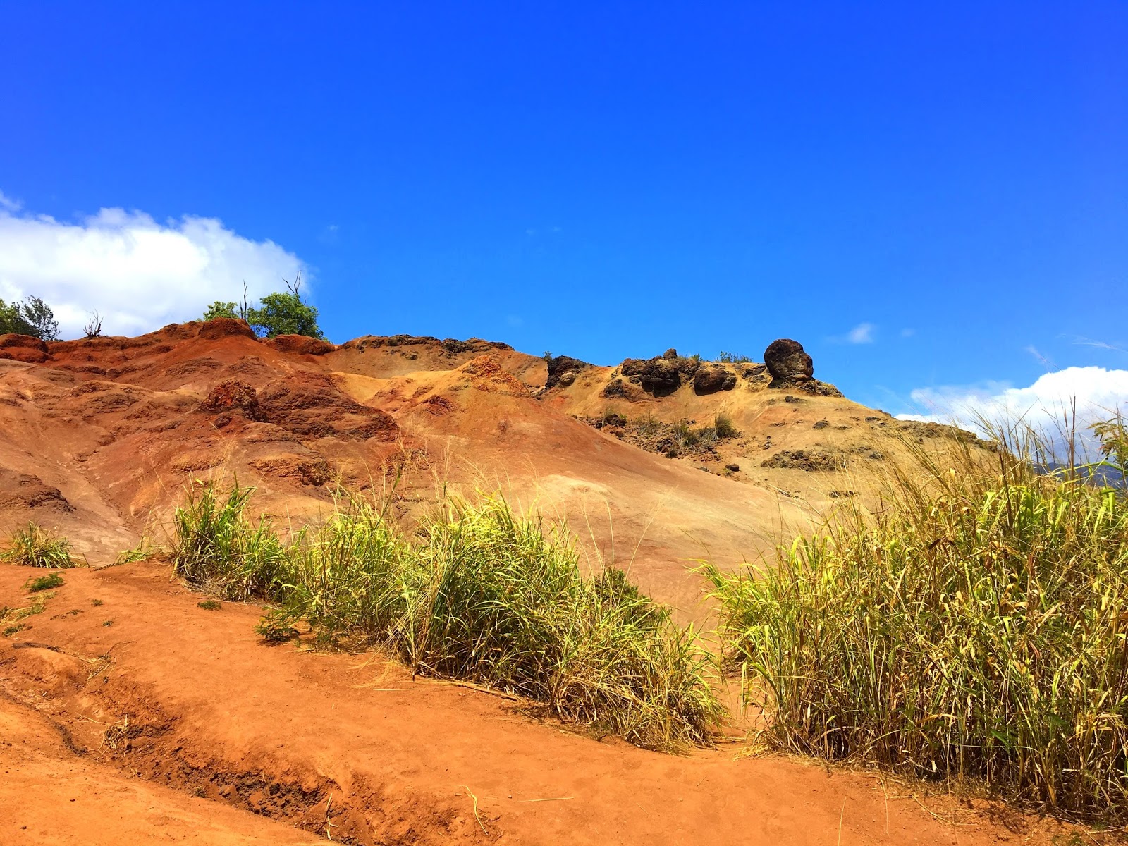
Mark Twain dubbed it as "The Grand Canyon of the Pacific" and true
to its name Waimea Canyon  is the largest canyon in the Pacific and a dramatic,
mammoth and humbling sight to behold. Located on the southwest side of Kauai in
Waimea, it is open all day during the daytime hours and the admission is free.
is the largest canyon in the Pacific and a dramatic,
mammoth and humbling sight to behold. Located on the southwest side of Kauai in
Waimea, it is open all day during the daytime hours and the admission is free.
Although not so big as it’s Arizona cousin, but at 14 miles long, 1 mile wide, and more than 3,600 ft. deep, it’s a geological wonder. ‘Waimea’ in Hawaiian means ‘red water’ and it refers to the red color run off because of erosion of canyon red soil. The canyon was carved thousands of years ago by flow of water in Waimea river because of record rainfall on the island's central peak, Mount Waiʻaleʻale, among the wettest places on earth.
The canyon is a part of the Kokee State Park, which covers an area of over 4,300 acres (17.4 sq. km) and includes 45 miles (72.4 km) of hiking trails. The trails require various level of expertise, some are only for experts while, others can be scaled by beginners too. The trails take visitors along the rim and down into the canyon. If you prefer a bird’s-eye view, take to the skies and enjoy a helicopter tour of the canyon.
We did not do any hiking but just drove through the Waimea Canon Drive,
which is the main access road, stopping at places to soak in the beautiful
vistas.
 |
| on the way to Waimea canyon |
You can access the Waimea Canyon and Koke’e state park by car via two roads. As you drive past the town of Waimea on the coastal road (Hwy. 50) you can take a turn into the Waimea Canyon Drive (Hwy. 550) or you can drive past the town of Waimea and turn into Koke'e Road (Hwy. 55) at Kekaha. Waimea Canyon Drive merges into Koke'e Road around mile marker 6 and continue further as Koke’e Road.
The Waimea Canyon Drive (later the Kokee Road) is the main access road. There are 4 main
lookouts, with ample parking spaces that offer panoramic views of two of
Kauai’s treasures: Waimea Canyon and Kalalau Valley.
 |
| Along the way to Waimea Canyon Lookout |
 |
| Along the way to Waimea Canyon Lookout |
 |
| Along the way to Waimea Canyon Lookout |
 |
| A small waterfall, along the way to Waimea Canyon Lookout |
 |
| Along the way to Waimea Canyon Lookout, Note the red mud all along |
 |
| The Kokee Hwy |
 |
| Hurrah! I am on the top |
 |
| Food truck |
The first lookout at 10- mile mark on Kokee Rd (Hwy 550) is Waimea Canyon
Lookout, it has got a huge parking lot. It also offers a concrete platform with
guard rails and boasts a 360-degree panoramic view of the valley below.
We also found a food truck in the parking lot selling cold tropical
fruits and local Hawaiian food.
 |
| View form Waimea Canyon Lookout |
 |
| View form Waimea Canyon Lookout |
|
 |
| View form Waimea Canyon Lookout |
|
 |
| View form Waimea Canyon Lookout |
|
 |
| View form Waimea Canyon Lookout , the people add the scale |
|
 |
| View form Waimea Canyon Lookout |
|
 |
| View form Waimea Canyon Lookout |
|
The next lookout we came across was the Puu Ka Pele lookout, which is
a small lookout near 13-mile marker on Hwy.550. We did not stop here and headed
Puu Hinahina lookout between 13-14-mile markers on the same Hwy. This
lookout offers more scenic views of canyon from a different angle. Here you
will see a board that looks towards the forbidden island of Ni’ihau.
 |
| View from Puu Hinahina lookout |
 |
| View from Puu Hinahina lookout |
 |
| How tiny we are in front of Nature's Grandeur |
Niʻihau is the westernmost and seventh largest inhabited island in
Hawaiʻi. It is 17.5 miles southwest of Kauaʻi across the Kaulakahi Channel. True
to its nickname “The Forbidden Island” it is owned by a single family for more
than 150 years and remains insulated from the outside world.
 |
| The forbidden island of Niihau, as seen from Kauai. Courtesy: Getty images |
As you pass the Puu Hinahina lookout, you will come to Kokee lodge and
Kokee Natural History Museum which are a part of Kokee State Park.
The Kokee State Park, it is
4,345 acres of rainforest, about 4200 feet above sea level, situated on the edge of the Alakai Swamp, the largest
swamp in Hawaii, on the summit plateau of Kauai. The forest is home to wide
variety of native flora and fauna.
Situated next to the lodge is Kokee Natural History Museum, open
daily from 10AM to 4 PM it is the best place to learn more about the rainforest,
trails and the Alakai Swamp before you begin to venture deep in the forrest. Admission
is free, though there is a Donation Box at the door.
 |
| Courtesy: Tripadvisor.com |
It has extensive selection of Hawaiian books, fine local craft and art,
and exclusive gift items like Ni‘ihau Shell jewelry. Look for Kaua’i Made
items! Donʻt miss exclusive items created especially by Hui o Laka – hiking
sticks, exclusive t-shirts and more!
It is advisable to take Pocket Guide on Native Plants on the Nature
Trail for Kokee State Park and the Road Guide to Kokee and
Waimea Canyon State Park.
For more information contact:
State Division of Parks, 3060 Eiwa St., Room 306, Lihue, HI 96766
 |
| The Kokee Lodge |
The Kokee lodge is decorated in rustic style and offer cabins with bunk
bed (Dormitory Type) or 2-bedroom units. On-site there's a gift shop, cocktail
lounge and restaurant serving local and international food, plus hiking trails,
bird watching and hunting. It is open for breakfast daily from 9am to 2:30pm.
You can camp at Koke‘e State Park with proper permit.
Contact: Kokee Lodge Manager, P.O. Box 819, Waimea, HI 96796
(tel. 808/335-6061).
(tel. 808/335-9975)
www.kokee.org
You will find various tour operators that offer some of the best Waimea
Canyon Tours including day hike, family-friendly sightseeing tours, and
spectacular helicopter tours that'll take you right into this geologic marvel.
As you move forward along the road, at 18-mile marker, you come to Kalalau
Lookout. I will be writing shortly about the Kalalau lookout. And finally,
about 1 mile from the Kalalau Lookout, the Kokee Hwy 550 comes to an end at the
Pu’u O Kila Lookout. Located at some 4,000-foot elevation, it offers a
spectacular and glorious perspective of the lush green Kalalau Valley, its
rugged peaks and the teal blue ocean beyond. It also overlooks the Alakai Swamp, which is
one of the wettest and highest swamp in the world.
 |
| View from the Pu’u O Kila Lookout |
 |
| Kalalau Valley |
You can embark on two trails at this point, the 7-mile (11-kilometer)
round-trip Alakai Swamp Trail and the Pihea Trail, which goes around the
Kalalau Valley before reaching the Alakai Swamp.
 |
| Alakai Swamp Trail |
 |
| Pihea Trail |
Here is a Map to Waimea Canyon Lookout and Kokee State Park

 is the largest canyon in the Pacific and a dramatic,
mammoth and humbling sight to behold. Located on the southwest side of Kauai in
Waimea, it is open all day during the daytime hours and the admission is free.
is the largest canyon in the Pacific and a dramatic,
mammoth and humbling sight to behold. Located on the southwest side of Kauai in
Waimea, it is open all day during the daytime hours and the admission is free.