 |
| Panoramic view from the top of Kuliouou Hike |
Trail name:
Kuliouou Ridge trail
DIFFICULTY:
Intermediate to Moderate
LENGTH:
Around 5 miles roundtrip
FEE: None
Elevation
gained: 1776 feet.
LOCATION:
The hike starts at the end of Kala‘au Place in Hawaii Kai
Kuliouou is
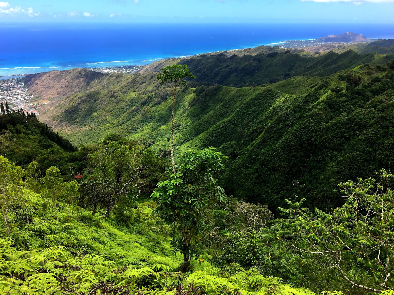
a best ridge hike trail in the island of Oahu atop the Majestic Ko’olau
mountains. The challenging and ever-changing terrain attracts nearly 2000
hikers each year, who are rewarded with near 360-degree views of Kailua and
Waimanalo from the top.
The trail
starts at a cul-de-sac at the end of Kala’au Place. There is no parking
provided and you must park on the neighborhood street. Be mindful of the
residents’ mailboxes and drive-ways.
Walk past
the ‘Kuliouou 350 reservoir board of water supply’ sign to start the trail. As
you proceed further you see a Kuliouou Public Hunting Area sign. At the sign
take right and leave the paved road to enter the trail. As you proceed further
you come to a fork. At this point the Kuliouou Ridge Trail and Kuliouou Valley
trail separate. There is a clear sign at the fork to direct you.
 |
| Walk past this sign |
 |
| The hunting sign |
 |
| The beginning of both trails |
 |
| The trail is rocky at the beginning |
 |
| Lots of exposed roots |
 |
| The bifurcation sign |
Kuli‘ou‘ou
Valley Trail is a very short and shady two-mile walk along a well-groomed and
graded path through this leeward valley.
Stay right
and you will be on the Kuliouou ridge trail. The trail is clearly defined, with
lots of switchback and is well maintained by State of Hawaii Nā Ala Hele program and the Sierra Club of
Hawai‘i. There are lots of shortcuts but it is better to stick to the defined
trail because this trail traverses a public hunting area and there might be
hunters off the trail.
The
switchbacks start immediately as you begin the hike and continue for the first
two-third of hike. After hiking for about 30 minutes you will come across first
awesome view of Hawaii Kai and the Koolau mountains.
At the
start, the hike is rocky, not so green and the low forest on both sides is
nothing like Hawaii. Vegetation seen here are Christmas berry, haole koa, and
other invasive plants which have taken over this part of the Koolau Mountains.
But, each elevation adds a different layer to the hike.
As you
proceed further and reach higher elevation, the flora changes. You will see the
ground is covered with thick carpet of ironwood pine needles and there are
ironwood pine trees all around. The landscape is like desert, with pine needles
instead of sand.
After hiking for about an hour and half, we
came to first open space and two covered picnic tables. The flora here now
changes to tall cook pines. These pines were planted here in the 1930s as part
of a reforestation project. This is the first proper sitting area you will
encounter after you start the hike.
 |
| The vegetation is low shrubbery |
 |
| The beginning part of hike |
 |
| The first open view of Hawaii Kai |
 |
| As you proceed further, vegetation changed to only pines all around |
 |
| The thick carpet of pine needles |
 |
| Pine tree |
 |
| The open space after the pine forest |
 |
| Aloha from Hawaii |
 |
| The picnic tables, first proper sitting area along the trail |
 |
| The covered picnic tables |
The
elevation and landscape changes drastically here. There are no switchbacks now,
the incline is steep and covered with exposed roots looking like ‘root stairs’.
These part is particularly very treacherous, muddy and dark with no clear cut
marked path. This was our least favorite section of the trail, it was easier to
climb on the left side of the ‘root stairs’ using the tree trunks for support.
But once you
are past it, you come across another resting place. There is one bench and an
open space looking at the Kuliouou valley. The final push to the summit
involves climbing about 278 in-earth dirt stairs, against a very beautiful lush
green rain forest backdrop that rewards you with some very amazing views of south
and east coasts. The stairs are wet and slippery when it rains, they were put
here by Sierra Club to prevent erosion.
 |
| The cook pines |
 |
| Welcoming Arches |
 |
| Natural Arches |
 |
| The cook pine needles |
 |
| The bark of cook pine tree |
 |
| The root stairs |
 |
| The ‘root stairs’. These part of hike is particularly very
treacherous, muddy and dark with no clear cut marked path. |
 |
| A lookout and bench before the stairs begin |
 |
| Let's take a break |
We also saw
Bright orange lichen (Teloschistes flavicans) and white lichen (Usnea
australis) growing in patches on trees along with ahinahina (Artemesia
australis) one of the few endemic plants left in this region of the Koolau
Mountains.
 |
| Bright orange lichen (Teloschistes flavicans)growing on trees |
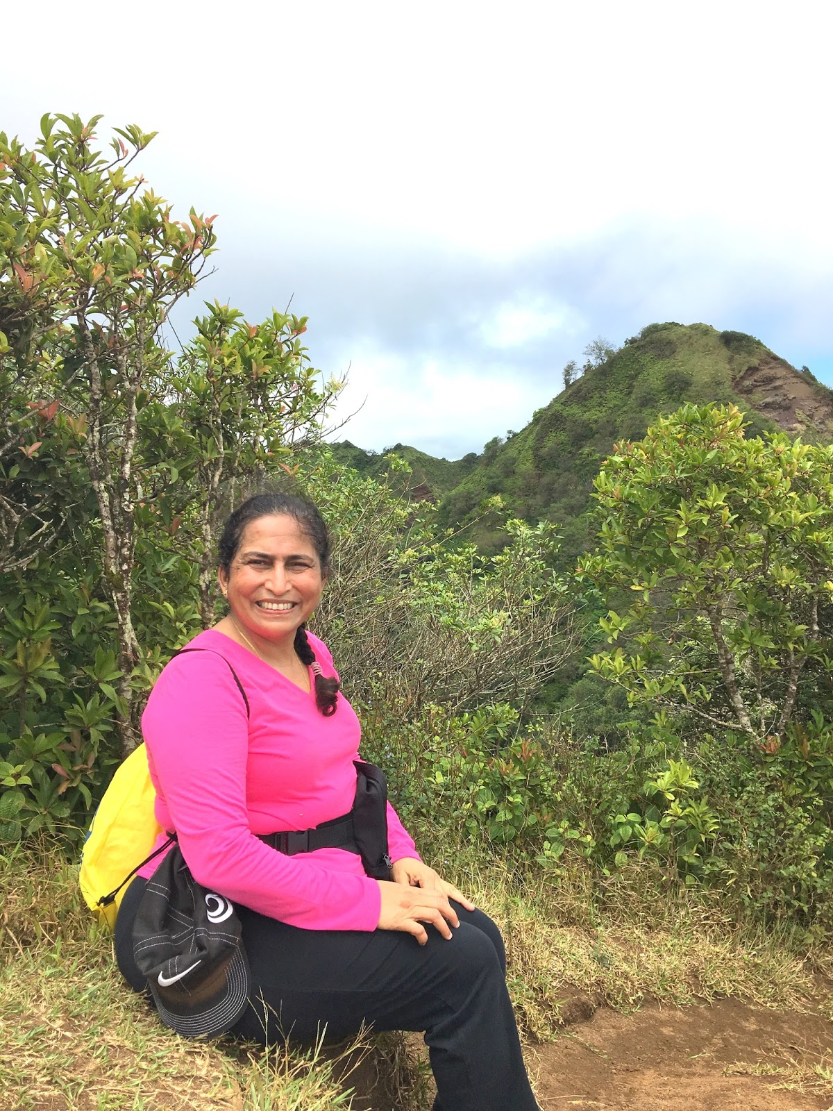
At the top
of the mountain is an end-of-trail sign. Be careful not to go any further
because there is a dangerous cliff and high winds. You can also make out the
sudden fall in temperature at the top. Experienced hikers continue ahead to
Pu’u O Kona from the top of Kuliouou Ridge. The distance between the two peak
is 30-40 minutes, but the trail is not maintained and you need to have proper
hiking gear to go further.
If it’s not
too cloudy, we can see Waimānalo and the Mokulua Islands off the coast of
Kailua. On the right, you can see Rabbit Island and Koko Crater. On far right
you also see Diamond head at a distance. Sometimes if it is clear and bright you
could see Moloka‘i, Lānaʻi and Maui, too.
We rested
here for some time, ate sandwiches we have brought along and soaked in the
beautiful vistas at the top. The view is so beautiful that you can never get
enough of taking panoramas and photos. After resting there for about 30 minutes
we started the descend.
There are
fixed brushes provided at the beginning and at the end of hike in forested
areas, prevent the spread of weeds by checking your hiking boots and brushing
the sole to prevent the dispersal of weed seeds to protect Hawaii’s fragile
ecosystem. Hikers are requested to brush the sole of muddy boots before and at
the end of hike.
It took us
nearly half hour to reach the picnic tables and another one hour and 20 minutes
to navigate the switchbacks and reach the parking area.
The summit
is often covered in clouds and it rains frequently. It is better to do this
hike on a clear day.
It took us
nearly 5.30 hours round trip.
PACKING
LIST:
LOTS of
water, water and water
Wear hiking
shoes, it’s a difficult hike wearing
simple tennis shoes.
Sunblock/bug
spray
Poncho or
wind cheater
Food
 |
| The last leg of hike, the stairs begin |
 |
| The rain forest begins |
 |
| New arrivals in department of nature |
 |
| View of Koko crater on the way to top |
 |
| Welcoming arches |
 |
| In between the set of stairs |
 |
More stairs with ahinahina (Artemesia australis) on both sides, one of the few endemic plants left in this region of the Koolau Mountains.
|
 |
| And the final few before the top |
 |
It's lonely at the top
|
 |
| Framed |
 |
| At the top |
 |
| Diamond head on the right: View from the top |
 |
| Finally at the top, Pu’u O Kona peak in the background |
 |
| The lost horizon |
 |
| Mokulua Islands off the coast of Kailua |
 |
| The lost horizon |
 |
| The Rabbit island |
 |
| View from the top |
 |
The brush to clean weed seeds on your muddy shoes
|
 |
| Let's clean the shoes and protect the rainforests |
 |
| Add caption |
 |
| The hike in the Koolau Mountains |
 |
| The location of the Kuliouou Trail |


No comments:
Post a Comment